List of listed buildings in Cupar, Fife
List
| Name | Location | Date Listed | Grid Ref. [note 1] | Geo-coordinates | Notes | LB Number [note 2] | Image |
|---|---|---|---|---|---|---|---|
| 116-120 Bonnygate | 56°19′09″N 3°01′01″W | Category C(S) | 24271 |  | |||
| 7 Provost Wynd | 56°19′04″N 3°00′55″W | Category C(S) | 24281 | | |||
| 16 Provost Wynd | 56°19′05″N 3°00′55″W | Category C(S) | 24285 | | |||
| 15-25 St Catherine Street | 56°19′09″N 3°00′39″W | Category B | 24159 | | |||
| 1, 3 The Cross (Front Building Only) | 56°19′09″N 3°00′43″W | Category C(S) | 24171 | | |||
| 7 The Cross | 56°19′11″N 3°00′43″W | Category C(S) | 24173 | | |||
| Duncan Institute 33,35 Crossgate | 56°19′07″N 3°00′43″W | Category C(S) | 24180 | 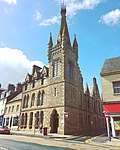 | |||
| 47-49 Crossgate (Front Building Only Rear Properties At 49 Excluded) | 56°19′06″N 3°00′43″W | Category C(S) | 24183 | | |||
| 61-63 Crossgate (Front Building Only) | 56°19′05″N 3°00′43″W | Category C(S) | 24186 | | |||
| Volcano Cafe, Crossgate | 56°19′04″N 3°00′42″W | Category C(S) | 24207 | | |||
| 80 Crossgate (Excluding Building At Corner Of South Bridge Occupied As Hotel) | 56°19′03″N 3°00′42″W | Category B | 24211 | | |||
| 3-5 Bonnygate | 56°19′11″N 3°00′44″W | Category C(S) | 24223 | | |||
| 55-57 Bonnygate (Front Building Only) | 56°19′10″N 3°00′51″W | Category C(S) | 24233 | | |||
| 6, 8 Bonnygate | 56°19′10″N 3°00′44″W | Category C(S) | 24244 | | |||
| 66-70 Bonnygate (Front Building Only) | 56°19′09″N 3°00′51″W | Category C(S) | 24258 | | |||
| 86-88 Bonnygate | 56°19′09″N 3°00′54″W | Category C(S) | 24261 | | |||
| 90-92 Bonnygate | 56°19′09″N 3°00′54″W | Category C(S) | 24262 | | |||
| 94 Bonnygate | 56°19′09″N 3°00′55″W | Category C(S) | 24263 | | |||
| Foxton House And Gatepiers | 56°20′07″N 2°59′08″W | Category B | 2627 | | |||
| Kinloss House | 56°19′45″N 3°01′44″W | Category B | 2637 | | |||
| Waterend Road, Footbridge Over River Eden | 56°19′06″N 3°00′35″W | Category C(S) | 48388 | | |||
| Bell Baxter School Annexe, Lovers' Lane | 56°18′59″N 3°01′02″W | Category C(S) | 24280 | | |||
| 23 Provost Wynd | 56°19′07″N 3°00′57″W | Category C(S) | 24284 | | |||
| Castle Hill (Academy) Original Primary School Building | 56°19′12″N 3°00′37″W | Category B | 24287 | | |||
| Bridge Over Eden Pitscottie Road | 56°19′11″N 3°00′15″W | Category B | 24291 | | |||
| Goods Shed At Cupar Railway Station | 56°19′08″N 3°00′26″W | Category A | 24293 | | |||
| 36-40 Kirkgate | 56°19′03″N 3°00′55″W | Category C(S) | 24144 | | |||
| 5,6 Kirk Wynd | 56°19′05″N 3°00′50″W | Category C(S) | 24148 | | |||
| 17 Kirk Wynd | 56°19′07″N 3°00′45″W | Category C(S) | 24154 | | |||
| 2-6 St Catherine Street | 56°19′10″N 3°00′41″W | Category C(S) | 24163 | | |||
| 51-55 Crossgate And Buildings In Court At 57 | 56°19′05″N 3°00′43″W | Category B | 24184 | | |||
| 22 Crossgate Edenbank House | 56°19′08″N 3°00′39″W | Category B | 24194 | | |||
| 24-26 Crossgate | 56°19′08″N 3°00′40″W | Category C(S) | 24195 | | |||
| 30 Crossgate | 56°19′07″N 3°00′41″W | Category C(S) | 24197 | | |||
| Youth Employment Offices, 52 Crossgate | 56°19′05″N 3°00′41″W | Category C(S) | 24204 | | |||
| 56, 60, 62 Crossgate | 56°19′04″N 3°00′42″W | Category C(S) | 24206 | | |||
| 1 Barony | 56°19′01″N 3°00′43″W | Category B | 24212 | | |||
| 2-4 Barony | 56°19′01″N 3°00′44″W | Category C(S) | 24213 | | |||
| 29 Bonnygate | 56°19′10″N 3°00′46″W | Category C(S) | 24227 | | |||
| St John's Church, Bonnygate | 56°19′12″N 3°00′54″W | Category B | 24237 | 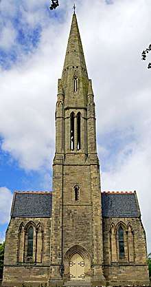 | |||
| Bonnygate, Tulach Ard | 56°19′13″N 3°00′55″W | Category C(S) | 24238 | | |||
| 44-54 Bonnygate (Front Buildings Only) | 56°19′09″N 3°00′49″W | Category C(S) | 24255 | | |||
| 82 And 84 Bonnygate. (Front Building Only) | 56°19′09″N 3°00′54″W | Category C(S) | 24260 | | |||
| 96 Bonnygate | 56°19′09″N 3°00′56″W | Category C(S) | 24264 | | |||
| Cupar Old St Michael Of Tarvit Parish Church Comprising:- Tower And Remains Of Nave; And | 56°19′02″N 3°00′55″W | Category A | 24136 | | |||
| Balass Farm House And Steading | 56°19′03″N 2°59′04″W | Category B | 2661 | | |||
| Balass Gatepiers (On Cupar Road) | 56°18′56″N 2°59′14″W | Category C(S) | 2662 | | |||
| Cupar Muir Elmwood College Farm (Formerly Springfield Farm) | 56°18′16″N 3°02′24″W | Category C(S) | 2624 | | |||
| Kinloss House Gatepiers | 56°19′41″N 3°01′36″W | Category C(S) | 2638 | | |||
| Cart Haugh, Cupar War Memorial With Piers And Railings | 56°19′10″N 3°00′32″W | Category B | 46365 | 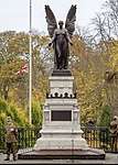 | |||
| East Burnside, Burnside Hotel Gothic Wing (To East) And 1, 1A And 1B Bishopgate, Former United Presbyterian Church Including Boundary Walls | 56°19′14″N 3°00′48″W | Category C(S) | 49882 | | |||
| 3 East Road, Castlefield House, Including Gatepiers And Boundary Wall | 56°19′16″N 3°00′24″W | Category C(S) | 49966 | | |||
| Ceres, Cupar Road, Bridgend Steading Including Boundary Walls | 56°17′42″N 2°58′41″W | Category B | 50054 | | |||
| Ladyinch, West Port | 56°19′09″N 3°01′23″W | Category B | 24275 | | |||
| Baptist Church, Provost Wynd | 56°19′07″N 3°00′55″W | Category B | 24286 | | |||
| Cupar Railway Station | 56°19′02″N 3°00′34″W | Category B | 24292 | | |||
| Rosemount Cottage, Rigg's Place And South Road | 56°18′58″N 3°00′34″W | Category B | 24296 | | |||
| Roseville Bank Street | 56°19′26″N 3°01′01″W | Category C(S) | 24300 | | |||
| Eden Park, Eden Place | 56°19′26″N 3°00′16″W | Category B | 24304 | | |||
| O'Brien, Ashlar Lane | 56°19′02″N 3°00′51″W | Category C(S) | 24139 | | |||
| 7-9 St Catherine Street | 56°19′10″N 3°00′40″W | Category B | 24157 | | |||
| 11, 13 St Catherine Street | 56°19′09″N 3°00′39″W | Category B | 24158 | | |||
| 10, 12 St Catherine Street, Including Royal Bank (Formerly Commercial Bank) And Part Of Bank Of Scotland (Formerly British Linen Bank) Premises | 56°19′11″N 3°00′39″W | Category B | 24166 | | |||
| 65-67 Crossgate | 56°19′04″N 3°00′44″W | Category C(S) | 24187 | | |||
| 14 Crossgate And Close To No 16 (Buildings At Rear At No 16 Excluded) | 56°19′09″N 3°00′41″W | Category C(S) | 24191 | | |||
| 6, 7 Barony | 56°19′00″N 3°00′45″W | Category C(S) | 24215 | | |||
| Eden Villa, Barony Including Front Wall And Gates | 56°18′59″N 3°00′44″W | Category C(S) | 24217 | | |||
| Kilrymont 1, 2 Millgate | 56°18′59″N 3°00′47″W | Category B | 24219 | | |||
| 59 Bonnygate (Front Building Only) | 56°19′10″N 3°00′51″W | Category C(S) | 24234 | | |||
| Bonnygate Church, Bonnygate | 56°19′11″N 3°00′56″W | Category C(S) | 24240 | | |||
| 22, 24, 28 Bonnygate | 56°19′09″N 3°00′47″W | Category C(S) | 24249 | | |||
| Ferrymuir Farm (Formerly Ferrybank) | 56°18′45″N 3°02′00″W | Category B | 2626 | | |||
| Hill Of Tarvit House, Terraced Garden, Walled Garden | 56°17′43″N 3°00′19″W | Category A | 2628 | 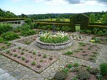 | |||
| Hilton House | 56°20′13″N 3°01′26″W | Category B | 2632 | | |||
| Whitehill Farm, Farmhouse With Gate Piers And Boundary Walls, Steading And Farm Cottages Nos 1-3 Including Ancillary Structures | 56°18′01″N 2°59′34″W | Category B | 49578 | | |||
| Bell Baxter Academy-Hall | 56°19′09″N 3°01′09″W | Category C(S) | 24274 | | |||
| 11 Provost Wynd | 56°19′05″N 3°00′55″W | Category C(S) | 24282 | | |||
| 13 Provost Wynd | 56°19′05″N 3°00′56″W | Category C(S) | 24283 | | |||
| West Tollhouse, (Edenlea) Pitscottie Road | 56°19′14″N 3°00′24″W | Category B | 24303 | | |||
| 46,47 Kirkgate | 56°19′04″N 3°00′53″W | Category C(S) | 24146 | | |||
| 10 Kirk Wynd | 56°19′06″N 3°00′49″W | Category C(S) | 24151 | | |||
| 8 St Catherine Street | 56°19′10″N 3°00′40″W | Category C(S) | 24164 | | |||
| The Corn Exchange Tower Only | 56°19′11″N 3°00′41″W | Category B | 24165 | | |||
| 14 St Catherine Street, Bank Of Scotland (Formerly British Linen Bank) | 56°19′11″N 3°00′38″W | Category B | 24167 | | |||
| Royal Hotel, St Catherine Street | 56°19′11″N 3°00′36″W | Category B | 24170 | | |||
| 8-12 Crossgate | 56°19′09″N 3°00′41″W | Category C(S) | 24190 | | |||
| 20 Crossgate | 56°19′08″N 3°00′41″W | Category C(S) | 24193 | | |||
| 28, 28A Crossgate | 56°19′07″N 3°00′41″W | Category C(S) | 24196 | | |||
| 36 Crossgate (Former Mansion House Only, Omnibus Sheds Excluded) | 56°19′06″N 3°00′39″W | Category B | 24199 | | |||
| 66-70 Crossgate | 56°19′04″N 3°00′42″W | Category C(S) | 24208 | | |||
| 7-13 Bonnygate (Excluding Rear Properties At 11) | 56°19′10″N 3°00′44″W | Category C(S) | 24224 | | |||
| Stratheden Temperance Hotel, 23, 25 Bonnygate | 56°19′10″N 3°00′46″W | Category C(S) | 24226 | | |||
| 35 Bonnygate | 56°19′10″N 3°00′47″W | Category C(S) | 24229 | | |||
| Preston Lodge 95 Bonnygate Gatepiers To Moat Hill Road | 56°19′14″N 3°01′00″W | Category B | 24243 | | |||
| Freemasons' Hall, 72-74 Bonnygate | 56°19′09″N 3°00′52″W | Category B | 24259 | | |||
| Dalgairn House | 56°19′35″N 3°00′52″W | Category B | 2625 | | |||
| Hilton Lodge | 56°20′11″N 3°01′10″W | Category C(S) | 138 | | |||
| West Port Bar, 130 Bonnygate | 56°19′08″N 3°01′04″W | Category C(S) | 24273 | | |||
| Primrose Cottage (South Toll House), 1 Ceres Road (James Place) | 56°18′50″N 3°00′33″W | Category B | 24297 | | |||
| 29 Kirkgate | 56°19′01″N 3°00′57″W | Category C(S) | 24141 | | |||
| 2,4 Kirk Wynd | 56°19′05″N 3°00′51″W | Category C(S) | 24147 | | |||
| Angle Cottage, Kirk Wynd | 56°19′06″N 3°00′47″W | Category C(S) | 24153 | | |||
| Town Hall, And 5 St Catherine St | 56°19′10″N 3°00′40″W | Category B | 24156 | | |||
| 16 St Catherine Street, Clydesdale Bank | 56°19′11″N 3°00′37″W | Category B | 24168 | | |||
| 19 Crossgate (Front Building Only) | 56°19′08″N 3°00′43″W | Category C(S) | 24178 | | |||
| 18 Crossgate Royal Bank Of Scotland | 56°19′08″N 3°00′41″W | Category B | 24192 | | |||
| 38-40 Crossgate | 56°19′06″N 3°00′41″W | Category C(S) | 24200 | | |||
| Supplies Department 48, 50 Crossgate | 56°19′05″N 3°00′41″W | Category C(S) | 24203 | | |||
| Weights & Measures Offices 54 Crossgate | 56°19′05″N 3°00′42″W | Category C(S) | 24205 | | |||
| 76,Crossgate | 56°19′03″N 3°00′42″W | Category C(S) | 24209 | | |||
| 78 Crossgate | 56°19′03″N 3°00′42″W | Category B | 24210 | | |||
| 5 Barony | 56°19′00″N 3°00′44″W | Category C(S) | 24214 | | |||
| 3 Millgate | 56°19′00″N 3°00′47″W | Category C(S) | 24220 | | |||
| 19-21 Bonnygate (Front Building Only) | 56°19′10″N 3°00′46″W | Category C(S) | 24225 | | |||
| 31 Bonnygate (Front Building Only) | 56°19′10″N 3°00′47″W | Category B | 24228 | | |||
| 41 Bonnygate (Front Building Only) | 56°19′10″N 3°00′48″W | Category C(S) | 24231 | | |||
| 61-67 Bonnygate | 56°19′10″N 3°00′52″W | Category B | 24235 | | |||
| 16 Bonnygate | 56°19′10″N 3°00′46″W | Category C(S) | 24247 | | |||
| 18, 20 Bonnygate | 56°19′10″N 3°00′46″W | Category C(S) | 24248 | | |||
| 56-58 Bonnygate (Front Building Only) | 56°19′09″N 3°00′50″W | Category C(S) | 24256 | | |||
| Prestonhall House And Gatepiers | 56°19′25″N 2°59′04″W | Category B | 2672 | | |||
| Kilmaron House Former Stable Block | 56°19′56″N 3°02′05″W | Category B | 2636 | | |||
| Castlebank Road, 'Castlebank' Including Gatepiers And Boundary Wall And Excluding Modern Bungalow 'Cullaloe' In Grounds | 56°19′16″N 3°00′24″W | Category C(S) | 49965 | | |||
| 114 Bonnygate | 56°19′09″N 3°01′00″W | Category C(S) | 24270 | | |||
| 122-126 Bonnygate | 56°19′08″N 3°01′02″W | Category C(S) | 24272 | | |||
| Blairneuk, Corner West Port And Balgarvie Road | 56°19′08″N 3°01′25″W | Category B | 24276 | | |||
| Moatview, North Union Street | 56°19′13″N 3°01′07″W | Category C(S) | 24279 | | |||
| Bishopgate House, Bishopgate | 56°19′18″N 3°00′46″W | Category B | 24301 | | |||
| 34 Kirkgate | 56°19′02″N 3°00′56″W | Category C(S) | 24142 | | |||
| 35 Kirkgate (Front Building Only) | 56°19′02″N 3°00′56″W | Category C(S) | 24143 | | |||
| 44,45 Kirkgate | 56°19′04″N 3°00′53″W | Category C(S) | 24145 | | |||
| 7,8 Kirk Wynd | 56°19′05″N 3°00′50″W | Category C(S) | 24149 | | |||
| Winthank House, Kirk Wynd | 56°19′07″N 3°00′47″W | Category B | 24152 | | |||
| County Buildings, St Catherine Street A) West Section | 56°19′10″N 3°00′36″W | Category B | 24160 | | |||
| St James The Great Episcopal Church, St Catherine Street | 56°19′11″N 3°00′37″W | Category B | 24169 | | |||
| 39-41 Crossgate (Front Building Only) | 56°19′07″N 3°00′43″W | Category C(S) | 24181 | | |||
| 43-45 Crossgate (Front Building Only) | 56°19′06″N 3°00′43″W | Category C(S) | 24182 | | |||
| 32-34 Crossgate | 56°19′07″N 3°00′41″W | Category C(S) | 24198 | | |||
| 4 Millgate | 56°19′00″N 3°00′47″W | Category C(S) | 24221 | | |||
| 37-39 Bonnygate (Front Building Only) | 56°19′10″N 3°00′48″W | Category C(S) | 24230 | | |||
| 73, 75 Bonnygate | 56°19′10″N 3°00′53″W | Category C(S) | 24236 | | |||
| Bonnygate, Temple Knowe Garden House | 56°19′14″N 3°00′56″W | Category B | 24239 | | |||
| 42 Bonnygate | 56°19′09″N 3°00′48″W | Category C(S) | 24254 | | |||
| Tarvit Farm | 56°18′51″N 2°59′42″W | Category A | 2674 | 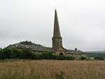 | |||
| Bridgend Village 1, 3 Wemysshall Road | 56°17′45″N 2°58′43″W | Category C(S) | 2618 | | |||
| Cairney Lodge | 56°20′30″N 3°01′10″W | Category B | 2619 | | |||
| Cairney Lodge Home Farm | 56°20′30″N 3°01′12″W | Category C(S) | 2620 | | |||
| Hill Of Tarvit Laundry | 56°17′44″N 3°00′14″W | Category B | 2629 | | |||
| Kilmaron House Garden Wall, Gatepiers And Former Summerhouse | 56°19′57″N 3°01′57″W | Category B | 2634 | | |||
| Pittencrieff Farmhouse, Steading And Former Horsemill | 56°19′54″N 3°00′57″W | Category C(S) | 2640 | | |||
| Easterhill (Former Parsonage), Castlebank Road Including Gatepiers And Boundary Wall (Excluding Modern Bungalow 'suilven' In Grounds) | 56°19′17″N 3°00′25″W | Category C(S) | 49967 | | |||
| 7 And 9 East Road Including Boundary Wall | 56°19′16″N 3°00′21″W | Category C(S) | 49969 | | |||
| Albert Hotel, 102, 104 Bonnygate | 56°19′09″N 3°00′57″W | Category C(S) | 24266 | | |||
| 106 Bonnygate | 56°19′09″N 3°00′58″W | Category C(S) | 24267 | | |||
| 110, 112 Bonnygate "The Star' | 56°19′09″N 3°00′59″W | Category C(S) | 24269 | | |||
| Weston, West Port | 56°19′06″N 3°01′11″W | Category B | 24277 | | |||
| Westfield House, Westfield Road | 56°19′01″N 3°01′15″W | Category B | 24278 | | |||
| Castle Hill (Academy) Primary School Sw Wing | 56°19′11″N 3°00′39″W | Category B | 24288 | | |||
| D Maitland Makgill Crichton (1801-51) Statue, South Road | 56°19′00″N 3°00′32″W | Category C(S) | 24295 | | |||
| Southfield, Ceres Road (James Place) | 56°18′48″N 3°00′34″W | Category B | 24298 | | |||
| Knox's Cottages, South Road | 56°18′40″N 3°00′40″W | Category B | 24299 | | |||
| Marybank, East Burnside Including Railings And Bridge Over Lady Burn | 56°19′15″N 3°00′37″W | Category B | 24302 | | |||
| County Buildings, St Catherine Street. C) East Section | 56°19′10″N 3°00′33″W | Category B | 24162 | | |||
| Former George Hotel, 11-13 Crossgate (Front Building Only) | 56°19′09″N 3°00′43″W | Category C(S) | 24176 | | |||
| 15-17 Crossgate (Front Building Only) | 56°19′09″N 3°00′43″W | Category C(S) | 24177 | | |||
| 21-27 Crossgate (Front Building Only) | 56°19′08″N 3°00′43″W | Category C(S) | 24179 | | |||
| 4 Crossgate | 56°19′09″N 3°00′41″W | Category C(S) | 24188 | | |||
| 6 Crossgate | 56°19′09″N 3°00′41″W | Category C(S) | 24189 | | |||
| The Barony | 56°19′00″N 3°00′45″W | Category C(S) | 24216 | | |||
| Bellfield House, Millgate | 56°18′58″N 3°00′53″W | Category B | 24218 | | |||
| Arkaig 5 Millgate | 56°19′00″N 3°00′46″W | Category C(S) | 24222 | | |||
| Ymca 93 Bonnygate (Front Building Only) | 56°19′10″N 3°00′58″W | Category C(S) | 24241 | | |||
| 38-40 Bonnygate | 56°19′10″N 3°00′48″W | Category C(S) | 24253 | | |||
| 60-62 Bonnygate | 56°19′09″N 3°00′51″W | Category C(S) | 24257 | | |||
| Carslogie House & Garden Walls | 56°19′01″N 3°02′55″W | Category B | 2622 | | |||
| Clushford Clushgreen Bridge Over Eden (Near Springfield Village) | 56°17′40″N 3°03′04″W | Category B | 2623 | | |||
| Hill Of Tarvit Stable Lodge | 56°17′41″N 3°00′12″W | Category C(S) | 2630 | | |||
| Kilmaron Farmhouse | 56°20′06″N 3°02′51″W | Category C(S) | 2633 | | |||
| Drumdryan Quarry Powder Magazine | 56°18′28″N 2°59′49″W | Category C(S) | 51660 | | |||
| 98 Bonnygate, Corner Of Provost's Wynd | 56°19′09″N 3°00′56″W | Category C(S) | 24265 | | |||
| 108 Bonnygate | 56°19′09″N 3°00′59″W | Category C(S) | 24268 | | |||
| Bandstand, Hood Park | 56°19′10″N 3°00′28″W | Category B | 24289 | | |||
| Wm Watt, Seed Merchant Offices (Former Prison) Station Road | 56°19′07″N 3°00′29″W | Category B | 24290 | | |||
| Station Bridge Over Railway | 56°19′00″N 3°00′34″W | Category B | 24294 | | |||
| D Brown, Ashlar Lane | 56°19′02″N 3°00′51″W | Category C(S) | 24140 | | |||
| 9 Kirk Wynd | 56°19′05″N 3°00′50″W | Category C(S) | 24150 | | |||
| Mercat Cross | 56°19′10″N 3°00′42″W | Category B | 24155 | | |||
| County Buildings, St Catherine Street. B) Centre Section | 56°19′10″N 3°00′35″W | Category B | 24161 | | |||
| 5 The Cross And Walker's Tavern Within Close | 56°19′11″N 3°00′42″W | Category B | 24172 | | |||
| 1-3 Crossgate And 6 Bonnygate | 56°19′10″N 3°00′44″W | Category B | 24174 | | |||
| 5-9 Crossgate (Front Building Only) | 56°19′09″N 3°00′43″W | Category C(S) | 24175 | | |||
| 59 Crossgate With Pend To 57 | 56°19′05″N 3°00′44″W | Category C(S) | 24185 | | |||
| 44 Crossgate | 56°19′06″N 3°00′41″W | Category C(S) | 24201 | | |||
| Savings Bank 46 Crossgate | 56°19′06″N 3°00′41″W | Category C(S) | 24202 | | |||
| 43 Bonnygate And 2, 4 Lady Wynd | 56°19′11″N 3°00′48″W | Category C(S) | 24232 | | |||
| Preston Lodge, 95 Bonnygate | 56°19′10″N 3°01′00″W | Category A | 24242 | | |||
| 10 Bonnygate | 56°19′10″N 3°00′45″W | Category C(S) | 24245 | | |||
| 12, 14 Bonnygate | 56°19′09″N 3°00′45″W | Category C(S) | 24246 | | |||
| 34, 36 Bonnygate | 56°19′09″N 3°00′48″W | Category C(S) | 24252 | | |||
| Parish Church | 56°19′02″N 3°00′53″W | Category B | 24137 | | |||
| Cupar Old And St Michael Of Tarvit Parish Church Graveyard | 56°19′01″N 3°00′55″W | Category B | 24138 | | |||
| Prestonhall Dovecot | 56°19′21″N 2°59′04″W | Category B | 2673 | | |||
| Trynlaw | 56°18′46″N 3°02′04″W | Category B | 2675 | | |||
| Cairney Lodge Gate Lodge | 56°20′23″N 3°01′13″W | Category C(S) | 2621 | | |||
| Hill Of Tarvit Stables | 56°17′42″N 3°00′11″W | Category B | 2631 | | |||
| Kilmaron House South Lodge And Gatepiers | 56°19′52″N 3°02′24″W | Category B | 2635 | | |||
| Kinloss Steading | 56°19′44″N 3°01′34″W | Category B | 2639 | | |||
| 1 East Road, Boundary Wall With Toll Post And Gatepiers Excluding Modern House | 56°19′14″N 3°00′25″W | Category B | 49968 | |
Key
The scheme for classifying buildings in Scotland is:
- Category A: "buildings of national or international importance, either architectural or historic; or fine, little-altered examples of some particular period, style or building type."[1]
- Category B: "buildings of regional or more than local importance; or major examples of some particular period, style or building type, which may have been altered."[1]
- Category C: "buildings of local importance; lesser examples of any period, style, or building type, as originally constructed or moderately altered; and simple traditional buildings which group well with other listed buildings."[1]
In March 2016 there were 47,288 listed buildings in Scotland. Of these, 8% were Category A, and 50% were Category B, with the remaining 42% being Category C.[2]
gollark: As an ethical dragon keeper, I basically just go about hatching eggs and either trading them or raising them to adulthood.
gollark: So, *a* zombie month.
gollark: Oh, right.
gollark: It's August.
gollark: Huh?
See also
Notes
- Sometimes known as OSGB36, the grid reference (where provided) is based on the British national grid reference system used by the Ordnance Survey.
• "Guide to National Grid". Ordnance Survey. Retrieved 2007-12-12.
• "Get-a-map". Ordnance Survey. Retrieved 2007-12-17. - Historic Environment Scotland assign a unique alphanumeric identifier to each designated site in Scotland, for listed buildings this always begins with "LB", for example "LB12345".
References
- All entries, addresses and coordinates are based on data from Historic Scotland. This data falls under the Open Government Licence
- "What is Listing?". Historic Environment Scotland. Retrieved 29 May 2018.
- Scotland's Historic Environment Audit 2016 (PDF). Historic Environment Scotland and the Built Environment Forum Scotland. pp. 15–16. Retrieved 29 May 2018.
This article is issued from Wikipedia. The text is licensed under Creative Commons - Attribution - Sharealike. Additional terms may apply for the media files.