List of highways in Presidio County, Texas
The following is a list of all state highways in Presidio County, Texas maintained by the Texas Department of Transportation. All state highways in Texas are paved.
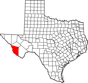
Location of Presidio County
U.S. highways
| Route Name | Direction | Termini | Junctions | Length[1] | Remarks |
|---|---|---|---|---|---|
| S/N | Brewster County |
74.60 miles (120.1 km) | Begins at Presidio, passes through Shafter, then overlays US 90 from Marfa eastward | ||
| S/N | Brewster County Brewster County |
1.5 miles (2.4 km) | Overlays US 90 and briefly reenters county | ||
| W/E | Jeff Davis County Brewster County |
41.8 miles (67.3 km) | Route overlays US 67 from Marfa eastward | ||
| S/N | Brewster County Brewster County |
1.5 miles (2.4 km) | Overlays US 90 and briefly reenters county |
U.S. highway business routes
| Route Name | Direction | Termini | Junctions | Length | Remarks |
|---|---|---|---|---|---|
| S/N | 1.8 miles (2.9 km)[4] |
State highways
| Route Name | Direction | Termini | Junctions | Length[1] | Remarks |
|---|---|---|---|---|---|
| S/N | Jeff Davis County |
8.7 miles (14.0 km) | Route begins in Marfa |
State highway spurs
| Route Name | Direction | Termini | Junctions | Length | Remarks |
|---|---|---|---|---|---|
| S/N | Dead end |
0.8 miles (1.3 km)[6] | |||
Farm and ranch to market roads
| Route Name | Direction | Termini | Junctions | Length | Remarks |
|---|---|---|---|---|---|
| S/N | Casa Piedra Road |
25.0 miles (40.2 km)[7] | |||
| W/E | Chispa Road Brewster County |
98.0 miles (157.7 km)[1] | Follows Rio Grande through Candelaria, Ruidosa, Presidio, and Redford | ||
| W/E | Former Marfa airport |
2.9 miles (4.7 km)[9] | |||
| S/N | Pinto Canyon County Road |
32.0 miles (51.5 km)[10] | |||
Historic roads
| Route Name | Direction | Termini | Remarks |
|---|---|---|---|
| W/E | Jeff Davis County Brewster County |
Replaced by US 90 in 1939 |
Adjacent countries and counties
- Jeff Davis County (north)
- Brewster County (east)
- Mexico (southwest)
gollark: It's awful for both heat AND power.
gollark: And it does that badly.
gollark: Wow. That is an awful design.
gollark: I imagine HEE-Ox reactors will be the next big thing.
gollark: ***u n u n o c t i u m***
References
- Texas Department of Transportation, Statewide Planning Map
- Transportation Planning and Programming Division (n.d.). "U.S. Highway No. 67". Highway Designation Files. Texas Department of Transportation.
- Transportation Planning and Programming Division (n.d.). "U.S. Highway No. 90". Highway Designation Files. Texas Department of Transportation.
- Texas Department of Transportation, "Highway Designation File - Business U.S. Highway No.67-A Archived 2012-10-10 at the Wayback Machine"
- Transportation Planning and Programming Division (n.d.). "State Highway No. 17". Highway Designation Files. Texas Department of Transportation.
- Transportation Planning and Programming Division (n.d.). "State Highway Spur No. 203". Highway Designation Files. Texas Department of Transportation.
- Transportation Planning and Programming Division (n.d.). "Ranch to Market Road No. 169". Highway Designation Files. Texas Department of Transportation.
- Transportation Planning and Programming Division (n.d.). "Farm to Market Road No. 170". Highway Designation Files. Texas Department of Transportation.
- Transportation Planning and Programming Division (n.d.). "Farm to Market Road No. 1112". Highway Designation Files. Texas Department of Transportation.
- Transportation Planning and Programming Division (n.d.). "Ranch to Market Road No. 2810". Highway Designation Files. Texas Department of Transportation.
- Transportation Planning and Programming Division (n.d.). "State Highway No. 3". Highway Designation Files. Texas Department of Transportation.
This article is issued from Wikipedia. The text is licensed under Creative Commons - Attribution - Sharealike. Additional terms may apply for the media files.