List of glaciers in Wyoming
Wyoming /waɪˈoʊmɪŋ/ (![]()
- Baby Glacier, Sublette County, Wyoming, 43°10′16″N 109°41′01″W, el. 11,696 feet (3,565 m)[1]
- Bull Lake Glacier, Fremont County, Wyoming, 43°07′28″N 109°35′56″W, el. 12,306 feet (3,751 m)[2]
- Connie Glacier, Sublette County, Wyoming, 43°16′07″N 109°41′37″W, el. 12,021 feet (3,664 m)[3]
- Continental Glacier, Fremont County, Wyoming, 43°20′03″N 109°41′29″W, el. 12,424 feet (3,787 m)[4]
- Dinwoody Glacier, Fremont County, Wyoming, 43°10′24″N 109°38′19″W, el. 11,585 feet (3,531 m)[5]
- Downs Glacier, Fremont County, Wyoming, 43°17′41″N 109°39′49″W, el. 11,995 feet (3,656 m)[6]
- Dry Creek Glacier, Fremont County, Wyoming, 43°10′38″N 109°30′30″W, el. 12,320 feet (3,760 m)[7]
- DuNoir Glacier, Fremont County, Wyoming, 43°47′46″N 109°52′10″W, el. 11,142 feet (3,396 m)[8]
- East Torrey Glacier, Fremont County, Wyoming, 43°19′16″N 109°40′31″W, el. 12,600 feet (3,800 m)[9]
- Falling Ice Glacier, Teton County, Wyoming, 43°50′00″N 110°46′13″W, el. 10,991 feet (3,350 m)[10]
- Fishhawk Glacier, Park County, Wyoming, 44°15′40″N 109°51′58″W, el. 10,646 feet (3,245 m)[11]
- Gannett Glacier, Fremont County, Wyoming, 43°11′45″N 109°38′44″W, el. 11,817 feet (3,602 m)[12]
- Gooseneck Glacier, Fremont County, Wyoming, 43°10′55″N 109°38′54″W, el. 12,375 feet (3,772 m)[13]
- Grasshopper Glacier, Fremont County, Wyoming, 43°14′12″N 109°39′55″W, el. 12,257 feet (3,736 m)[14]
- Harrower Glacier, Sublette County, Wyoming, 43°06′02″N 109°35′18″W, el. 12,014 feet (3,662 m)[15]
- Heap Steep Glacier, Fremont County, Wyoming, 43°10′30″N 109°37′03″W, el. 11,785 feet (3,592 m)[16]
- Helen Glacier, Fremont County, Wyoming, 43°09′21″N 109°37′01″W, el. 11,909 feet (3,630 m)[17]
- Hooker Glacier, Fremont County, Wyoming, 42°51′24″N 109°18′40″W, el. 11,197 feet (3,413 m)[18]
- J Glacier, Sublette County, Wyoming, 43°14′17″N 109°41′56″W, el. 11,876 feet (3,620 m)[19]
- Klondike Glacier, Fremont County, Wyoming, 43°13′26″N 109°39′59″W, el. 12,600 feet (3,800 m)[20]
- Knife Point Glacier, Fremont County, Wyoming, 43°06′41″N 109°34′39″W, el. 11,552 feet (3,521 m)[21]
- Lander Glacier, Fremont County, Wyoming, 42°52′02″N 109°19′45″W, el. 11,800 feet (3,600 m)[22]
- Lizard Head Glacier, Fremont County, Wyoming, 42°47′34″N 109°12′23″W, el. 12,000 feet (3,700 m)[23]
- Lower Fremont Glacier, Fremont County, Wyoming, 43°07′56″N 109°35′49″W, el. 12,090 feet (3,690 m)[24]
- Mammoth Glacier, Sublette County, Wyoming, 43°10′05″N 109°39′59″W, el. 11,886 feet (3,623 m)[25]
- Middle Teton Glacier, Teton County, Wyoming, 43°43′57″N 110°48′15″W, el. 10,869 feet (3,313 m)[26]
- Minor Glacier, Sublette County, Wyoming, 43°11′12″N 109°39′45″W, el. 12,047 feet (3,672 m)[27]
- Petersen Glacier, Teton County, Wyoming, 43°46′45″N 110°50′54″W, el. 9,813 feet (2,991 m)[28]
- Sacagawea Glacier, Fremont County, Wyoming, 43°08′37″N 109°36′42″W, el. 11,985 feet (3,653 m)[29]
- Schoolroom Glacier, Teton County, Wyoming, 43°43′33″N 110°50′56″W, el. 10,203 feet (3,110 m)[30]
- Skillet Glacier, Teton County, Wyoming, 43°50′14″N 110°45′50″W, el. 10,006 feet (3,050 m)[31]
- Sourdough Glacier, Sublette County, Wyoming, 43°14′48″N 109°41′15″W, el. 11,794 feet (3,595 m)[32]
- Sphinx Glacier, Sublette County, Wyoming, 43°09′56″N 109°38′53″W, el. 13,000 feet (4,000 m)[33]
- Stroud Glacier, Sublette County, Wyoming, 43°08′50″N 109°40′46″W, el. 11,663 feet (3,555 m)[34]
- Teepe Glacier, Teton County, Wyoming, 43°44′11″N 110°47′55″W, el. 11,480 feet (3,500 m)[35]
- Teton Glacier, Teton County, Wyoming, 43°44′30″N 110°47′32″W, el. 10,600 feet (3,200 m)[36]
- Tiny Glacier, Sublette County, Wyoming, 43°03′13″N 109°33′56″W, el. 11,591 feet (3,533 m)[37]
- Triple Glaciers, Teton County, Wyoming, 43°50′17″N 110°47′04″W, el. 10,518 feet (3,206 m)[38]
- Twins Glacier, Sublette County, Wyoming, 43°08′59″N 109°39′15″W, el. 11,539 feet (3,517 m)[39]
- Upper Fremont Glacier, Fremont County, Wyoming, 43°07′52″N 109°36′58″W, el. 13,028 feet (3,971 m)[40]
- Washakie Glacier, Fremont County, Wyoming, 42°48′31″N 109°14′47″W, el. 11,335 feet (3,455 m)[41]
- Wind River Glacier, Fremont County, Wyoming, 42°42′31″N 109°07′41″W, el. 12,600 feet (3,800 m)[42]
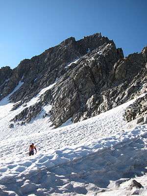
Sacagawea glacier, Fremont County, Wyoming
Notes
- "Baby Glacier". Geographic Names Information System. United States Geological Survey.
- "Bull Lake Glacier". Geographic Names Information System. United States Geological Survey.
- "Connie Glacier". Geographic Names Information System. United States Geological Survey.
- "Continental Glacier". Geographic Names Information System. United States Geological Survey.
- "Dinwoody Glacier". Geographic Names Information System. United States Geological Survey.
- "Downs Glacier". Geographic Names Information System. United States Geological Survey.
- Fremont Peak North, WY (Map). TopoQwest (United States Geological Survey Maps). Retrieved October 19, 2013.
- "DuNoir Glacier". Geographic Names Information System. United States Geological Survey.
- Downs Mountain, WY (Map). TopoQwest (United States Geological Survey Maps). Retrieved October 26, 2013.
- "Falling Ice Glacier". Geographic Names Information System. United States Geological Survey.
- "Fishhawk Glacier". Geographic Names Information System. United States Geological Survey.
- "Gannett Glacier". Geographic Names Information System. United States Geological Survey.
- "Gooseneck Glacier". Geographic Names Information System. United States Geological Survey.
- "Grasshopper Glacier". Geographic Names Information System. United States Geological Survey.
- "Harrower Glacier". Geographic Names Information System. United States Geological Survey.
- "Heap Steep Glacier". Geographic Names Information System. United States Geological Survey.
- "Helen Glacier". Geographic Names Information System. United States Geological Survey.
- "Hooker Glacier". Geographic Names Information System. United States Geological Survey.
- "J Glacier". Geographic Names Information System. United States Geological Survey.
- Gannett Peak, WY (Map). TopoQwest (United States Geological Survey Maps). Retrieved October 26, 2013.
- "Knife Point Glacier". Geographic Names Information System. United States Geological Survey.
- Roberts Mountain, WY (Map). TopoQwest (United States Geological Survey Maps). Retrieved October 26, 2013.
- Lizard Head Peak, WY (Map). TopoQwest (United States Geological Survey Maps). Retrieved October 26, 2013.
- "Lower Fremont Glacier". Geographic Names Information System. United States Geological Survey.
- "Mammoth Glacier". Geographic Names Information System. United States Geological Survey.
- "Middle Teton Glacier". Geographic Names Information System. United States Geological Survey.
- "Minor Glacier". Geographic Names Information System. United States Geological Survey.
- "Petersen Glacier". Geographic Names Information System. United States Geological Survey.
- "Sacagawea Glacier". Geographic Names Information System. United States Geological Survey.
- "Schoolroom Glacier". Geographic Names Information System. United States Geological Survey.
- "Skillet Glacier". Geographic Names Information System. United States Geological Survey.
- "Sourdough Glacier". Geographic Names Information System. United States Geological Survey.
- "The Sphinx". Geographic Names Information System. United States Geological Survey.
- "Stroud Glacier". Geographic Names Information System. United States Geological Survey.
- "Teepe Glacier". Geographic Names Information System. United States Geological Survey.
- "Teton Glacier". Geographic Names Information System. United States Geological Survey.
- "Tiny Glacier". Geographic Names Information System. United States Geological Survey.
- "Triple Glaciers". Geographic Names Information System. United States Geological Survey.
- "Twins Glacier". Geographic Names Information System. United States Geological Survey.
- "Upper Fremont Glacier". Geographic Names Information System. United States Geological Survey.
- "Washakie Glacier". Geographic Names Information System. United States Geological Survey.
- "Wind River Peak". Geographic Names Information System. United States Geological Survey.

This article is issued from Wikipedia. The text is licensed under Creative Commons - Attribution - Sharealike. Additional terms may apply for the media files.