List of cultural property of national significance in Switzerland: Aargau
This list contains all cultural property of national significance (class A) in the canton of Aargau from the 2009 Swiss Inventory of Cultural Property of National and Regional Significance. It is sorted by municipality and contains 175 individual buildings, 11 collections and 56 archaeological finds.
The geographic coordinates provided are in the Swiss coordinate system as given in the Inventory.
Aarau
| KGS No.? |
Picture | Name | Street Address | CH1903 X coordinate | CH1903 Y coordinate | Location |
|---|---|---|---|---|---|---|
| 8924 8489 9321 |
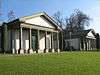
 Aargau Cantonal Library and Aargauer Kunsthaus |
 Aargauerplatz | 645.755 | 248.963 | 47.389903°N 8.044631°E |
| 7 | 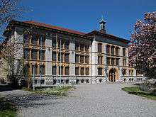 Alte Kantonsschule (Old Cantonal School) |
 Bahnhofstrasse 91 | 646.400 | 249.350 | 47.393339°N 8.053214°E |
| 9815 | 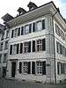 Christian Catholic Rectory (former Helferei) |
 Adelbändli 2 | 645.621 | 249.320 | 47.393123°N 8.042893°E |
| 9281 |  Former Rickenbach factory |
 Rohrerstrasse 12 | 646.649 | 249.405 | 47.393816°N 8.056517°E |
| 10465 | 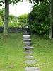 Garten Schmidlin |
 Wasserfluhweg 5 | 645.894 | 248.056 | 47.381736°N 8.046379°E |
| 9386 | 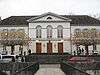 Grossratsgebäude (Grand Council building) |
 Obere Vorstadt 10 | 645.827 | 248.936 | 47.389655°N 8.045582°E |
| 9115 | 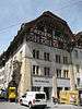 House zum Erker |
 Rathausgasse 10 | 645.666 | 249.282 | 47.392778°N 8.043485°E |
| 12 | 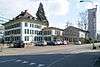 Katholisches Rectory (former Feerhaus) |
 Laurenzenvorstadt 80 | 646.190 | 249.394 | 47.393749°N 8.050437°E |
| 9817 | 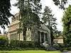 Krematorium |
 Rosengartenweg | 645.942 | 248.758 | 47.388046°N 8.047087°E |
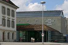
| 8490 | 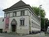 Naturama Aargau |
 Feerstrasse 15 | 646.269 | 249.263 | 47.392565°N 8.05147°E |
| 23 | 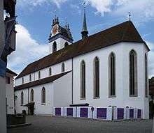 Swiss Reformed Stadtkirche |
 Kirchplatz | 645.595 | 249.273 | 47.392702°N 8.042544°E |
| 5 | 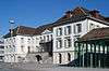 Regierungsgebäude |
 Regierungsplatz | 645.813 | 248.982 | 47.39007°N 8.045401°E |
| 9387 |  Restaurant Zunftstube |
 Pelzgasse 19 | 645.768 | 249.249 | 47.392475°N 8.044833°E |
| 9388 |  «Schlossgarten» |
 Laurenzenvorstadt 3 | 645.848 | 249.425 | 47.394052°N 8.04591°E |
| 8786 |  State Archives des Canton Aargau (State Archives) |
 Entfelderstrasse 22 | 646.121 | 248.740 | 47.387872°N 8.049456°E |
| Unknown | ISOS City: Aarau |
Aarburg
| KGS No.? |
Picture | Name | Street Address | CH1903 X coordinate | CH1903 Y coordinate | Location |
|---|---|---|---|---|---|---|
| 31 | Galgen or Gallows | 635.570 | 243.320 | 47.339778°N 7.909293°E | ||
| 29 |  Gasthof alte Post (former noble seat) |
 Städtchen 5 | 634.773 | 241.192 | 47.32068°N 7.898583°E |
| 28 | castle and fortifications | Schlossrain | 634.950 | 241.300 | 47.321642°N 7.900933°E | |
| Unknown | ISOS Town: Aarburg |
Ammerswil
| KGS No.? |
Picture | Name | Street Address | CH1903 X coordinate | CH1903 Y coordinate | Location |
|---|---|---|---|---|---|---|
| 34 | 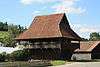 Pfrundspeicher |
 Hendschikerstrasse | 658.124 | 246.988 | 47.371165°N 8.208185°E |
Auw
| KGS No.? |
Picture | Name | Street Address | CH1903 X coordinate | CH1903 Y coordinate | Location |
|---|---|---|---|---|---|---|
| 9822 |  Old Mill |
 Alikonerstrasse 6 | 670.010 | 229.353 | 47.211403°N 8.362791°E |
| 9823 | 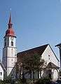 Catholic Parish Church |
 Sinserstrasse | 670.333 | 229.204 | 47.210029°N 8.367031°E |
| 9824 | 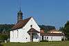 St. Josephs Chapel |
 Rüstenschwil | 670.254 | 231.064 | 47.226766°N 8.366279°E |
| 10547 |  Residential building |
 eastern part, Käsereistrasse 13 | 670.188 | 229.261 | 47.210557°N 8.365126°E |
Baden
| KGS No.? |
Picture | Name | Street Address | CH1903 X coordinate | CH1903 Y coordinate | Location |
|---|---|---|---|---|---|---|
| 9163 | 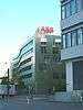 ABB Schweiz Archives |
 Husmatt 7 | 663.644 | 256.308 | 47.454476°N 8.28259°E |
| 9532 | Aquae Helveticae | Roman vicus, medieval/modern spa town | 665.850 | 259.220 | 47.480448°N 8.31227°E | |
| 9391 |  Berner House |
 Weite Gasse 13 | 665.491 | 258.301 | 47.472219°N 8.307372°E |
| 9826 37? |
 Former common building of the Brown Boveri Co. |
 Hauptbahnhof, Bahnhofstrasse 25 | 664.820 | 259.092 | 47.479399°N 8.298587°E |
| 47 |  House «Zum Schwert» |
 Schwertstrasse / Oelrainstrasse 29 | 665.653 | 258.888 | 47.477482°N 8.309607°E |
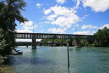
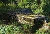
| 46 |  Wooden Bridge |
 Untere Halde / Wettingerstrasse | 665.739 | 258.351 | 47.472644°N 8.310669°E |
| 43 |  Hotel Verenahof |
 Kurplatz 1 | 665.945 | 259.250 | 47.480709°N 8.313534°E |
| 9829 |  Hotel «Zum wilden Mann» |
 Obere Gasse 33 | 665.496 | 258.364 | 47.472785°N 8.307448°E |
| 48 |  Catholic City Church and Sebastian's Chapel |
Kirchplatz | 665.600 | 258.340 | 47.472559°N 8.308824°E |
| 9833 |  Crematorium with Memorial Hall |
 Zürcherstrasse 108 | 665.357 | 257.112 | 47.461539°N 8.305421°E |
| 9508 |  Kurtheater with glass foyer |
 Parkstrasse 20 | 665.689 | 259.190 | 47.480195°N 8.310129°E |
| 9835 |  Swiss Reformed Parish Church |
 Bahnhofplatz | 665.620 | 258.789 | 47.476595°N 8.309155°E |
| 9836 |  Regionalwerke Baden (former Städtische Werke) |
 Haselstrasse 15 | 665.435 | 258.956 | 47.478115°N 8.306726°E |
| 9758 | 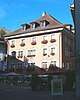 Restaurant "Paradies" |
 Cordulaplatz | 665.454 | 258.316 | 47.472358°N 8.306884°E |
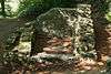
| 44 | 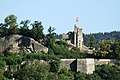 Ruins of Stein Castle |
 665.330 | 258.420 | 47.473305°N 8.305254°E | |
| 39 | 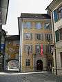 Stadthaus with Tagsatzungssaal |
 Rathausgasse 1 | 665.615 | 258.412 | 47.473205°N 8.309033°E |
| 11609 | Synagogue | Parkstrasse 17 | 665.594 | 259.024 | 47.478711°N 8.308845°E | |
| 53 | 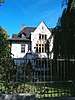 Villa Boveri (since 1943 Clubhaus BBC/ABB) |
 Ländliweg 5 | 665.529 | 258.070 | 47.470138°N 8.307842°E |
| 38 |  Villa Langmatt / Museum Langmatt Sidney and Jenny Brown Foundation |
Römerstrasse 30 | 665.492 | 259.320 | 47.481383°N 8.307535°E |
| Unknown | ISOS City: Baden / Ennetbaden |
Bad Zurzach
| KGS No.? |
Picture | Name | Street Address | CH1903 X coordinate | CH1903 Y coordinate | Location |
|---|---|---|---|---|---|---|
| 320 |  Former Collegiate church of St. Verena |
 Hauptstrasse | 664.280 | 271.030 | 47.586814°N 8.293147°E |
| 9904 | 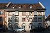 Gasthof «Zur Waag» (Messehaus) |
 Hauptstrasse 25 | 664.212 | 270.908 | 47.585724°N 8.292225°E |
| 319 | 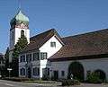 Swiss Reformed Church |
 Schwertgasse 153 | 664.420 | 271.060 | 47.58707°N 8.295012°E |
| 9905 | 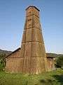 Salzbohr Tower |
 Bohrturmweg | 664.151 | 271.770 | 47.593482°N 8.291539°E |
| 318 |  Tenedo, Pre-historic/Roman/Medieval/Modern Settlement |
664.500 | 271.200 | 47.588321°N 8.296096°E | |
| 11731 | Oberfeld, part of late Roman Rhine fortifications |
665.950 | 270.100 | 47.578285°N 8.315207°E | ||
| Unknown | ISOS Town: Bad Zurzach |
Beinwil (Freiamt)
| KGS No.? |
Picture | Name | Street Address | CH1903 X coordinate | CH1903 Y coordinate | Location |
|---|---|---|---|---|---|---|
| 9841 |  Farm House |
 668.271 | 232.558 | 47.240411°N 8.340324°E | |
| 56 |  Catholic Church of St. Burkhard |
 668.730 | 231.425 | 47.230173°N 8.346213°E | |
| 58 | Horben Castle | 667.261 | 230.285 | 47.220071°N 8.326646°E | ||
| Unknown | ISOS Hamlets: Wiggwil |
Beinwil am See
| KGS No.? |
Picture | Name | Street Address | CH1903 X coordinate | CH1903 Y coordinate | Location |
|---|---|---|---|---|---|---|
| Unknown | Ägelmoos, Bronze Age Settlement |
Besenbüren
| KGS No.? |
Picture | Name | Street Address | CH1903 X coordinate | CH1903 Y coordinate | Location |
|---|---|---|---|---|---|---|
| 9843 |  Speicher (Warehouse) |
 Zentralstrasse | 668.412 | 240.714 | 47.313751°N 8.343428°E |
Biberstein
| KGS No.? |
Picture | Name | Street Address | CH1903 X coordinate | CH1903 Y coordinate | Location |
|---|---|---|---|---|---|---|
| Unknown | ISOS special case: Biberstein |
Birr
| KGS No.? |
Picture | Name | Street Address | CH1903 X coordinate | CH1903 Y coordinate | Location |
|---|---|---|---|---|---|---|
| 64 |  Grave of Heinrich Pestalozzi |
 Pestalozzistrasse 2 | 657.575 | 254.284 | 47.436832°N 8.201856°E |
Boswil
| KGS No.? |
Picture | Name | Street Address | CH1903 X coordinate | CH1903 Y coordinate | Location |
|---|---|---|---|---|---|---|
| 68 |  Catholic Church of St. Pankraz |
 Kirchweg | 666.060 | 239.033 | 47.298872°N 8.312076°E |
| 9846 |  Säge Weissenbach |
 Weissenbach 301 | 665.506 | 236.629 | 47.277306°N 8.304401°E |
| 9845 | .JPG) House (residential house) no. 169 |
House (residential house) no. 169 | Niesenbergstrasse 6 | 665.719 | 239.211 | 47.300507°N 8.307594°E |
| Unknown | ISOS Village: Boswil |
Böttstein
| KGS No.? |
Picture | Name | Street Address | CH1903 X coordinate | CH1903 Y coordinate | Location |
|---|---|---|---|---|---|---|
| 9848 | .jpg) Öhlmühle (Oil Mill) Sägerei (Saw Mill) |
Öhlmühle (Oil Mill) Sägerei (Saw Mill) |
659.095 | 267.399 | 47.554647°N 8.223742°E | |
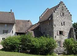
| 69 |  Castle Chapel |
 Schlossweg | 659.141 | 267.448 | 47.555083°N 8.22436°E |
| Unknown | ISOS special case: Böttstein |
Bözberg
| KGS No.? |
Picture | Name | Street Address | CH1903 X coordinate | CH1903 Y coordinate | Location |
|---|---|---|---|---|---|---|
| Unknown | ISOS Dorf: Linn | |||||
| Unknown | ISOS Weiler: Ueberthal | |||||
| Unknown | ISOS Spezialfall: Kirchbözberg |
Bremgarten (AG)
| KGS No.? |
Picture | Name | Street Address | CH1903 X coordinate | CH1903 Y coordinate | Location |
|---|---|---|---|---|---|---|
| 71 | 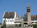 Former Muri Administration Building |
 Antonigasse 2 | 668.183 | 244.831 | 47.350802°N 8.341025°E |
| 9402 | Additional Construction of the Muri Administration Building |
Antonigasse 4 | 668.206 | 244.835 | 47.350836°N 8.34133°E | |
| 76 | 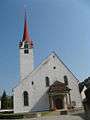 Church Complex with the Catholic City Church and St. Klara Chapel, St. Anna-Chapel and Muttergottes Chapel |
Pfarrgasse / Kirchgasse | 668.113 | 244.949 | 47.351871°N 8.340117°E |
| 80 | 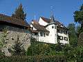 Schlössli |
 Schlossgässli 2 | 668.375 | 244.946 | 47.351817°N 8.343583°E |
| 10416 |  City Fortifications |
 667.960 | 244.830 | 47.350816°N 8.338074°E | |
| 9403 |  Weissenbach House |
 Antonigasse 24 | 668.318 | 244.798 | 47.350491°N 8.342807°E |
| 119 | 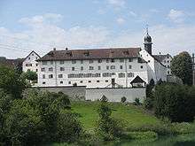 Benedictine Convent of St. Martin |
 Hermetschwil-Staffeln | 668.574 | 242.983 | 47.334141°N 8.345917°E |
| 9858 |  Former Gasthaus (Combination Hotel and Restaurant) |
 Dorfstrasse 9, Hermetschwil-Staffeln | 668.470 | 242.733 | 47.331903°N 8.344503°E |
| Unknown | ISOS Town: Bremgarten (AG) |
Brugg
| KGS No.? |
Picture | Name | Street Address | CH1903 X coordinate | CH1903 Y coordinate | Location |
|---|---|---|---|---|---|---|
| 93 | Schlössli | Im Hof 11, Altenburg bei Brugg | 656.950 | 259.300 | 47.481998°N 8.194211°E | |
| 87 |  Former Lateinschule (former Latin school) |
 Kirchplatz 8 | 657.784 | 259.672 | 47.485271°N 8.205324°E |
| 92 |  Swiss Reformed City Church |
 Kirchplatz | 657.805 | 259.656 | 47.485126°N 8.2056°E |
| 94 |  Schwarzer Turm (Black Tower) |
 Rathausplatz 2 | 657.880 | 259.753 | 47.485991°N 8.206608°E |
| 8506 | 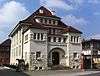 Vindonissa-Museum |
 Museumsstrasse 1 | 657.811 | 259.569 | 47.484343°N 8.205668°E |
| 10415 | Altenburg, Late Roman Castle | Im Hof 11, below the Schlössli | ||||
| Unknown | ISOS City: Brugg |
Büttikon
| KGS No.? |
Picture | Name | Street Address | CH1903 X coordinate | CH1903 Y coordinate | Location |
|---|---|---|---|---|---|---|
| 99 | 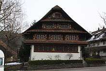 Koch House |
 Sarmenstorferstrasse 9 | 662.733 | 241.954 | 47.325468°N 8.268498°E |
Densbüren
| KGS No.? |
Picture | Name | Street Address | CH1903 X coordinate | CH1903 Y coordinate | Location |
|---|---|---|---|---|---|---|
| 100 | .JPG) Ruins of Urgiz Castle |
Ruins of Urgiz Castle | 646.230 | 256.840 | 47.460715°N 8.051737°E |
Dietwil
| KGS No.? |
Picture | Name | Street Address | CH1903 X coordinate | CH1903 Y coordinate | Location |
|---|---|---|---|---|---|---|
| 101 | 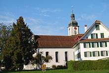 Catholic Parish Church |
 Vorderdorfstrasse | 672.369 | 222.277 | 47.147507°N 8.392792°E |
Effingen
| KGS No.? |
Picture | Name | Street Address | CH1903 X coordinate | CH1903 Y coordinate | Location |
|---|---|---|---|---|---|---|
| Unknown | ISOS Village: Effingen |
Endingen
| KGS No.? |
Picture | Name | Street Address | CH1903 X coordinate | CH1903 Y coordinate | Location |
|---|---|---|---|---|---|---|
| 103 |  Judenfriedhof (Jewish Cemetery) |
 Hauptstrasse | 665.550 | 265.050 | 47.532909°N 8.309147°E |
| 104 |  Synagoge Endingen |
 Hintersieg | 664.084 | 265.469 | 47.536822°N 8.28974°E |
| Unknown | ISOS special case: Endingen | |||||
| Unknown | ISOS Dorf: Unterendingen |
Fisibach
| KGS No.? |
Picture | Name | Street Address | CH1903 X coordinate | CH1903 Y coordinate | Location |
|---|---|---|---|---|---|---|
| 11658 | Bleiche, Part of the late-Roman era Rhine Fortifications |
672.850 | 269.650 | 47.573509°N 8.406836°E |
Fischbach-Göslikon
| KGS No.? |
Picture | Name | Street Address | CH1903 X coordinate | CH1903 Y coordinate | Location |
|---|---|---|---|---|---|---|
| 107 |  Catholic Parish Church of Maria Himmelfahrt |
 Mellingerstrasse | 665.379 | 247.405 | 47.374236°N 8.304293°E |
Frick
| KGS No.? |
Picture | Name | Street Address | CH1903 X coordinate | CH1903 Y coordinate | Location |
|---|---|---|---|---|---|---|
| 109 |  Catholic Church of St. Peter and Paul and Ossuary |
Rampart | 643.990 | 261.686 | 47.504452°N 8.022509°E |
| Unknown | ISOS Verstädtertes Dorf: Frick |
Full-Reuenthal
| KGS No.? |
Picture | Name | Street Address | CH1903 X coordinate | CH1903 Y coordinate | Location |
|---|---|---|---|---|---|---|
| 11660 | Jüppe, Part of the late-Roman era Rhine Fortifications |
658.200 | 274.550 | 47.619037°N 8.212789°E |
Geltwil
| KGS No.? |
Picture | Name | Street Address | CH1903 X coordinate | CH1903 Y coordinate | Location |
|---|---|---|---|---|---|---|
| 111 |  House |
 Isenbergschwilerstrasse 37 | 668.100 | 233.061 | 47.244952°N 8.338142°E |
Gipf-Oberfrick
| KGS No.? |
Picture | Name | Street Address | CH1903 X coordinate | CH1903 Y coordinate | Location |
|---|---|---|---|---|---|---|
| 112 | Ruins of Alt-Thierstein Castle | 640.240 | 260.820 | 47.496903°N 7.972659°E |
Gontenschwil
| KGS No.? |
Picture | Name | Street Address | CH1903 X coordinate | CH1903 Y coordinate | Location |
|---|---|---|---|---|---|---|
| 9856 |  House «Fischerhübel» |
 Fischerhübel 200 | 653.504 | 235.540 | 47.268592°N 8.145656°E |
Gränichen
| KGS No.? |
Picture | Name | Street Address | CH1903 X coordinate | CH1903 Y coordinate | Location |
|---|---|---|---|---|---|---|
| 114 | Swiss Reformed Church |
Swiss Reformed Church | Kirchweg | 650.132 | 245.285 | 47.356505°N 8.102188°E |
| 116 |  Untervogthaus |
 Lochgasse | 649.756 | 245.468 | 47.358179°N 8.097231°E |
Habsburg
| KGS No.? |
Picture | Name | Street Address | CH1903 X coordinate | CH1903 Y coordinate | Location |
|---|---|---|---|---|---|---|
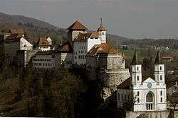
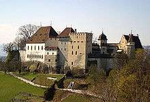
| 117 |  Habsburg |
 Schlossgasse 30 | 655.944 | 257.125 | 47.462524°N 8.180592°E |
Hellikon
| KGS No.? |
Picture | Name | Street Address | CH1903 X coordinate | CH1903 Y coordinate | Location |
|---|---|---|---|---|---|---|
| Unknown | ISOS Dorf: Hellikon |
Hendschiken
| KGS No.? |
Picture | Name | Street Address | CH1903 X coordinate | CH1903 Y coordinate | Location |
|---|---|---|---|---|---|---|
| 9857 | Thatched Roof House | Bühlhofstrasse 4 | 658.380 | 247.807 | 47.378509°N 8.211681°E |
Herznach
| KGS No.? |
Picture | Name | Street Address | CH1903 X coordinate | CH1903 Y coordinate | Location |
|---|---|---|---|---|---|---|
| 120 |  Roman Catholic Church of St. Nikolaus with its Mortuary and Church Treasure |
Kirchweg | 646.065 | 258.160 | 47.472598°N 8.049685°E |
| Unknown | ISOS Dorf: Herznach |
Hornussen
| KGS No.? |
Picture | Name | Street Address | CH1903 X coordinate | CH1903 Y coordinate | Location |
|---|---|---|---|---|---|---|
| 9480 |  Former Säckinger Administration House |
 Hauptstrasse 37 | 647.048 | 261.236 | 47.500193°N 8.063048°E |
| Unknown | ISOS Dorf: Hornussen |
Hunzenschwil
| KGS No.? |
Picture | Name | Street Address | CH1903 X coordinate | CH1903 Y coordinate | Location |
|---|---|---|---|---|---|---|
| 9535 | Ziegelmatte / Zotzelacker, Roman era brickyard |
652.000 | 249.150 | 47.391122°N 8.12736°E |
Jonen
| KGS No.? |
Picture | Name | Street Address | CH1903 X coordinate | CH1903 Y coordinate | Location |
|---|---|---|---|---|---|---|
| 125 |  Pilgrimage Chapel |
 Jonental | 673.560 | 239.360 | 47.301019°N 8.411285°E |
| Unknown | ISOS Dorf: Jonen | |||||
| Unknown | ISOS Weiler: Obschlagen / Litzi |
Kaiseraugst
| KGS No.? |
Picture | Name | Street Address | CH1903 X coordinate | CH1903 Y coordinate | Location |
|---|---|---|---|---|---|---|
| 128 |  |
Augusta Raurica, Roman era City / Late Roman Castle |
621.360 | 265.470 | 47.539609°N 7.72233°E | |
| Unknown | ISOS Dorf: Kaiseraugst |
Kaiserstuhl
| KGS No.? |
Picture | Name | Street Address | CH1903 X coordinate | CH1903 Y coordinate | Location |
|---|---|---|---|---|---|---|
| 133 |  Administration Building of St. Blasien Monastery |
 Hauptstrasse 35 | 673.745 | 269.170 | 47.569092°N 8.41865°E |
| 136 | Mayenfisch- or Marschall House | Rheingasse 5 | 673.727 | 269.204 | 47.5694°N 8.418417°E | |
| 137 |  Oberer Turm, (Upper Tower) |
(Vorstadt) Lindengut | 673.733 | 269.004 | 47.567601°N 8.418463°E |
| 9860 |  Fortifications |
 673.750 | 269.010 | 47.567653°N 8.41869°E | |
| Unknown | ISOS Kleinstadt / Flecken: Kaiserstuhl |
Kaisten
| KGS No.? |
Picture | Name | Street Address | CH1903 X coordinate | CH1903 Y coordinate | Location |
|---|---|---|---|---|---|---|
| Unknown | ISOS Dorf: Ittenthal |
Kallern
| KGS No.? |
Picture | Name | Street Address | CH1903 X coordinate | CH1903 Y coordinate | Location |
|---|---|---|---|---|---|---|
| 9861 |  Farm House |
 Unterniesenberg 45 | 664.260 | 239.596 | 47.304113°N 8.288359°E |
Klingnau
| KGS No.? |
Picture | Name | Street Address | CH1903 X coordinate | CH1903 Y coordinate | Location |
|---|---|---|---|---|---|---|
| 140 |  Former Provost's House of St. Blasien Monastery |
 Propsteistrasse 1 | 661.999 | 270.250 | 47.580019°N 8.262718°E |
| Unknown | ISOS Kleinstadt / Flecken: Klingnau |
Koblenz
| KGS No.? |
Picture | Name | Street Address | CH1903 X coordinate | CH1903 Y coordinate | Location |
|---|---|---|---|---|---|---|
| 10514 | _06_09.jpg) Koblenz–Felsenau railway bridge (Shared with Leuggern) |
Koblenz–Felsenau railway bridge (Shared with Leuggern) | 658.845 | 272.177 | 47.597639°N 8.221053°E | |
| 9072 | Koblenz–Waldshut railway bridge | 659.820 | 273.460 | 47.609089°N 8.234189°E | ||
| 142 | Kleiner Laufen, Part of the late-Roman era Rhine Fortifications |
661.380 | 274.040 | 47.614161°N 8.255014°E |
Kölliken
| KGS No.? |
Picture | Name | Street Address | CH1903 X coordinate | CH1903 Y coordinate | Location |
|---|---|---|---|---|---|---|
| 9864 | 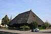 Strohdachhaus Dorfmuseum, Thatched-Roof-House Museum |
Hauptstrasse 43 | 644.287 | 242.796 | 47.334537°N 8.02458°E |
| 143 | 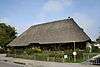 Thatched Roof House |
 Schönenwerderstrasse 6 | 644.208 | 243.169 | 47.337897°N 8.023571°E |
Künten
| KGS No.? |
Picture | Name | Street Address | CH1903 X coordinate | CH1903 Y coordinate | Location |
|---|---|---|---|---|---|---|
| 9865 | 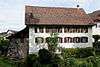 Mill |
 Mühlegasse 2 | 667.249 | 249.005 | 47.388438°N 8.329291°E |
Laufenburg
| KGS No.? |
Picture | Name | Street Address | CH1903 X coordinate | CH1903 Y coordinate | Location |
|---|---|---|---|---|---|---|
| 147 | Courthouse | Gerichtsgasse 86 | 646.738 | 268.038 | 47.561389°N 8.059648°E | |
| 149 |  Catholic Parish Church |
 646.880 | 268.100 | 47.561937°N 8.061541°E | |
| 8985 | Powerplant of Laufenburg |
Powerplant of Laufenburg | Dorf | 645.930 | 267.420 | 47.555888°N 8.048849°E |
| 152 11674 |
Ruins of Laufenburg Castle and Schlossberg, Part of the late-Roman era Rhine Fortifications |
646.830 | 268.060 | 47.56158°N 8.060873°E | ||
| Unknown | ISOS Kleinstadt / Flecken: Laufenburg |
Leimbach
| KGS No.? |
Picture | Name | Street Address | CH1903 X coordinate | CH1903 Y coordinate | Location |
|---|---|---|---|---|---|---|
| 155 |  Straw Thatched House |
 Seeberg | 655.611 | 236.450 | 47.276603°N 8.173609°E |
Lengnau
| KGS No.? |
Picture | Name | Street Address | CH1903 X coordinate | CH1903 Y coordinate | Location |
|---|---|---|---|---|---|---|
| 156 |  Synagoge |
 Zürichstrasse | 667.180 | 263.740 | 47.520964°N 8.330594°E |
| Unknown | ISOS Weiler: Husen | |||||
| Unknown | ISOS Weiler: Vogelsang | |||||
| Unknown | ISOS Spezialfall: Lengnau |
Lenzburg
| KGS No.? |
Picture | Name | Street Address | CH1903 X coordinate | CH1903 Y coordinate | Location |
|---|---|---|---|---|---|---|
| 10464 |  Castle Hill |
 Schlossgasse 21 | 656.196 | 248.589 | 47.385732°N 8.182861°E |
| Unknown |  Goffersberg, Neolithic Graves |
656.490 | 248.715 | 47.38684°N 8.18677°E | |
| 158 | Lindfeld, Roman era Vicus |
656.780 | 249.420 | 47.393156°N 8.1907°E | ||
| 162 |  Müller House |
 Bleicherain 7 | 655.622 | 248.625 | 47.386104°N 8.175264°E |
| 165 |  Rathaus (Town council house) |
 Rathausgasse 16 | 655.993 | 248.763 | 47.387314°N 8.180195°E |
| 159 8492 |
 Castle and Prehistoric Settlement with Historical Museum of Aargau |
Schloss 1 | 656.379 | 248.790 | 47.387524°N 8.18531°E |
| 9871 |  Sonnenberg (former Landweibelei) |
 Schlossgasse 50 | 656.446 | 248.614 | 47.385935°N 8.186175°E |
| 8992 |  Prison |
 Ziegeleiweg 13 | 655.858 | 247.935 | 47.379878°N 8.178304°E |
| 9873 |  Villa Malaga |
 Schützenmattstrasse 7 | 656.127 | 249.002 | 47.389452°N 8.181999°E |
| Unknown | ISOS Kleinstadt / Flecken: Lenzburg |
Leuggern
| KGS No.? |
Picture | Name | Street Address | CH1903 X coordinate | CH1903 Y coordinate | Location |
|---|---|---|---|---|---|---|
| 9875 | Railway Bridge Koblenz-Felsenau (Shared with Koblenz) |
Railway Bridge Koblenz-Felsenau (Shared with Koblenz) | 658.845 | 272.177 | 47.597639°N 8.221053°E | |
| Unknown | Im Sand-Felsenau, Part of the late-Roman era Rhine Fortifications |
658.860 | 273.640 | 47.610795°N 8.221446°E | ||
| 11675 | ISOS Weiler: Hettenschwil |
Leutwil
| KGS No.? |
Picture | Name | Street Address | CH1903 X coordinate | CH1903 Y coordinate | Location |
|---|---|---|---|---|---|---|
| 9876 |  Farm House Baumann |
 Zopfweg 2 | 655.535 | 240.295 | 47.311192°N 8.17308°E |
Magden
| KGS No.? |
Picture | Name | Street Address | CH1903 X coordinate | CH1903 Y coordinate | Location |
|---|---|---|---|---|---|---|
| 9539 | Strick, Paleolithic / Neolithic Settlement |
629.200 | 264.850 | 47.533731°N 7.826415°E |
Mandach
| KGS No.? |
Picture | Name | Street Address | CH1903 X coordinate | CH1903 Y coordinate | Location |
|---|---|---|---|---|---|---|
| Unknown | ISOS Dorf: Mandach |
Meisterschwanden
| KGS No.? |
Picture | Name | Street Address | CH1903 X coordinate | CH1903 Y coordinate | Location |
|---|---|---|---|---|---|---|
| Unknown | Villa Fischer | Kirchrain 11 | 659.963 | 238.473 | 47.294417°N 8.231393°E | |
| 169 | ISOS Spezialfall: Meisterschwanden |
Mellingen
| KGS No.? |
Picture | Name | Street Address | CH1903 X coordinate | CH1903 Y coordinate | Location |
|---|---|---|---|---|---|---|
| 175 |  Ibergerhof |
 Kleine Kirchgasse 11 | 663.125 | 252.211 | 47.41768°N 8.275129°E |
| 177 |  City Walls |
 663.000 | 252.350 | 47.418942°N 8.273492°E | |
| Unknown | ISOS Kleinstadt / Flecken: Mellingen |
Menziken
| KGS No.? |
Picture | Name | Street Address | CH1903 X coordinate | CH1903 Y coordinate | Location |
|---|---|---|---|---|---|---|
| 180 | 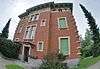 Villa Mathys |
 Hofmattpark 1 A | 657.156 | 231.930 | 47.235817°N 8.193453°E |
Merenschwand
| KGS No.? |
Picture | Name | Street Address | CH1903 X coordinate | CH1903 Y coordinate | Location |
|---|---|---|---|---|---|---|
| 181 | 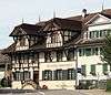 Gasthof «Zum Schwanen» |
 Bremgartenstrasse 2 | 670.814 | 234.757 | 47.259921°N 8.374254°E |
| 182 |  Catholic Parish Church |
 Kirchplatz | 670.914 | 234.787 | 47.26018°N 8.375579°E |
| Unknown | ISOS Dorf: Merenschwand |
Mettauertal
| KGS No.? |
Picture | Name | Street Address | CH1903 X coordinate | CH1903 Y coordinate | Location |
|---|---|---|---|---|---|---|
| 123 | 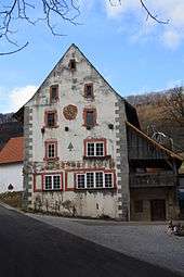 Hottwil, Former Untervogtei with Outbuildings |
Leumenstrasse 41 | 654.348 | 266.538 | 47.547313°N 8.160574°E |
| 184 | 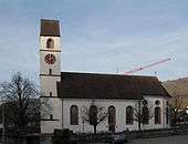 Catholic Parish Church |
 Mettau, Hauptstrasse | 651.740 | 268.400 | 47.56427°N 8.126149°E |
Möhlin
| KGS No.? |
Picture | Name | Street Address | CH1903 X coordinate | CH1903 Y coordinate | Location |
|---|---|---|---|---|---|---|
| 9877 | 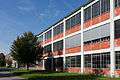 Bata Area |
 Batastrasse 719, 743 | 630.200 | 268.876 | 47.569894°N 7.839968°E |
| 11752 | Fahrgraben, Part of the late-Roman era Rhine Fortifications |
632.700 | 270.850 | 47.587528°N 7.873335°E | ||
| 185 | Riburg «Bürkli», Part of the late-Roman era Rhine Fortifications |
630.100 | 270.080 | 47.580727°N 7.838721°E | ||
| 11753 | Untere Wehren, Part of the late-Roman era Rhine Fortifications |
634.075 | 270.750 | 47.586558°N 7.891606°E |
Möriken-Wildegg
| KGS No.? |
Picture | Name | Street Address | CH1903 X coordinate | CH1903 Y coordinate | Location |
|---|---|---|---|---|---|---|
| 9878 | Gasthof Bären | Bruggerstrasse 19 | 655.018 | 252.136 | 47.417732°N 8.167698°E | |
| 9732 | 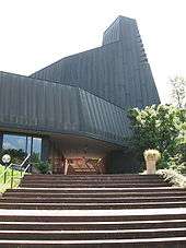 Catholic Church of St. Antonius |
 Stroheggstrasse | 655.277 | 251.926 | 47.415822°N 8.171103°E |
| 188 |  Kestenberg, Bronze Age Hilltop Settlement |
657.530 | 252.870 | 47.424119°N 8.201077°E | |
| 189 |  |
Wildegg Castle (Part of the Swiss National Museums) |
Effingerweg 5, 6, 8 | 655.217 | 252.466 | 47.420683°N 8.170375°E |
| 8605 | ISOS Spezialfall: Wildegg |
Mumpf
| KGS No.? |
Picture | Name | Street Address | CH1903 X coordinate | CH1903 Y coordinate | Location |
|---|---|---|---|---|---|---|
| 9562 | Chapf, Prehistoric Settlement |
636.290 | 265.930 | 47.543091°N 7.920657°E | ||
| 9563 |  Gasthaus (Combination Hotel and Restaurant) Anker, Built on the site of a Late-Roman Castle, Part of the Rhine Fortifications |
635.950 | 266.350 | 47.546887°N 7.916175°E |
Muri
| KGS No.? |
Picture | Name | Street Address | CH1903 X coordinate | CH1903 Y coordinate | Location |
|---|---|---|---|---|---|---|
| 194 |  Former Benedictine Abbey |
 Marktstrasse | 668.049 | 236.399 | 47.27498°N 8.337973°E |
| 9498 | 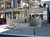 Leontiusbrunnen (Fountain) |
 Leontiusplatz | 667.969 | 236.395 | 47.274952°N 8.336915°E |
| 195 | 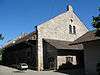 The so-called Klosterscheune |
 Klosterhof 197 | 668.060 | 236.657 | 47.277299°N 8.338158°E |
| 9883 | Granary | Hasli 233 | 668.331 | 237.565 | 47.285438°N 8.341877°E | |
| Unknown | ISOS Weiler: Hasli |
Niederlenz
| KGS No.? |
Picture | Name | Street Address | CH1903 X coordinate | CH1903 Y coordinate | Location |
|---|---|---|---|---|---|---|
| 9884 | 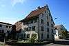 Former Tithe barn of Lenzburg Castle |
 Dorfrain 9 | 655.616 | 250.365 | 47.401754°N 8.175401°E |
Niederwil
| KGS No.? |
Picture | Name | Street Address | CH1903 X coordinate | CH1903 Y coordinate | Location |
|---|---|---|---|---|---|---|
| 197 | 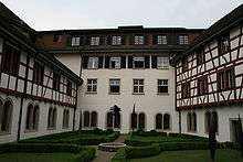 Former Cistercian Nuns Convent of Gnadenthal |
 Gnadenthalerstrasse | 665.240 | 249.556 | 47.393595°N 8.302766°E |
Oberkulm
| KGS No.? |
Picture | Name | Street Address | CH1903 X coordinate | CH1903 Y coordinate | Location |
|---|---|---|---|---|---|---|
| 201 | 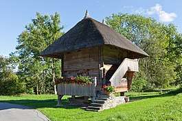 Granary |
 Im Obersteg 106 | 651.761 | 238.465 | 47.295039°N 8.122961°E |
Oberlunkhofen
| KGS No.? |
Picture | Name | Street Address | CH1903 X coordinate | CH1903 Y coordinate | Location |
|---|---|---|---|---|---|---|
| 202 | 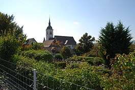 Catholic Parish Church |
 Chileweg | 671.918 | 240.606 | 47.312407°N 8.389775°E |
Obersiggenthal
| KGS No.? |
Picture | Name | Street Address | CH1903 X coordinate | CH1903 Y coordinate | Location |
|---|---|---|---|---|---|---|
| 10408 |  Tithe barn |
 Kirchweg 14 | 664.527 | 260.043 | 47.487981°N 8.294838°E |
| Unknown | ISOS Dorf: Kirchdorf |
Oftringen
| KGS No.? |
Picture | Name | Street Address | CH1903 X coordinate | CH1903 Y coordinate | Location |
|---|---|---|---|---|---|---|
| 207 |  Ruins of Alt-Wartburg Castle |
 636.310 | 242.610 | 47.333351°N 7.919027°E |
Olsberg
| KGS No.? |
Picture | Name | Street Address | CH1903 X coordinate | CH1903 Y coordinate | Location |
|---|---|---|---|---|---|---|
| 208 | 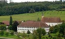 Former Cistercian Nuns Convent with Church and Outbuildings |
 625.245 | 263.745 | 47.523957°N 7.77383°E |
Othmarsingen
| KGS No.? |
Picture | Name | Street Address | CH1903 X coordinate | CH1903 Y coordinate | Location |
|---|---|---|---|---|---|---|
| 209 |  Swiss Reformed Church |
 658.500 | 250.040 | 47.398581°N 8.213562°E |
Rheinfelden
| KGS No.? |
Picture | Name | Street Address | CH1903 X coordinate | CH1903 Y coordinate | Location |
|---|---|---|---|---|---|---|
| 213 | 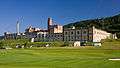 Feldschlösschen Brewery |
 Feldschlösschenstrasse 34 | 626.130 | 266.260 | 47.546541°N 7.785728°E |
| 214 | .jpg) Christian Catholic Collegiate church of St. Martin |
Christian Catholic Collegiate church of St. Martin | Kirchgasse | 626.650 | 267.110 | 47.554165°N 7.792687°E |
| 9886 |  Former Gasthof zum goldenen Adler |
 Obertorplatz 4 | 626.796 | 267.100 | 47.554069°N 7.794626°E |
| 11754 | Heimenholz, Part of the late-Roman era Rhine Fortifications |
628.875 | 270.760 | 47.586898°N 7.822483°E | ||
| 217 | 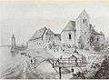 Johanniter Chapel |
 Johannitergasse 70 | 626.780 | 267.280 | 47.555689°N 7.794424°E |
| 216 | Pferrichgraben, Part of the late-Roman era Rhine Fortifications |
628.375 | 269.390 | 47.574598°N 7.815749°E | ||
| 9888 | 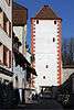 City Walls and Fortifications |
 626.700 | 267.100 | 47.554073°N 7.79335°E | |
| Unknown | ISOS Kleinstadt / Flecken: Rheinfelden |
Rümikon
| KGS No.? |
Picture | Name | Street Address | CH1903 X coordinate | CH1903 Y coordinate | Location |
|---|---|---|---|---|---|---|
| 226 | Sandgraben, Part of the late-Roman era Rhine Fortifications |
671.700 | 269.500 | 47.572287°N 8.39153°E |
Rupperswil
| KGS No.? |
Picture | Name | Street Address | CH1903 X coordinate | CH1903 Y coordinate | Location |
|---|---|---|---|---|---|---|
| Unknown | ISOS Spezialfall: Fabrikanlage Rupperswil |
Sarmenstorf
| KGS No.? |
Picture | Name | Street Address | CH1903 X coordinate | CH1903 Y coordinate | Location |
|---|---|---|---|---|---|---|
| 231 | Zigiholz, Neolithic Graves | 662.430 | 240.250 | 47.310171°N 8.264253°E |
Schafisheim
| KGS No.? |
Picture | Name | Street Address | CH1903 X coordinate | CH1903 Y coordinate | Location |
|---|---|---|---|---|---|---|
| 233 |  Urech House |
 Seetalstrasse 27 | 653.044 | 248.038 | 47.381037°N 8.141055°E |
| 234 |  Schlössli |
 Lenzburgerstrasse 5, 7 | 653.259 | 247.721 | 47.378169°N 8.143864°E |
Schinznach-Bad
| KGS No.? |
Picture | Name | Street Address | CH1903 X coordinate | CH1903 Y coordinate | Location |
|---|---|---|---|---|---|---|
| Unknown | ISOS Spezialfall: Bad Schinznach |
Schinznach
| KGS No.? |
Picture | Name | Street Address | CH1903 X coordinate | CH1903 Y coordinate | Location |
|---|---|---|---|---|---|---|
| 237 |  Swiss Reformed Church with Erlach-Chapel |
 Kirchgasse | 653.080 | 255.300 | 47.446348°N 8.142394°E |
| Unknown | ISOS Dorf: Schinznach Village | |||||
| Unknown | ISOS Dorf: Oberflachs |
Schöftland
| KGS No.? |
Picture | Name | Street Address | CH1903 X coordinate | CH1903 Y coordinate | Location |
|---|---|---|---|---|---|---|
| 242 | Schöftland Castle | Bahnhofstrasse 5 | 646.222 | 239.458 | 47.304382°N 8.049836°E | |
| Unknown | ISOS Verstädtertes Dorf: Schöftland |
Schupfart
| KGS No.? |
Picture | Name | Street Address | CH1903 X coordinate | CH1903 Y coordinate | Location |
|---|---|---|---|---|---|---|
| 243 | .JPG) Herrain, An Earthen Fortification |
Herrain, An Earthen Fortification |
639.760 | 262.880 | 47.51546°N 7.966473°E |
Schwaderloch
| KGS No.? |
Picture | Name | Street Address | CH1903 X coordinate | CH1903 Y coordinate | Location |
|---|---|---|---|---|---|---|
| 244 | Oberes Bürgli, Part of the late-Roman era Rhine Fortifications |
653.420 | 271.300 | 47.590216°N 8.14882°E | ||
| 245 | Unteres Bürgli, Part of the late-Roman era Rhine Fortifications |
652.700 | 270.500 | 47.583079°N 8.139153°E |
Seengen
| KGS No.? |
Picture | Name | Street Address | CH1903 X coordinate | CH1903 Y coordinate | Location |
|---|---|---|---|---|---|---|
| 246 | Risi, Late-Bronze Age Lake Shore Settlement |
Moos / Aabach | 657.750 | 241.000 | 47.317342°N 8.202462°E | |
| 9469 | Brestenberg Castle | Brestenbergstrasse 8 | 658.172 | 241.276 | 47.319788°N 8.208079°E | |
| 247 | Hallwyl Castle | 657.130 | 241.640 | 47.323153°N 8.194344°E | ||
| 9898 |  Schlossmühle (Castle's Mill) |
Boniswilerstrasse 38 | 657.076 | 241.702 | 47.323715°N 8.193638°E |
Seon
| KGS No.? |
Picture | Name | Street Address | CH1903 X coordinate | CH1903 Y coordinate | Location |
|---|---|---|---|---|---|---|
| 9899 | .JPG) Former Untere Mühle |
Former Untere Mühle | Unterdorfstrasse 50 | 654.579 | 244.484 | 47.348948°N 8.160948°E |
| 9470 | .JPG) Villa Walti |
Villa Walti | Oberdorfstrasse 28 | 654.304 | 244.288 | 47.347207°N 8.157285°E |
Sins
| KGS No.? |
Picture | Name | Street Address | CH1903 X coordinate | CH1903 Y coordinate | Location |
|---|---|---|---|---|---|---|
| 9276 |  Former Administration Building |
 Meienberg / Stadtplatz 2 | 670.943 | 227.838 | 47.197677°N 8.374867°E |
| 252 | _2.jpg) Municipal Building (former Rectory) |
Municipal Building (former Rectory) | Kirchstrasse 14 | 672.471 | 227.443 | 47.193959°N 8.394967°E |
| 10485 |  Ruins of Meienberg |
 671.000 | 227.800 | 47.19733°N 8.375614°E |
Spreitenbach
| KGS No.? |
Picture | Name | Street Address | CH1903 X coordinate | CH1903 Y coordinate | Location |
|---|---|---|---|---|---|---|
| 9534 | Moosweg, Neolithic Grave |
671.760 | 252.655 | 47.420788°N 8.389616°E |
Staufen
| KGS No.? |
Picture | Name | Street Address | CH1903 X coordinate | CH1903 Y coordinate | Location |
|---|---|---|---|---|---|---|
| 256 |  Staufberg Church Complex |
 654.670 | 248.000 | 47.380563°N 8.162581°E |
Stein
| KGS No.? |
Picture | Name | Street Address | CH1903 X coordinate | CH1903 Y coordinate | Location |
|---|---|---|---|---|---|---|
| 257 | 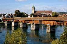 Wooden Bridge |
 Schaffhauserstrasse | 638.488 | 266.275 | 47.546069°N 7.94988°E |
Suhr
| KGS No.? |
Picture | Name | Street Address | CH1903 X coordinate | CH1903 Y coordinate | Location |
|---|---|---|---|---|---|---|
| 9731 |  Catholic Heiliggeist Parish church |
 Tramstrasse | 648.298 | 247.591 | 47.377382°N 8.078162°E |
Sulz
| KGS No.? |
Picture | Name | Street Address | CH1903 X coordinate | CH1903 Y coordinate | Location |
|---|---|---|---|---|---|---|
| 259 | Rheinsulz, Part of the late-Roman era Rhine Fortifications |
648.970 | 267.530 | 47.556658°N 8.089247°E |
Tegerfelden
| KGS No.? |
Picture | Name | Street Address | CH1903 X coordinate | CH1903 Y coordinate | Location |
|---|---|---|---|---|---|---|
| 261 |  So-called Gerichtshaus (Former Meierhof) |
663.778 | 268.323 | 47.562519°N 8.286086°E | |
| Unknown | ISOS Dorf: Tegerfelden |
Thalheim
| KGS No.? |
Picture | Name | Street Address | CH1903 X coordinate | CH1903 Y coordinate | Location |
|---|---|---|---|---|---|---|
| 262 |  Ruins of Schenkenberg castle |
 649.940 | 254.780 | 47.441916°N 8.100706°E | |
| Unknown | ISOS Dorf: Thalheim (AG) |
Unterkulm
| KGS No.? |
Picture | Name | Street Address | CH1903 X coordinate | CH1903 Y coordinate | Location |
|---|---|---|---|---|---|---|
| 266 |  Swiss Reformed Church |
 Hauptstrasse | 651.180 | 240.180 | 47.31051°N 8.115476°E |
Unterlunkhofen
| KGS No.? |
Picture | Name | Street Address | CH1903 X coordinate | CH1903 Y coordinate | Location |
|---|---|---|---|---|---|---|
| 267 |  |
Bärhau, Iron Age Burial Mounds |
672.660 | 241.840 | 47.323424°N 8.399787°E |
Untersiggenthal
| KGS No.? |
Picture | Name | Street Address | CH1903 X coordinate | CH1903 Y coordinate | Location |
|---|---|---|---|---|---|---|
| 269 |  Ruins of Freudenau Castle |
 659.910 | 262.700 | 47.512313°N 8.233937°E | |
| 270 | Heidenküche, Neolithic / Bronze Age Settlement |
662.160 | 261.760 | 47.503651°N 8.263672°E |
Veltheim
| KGS No.? |
Picture | Name | Street Address | CH1903 X coordinate | CH1903 Y coordinate | Location |
|---|---|---|---|---|---|---|
| Unknown | ISOS Dorf: Veltheim |
Villigen
| KGS No.? |
Picture | Name | Street Address | CH1903 X coordinate | CH1903 Y coordinate | Location |
|---|---|---|---|---|---|---|
| Unknown | ISOS Dorf: Villigen |
Villmergen
| KGS No.? |
Picture | Name | Street Address | CH1903 X coordinate | CH1903 Y coordinate | Location |
|---|---|---|---|---|---|---|
| 9900 | 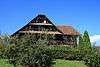 Farm House |
 Halde 2 | 660.496 | 244.600 | 47.349475°N 8.239265°E |
| 9901 | 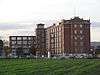 Main Building of the Former Bally Factory |
 Bahnhofstrasse 66 | 660.058 | 247.496 | 47.375561°N 8.233857°E |
| 121 | 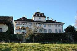 Hilfikon Castle and Chapel |
 Schloss 21 | 661.097 | 242.518 | 47.330694°N 8.246935°E |
| 275 | 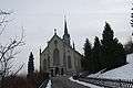 Catholic Parish Church |
 Kirchgasse | 660.835 | 244.199 | 47.345837°N 8.243697°E |
Villnachern
| KGS No.? |
Picture | Name | Street Address | CH1903 X coordinate | CH1903 Y coordinate | Location |
|---|---|---|---|---|---|---|
| 9902 |  Tithe barn |
 Vorstadt 2 | 654.475 | 258.118 | 47.471578°N 8.161232°E |
Wallbach
| KGS No.? |
Picture | Name | Street Address | CH1903 X coordinate | CH1903 Y coordinate | Location |
|---|---|---|---|---|---|---|
| 11755 | Businger House, Part of the late-Roman era Rhine Fortifications |
635.130 | 267.725 | 47.559297°N 7.905391°E | ||
| 276 | Stelli, Part of the late-Roman era Rhine Fortifications |
635.220 | 269.290 | 47.573367°N 7.906711°E | ||
| Unknown | ISOS Dorf: Wallbach |
Wegenstetten
| KGS No.? |
Picture | Name | Street Address | CH1903 X coordinate | CH1903 Y coordinate | Location |
|---|---|---|---|---|---|---|
| Unknown | ISOS Dorf: Wegenstetten |
Wettingen
| KGS No.? |
Picture | Name | Street Address | CH1903 X coordinate | CH1903 Y coordinate | Location |
|---|---|---|---|---|---|---|
| 278 |  Former Cistercian Monastery |
 Klosterstrasse 11 | 666.146 | 256.511 | 47.456055°N 8.315795°E |
| 11732 | Neolithic Stone-lined Graves | 664.775 | 258.175 | 47.471157°N 8.297857°E | ||
| Unknown | ISOS Spezialfall: Limmatknie |
Windisch
| KGS No.? |
Picture | Name | Street Address | CH1903 X coordinate | CH1903 Y coordinate | Location |
|---|---|---|---|---|---|---|
| 9027 |  Former Höhere Technische Lehranstalt |
 Klosterzelgstrasse | 658.372 | 259.045 | 47.479581°N 8.213043°E |
| 287 | 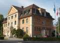 Former Wool Spinning Factory Kunz |
 Alte Spinnerei 4, 5 | 659.669 | 259.293 | 47.481695°N 8.230282°E |
| 281 | 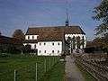 Former Königsfelden Abbey |
 658.728 | 259.127 | 47.480286°N 8.217776°E | |
| 285 | 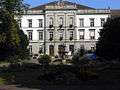 Psychiatric Clinic |
 Königsfelden | 658.550 | 259.244 | 47.481354°N 8.21543°E |
| 284 |  |
Vindonissa, Celtic Oppidum / Roman era Legion Camp / Civilian Settlement |
658.900 | 259.200 | 47.480927°N 8.220067°E | |
| Unknown | ISOS Spezialfall: Königsfelden |
Wittnau
| KGS No.? |
Picture | Name | Street Address | CH1903 X coordinate | CH1903 Y coordinate | Location |
|---|---|---|---|---|---|---|
| 290 | Ruins of Alt Homberg castle | 640.270 | 260.170 | 47.491056°N 7.972999°E | ||
| 289 | Wittnauer Horn, Prehistoric Hilltop Settlement Roman era / Early Middle Ages Fortification |
639.280 | 259.240 | 47.482751°N 7.95978°E | ||
| Unknown | ISOS Dorf: Wittnau |
Wölflinswil
| KGS No.? |
Picture | Name | Street Address | CH1903 X coordinate | CH1903 Y coordinate | Location |
|---|---|---|---|---|---|---|
| Unknown | ISOS Dorf: Wölflinswil |
Wohlen
| KGS No.? |
Picture | Name | Street Address | CH1903 X coordinate | CH1903 Y coordinate | Location |
|---|---|---|---|---|---|---|
| 9537 |  |
Häslerhau, Iron Age Burial Mounds |
662.950 | 246.860 | 47.369571°N 8.272058°E | |
| 291 | Hohbüehl, Iron Age Burial Mounds | 663.360 | 246.700 | 47.368093°N 8.277463°E | ||
| 295 |  Catholic Church of St. Leonhard |
 Kirchenplatz | 663.440 | 244.820 | 47.351177°N 8.278256°E |
Würenlingen
| KGS No.? |
Picture | Name | Street Address | CH1903 X coordinate | CH1903 Y coordinate | Location |
|---|---|---|---|---|---|---|
| Unknown | ISOS Dorf: Würenlingen |
Würenlos
| KGS No.? |
Picture | Name | Street Address | CH1903 X coordinate | CH1903 Y coordinate | Location |
|---|---|---|---|---|---|---|
| 298 |  Benedictine Women's Convent of Fahr |
 675.500 | 251.300 | 47.408184°N 8.438945°E | |
| 300 | Roman era Quarry | 669.420 | 255.685 | 47.44829°N 8.359079°E | ||
| Unknown | ISOS Weiler: Oetlikon | |||||
| Unknown | ISOS Spezialfall: Monastery Fahr |
Zeihen
| KGS No.? |
Picture | Name | Street Address | CH1903 X coordinate | CH1903 Y coordinate | Location |
|---|---|---|---|---|---|---|
| Unknown | ISOS Weiler: Oberzeihen |
Zeiningen
| KGS No.? |
Picture | Name | Street Address | CH1903 X coordinate | CH1903 Y coordinate | Location |
|---|---|---|---|---|---|---|
| 9540 | Möhliner Feld, Prehistoric Objects |
632.700 | 267.100 | 47.553802°N 7.87306°E |
Zofingen
| KGS No.? |
Picture | Name | Street Address | CH1903 X coordinate | CH1903 Y coordinate | Location |
|---|---|---|---|---|---|---|
| 307 |  Former Armory |
 General-Guisan-Strasse 12 | 638.518 | 237.695 | 47.289019°N 7.947817°E |
| 8999 | 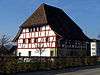 Former Siechenhaus (Quarantine house) |
Aarburgerstrasse 21 | 637.877 | 238.185 | 47.293464°N 7.939385°E |
| 308 |  Municipal School House |
 General-Guisan-Strasse 14 | 638.507 | 237.797 | 47.289937°N 7.94768°E |
| 10466 |  Heiternplatz |
 639.054 | 237.159 | 47.284167°N 7.954856°E | |
| 9561 | Hirzeberg, Roman era Farm House with Mosaic Floors |
638.670 | 237.020 | 47.282939°N 7.949768°E | ||
| 9735 |  Klösterli |
 Klösterligasse 2 | 638.488 | 237.570 | 47.287897°N 7.94741°E |
| 311 | Museum | General-Guisan-Strasse 18 | 638.430 | 237.862 | 47.290527°N 7.946668°E | |
| 305 |  Rathaus (Town council house) |
 Rathausgasse 4 | 638.400 | 237.610 | 47.288262°N 7.94625°E |
| 314 | Sennenhof | Hintere Hauptstrasse 9, 14 | 638.351 | 237.768 | 47.289686°N 7.945616°E | |
| 9322 | City Library of Zofingen | Hintere Hauptgasse 20 | 638.377 | 237.713 | 47.28919°N 7.945955°E |
gollark: Great!
gollark: I said derived, not written.
gollark: The quadratic formula is attained via completing the square on a general quadratic.
gollark: Guess how the quadratic formula is derived?
gollark: What of Gerard, however?
References
- All entries, addresses and coordinates are from: "Kantonsliste A-Objekte". KGS Inventar (in German). Federal Office of Civil Protection. 2009. Archived from the original on 28 June 2010. Retrieved 28 November 2009.
External links
- Swiss Inventory of Cultural Property of National and Regional Significance, 2009 edition:
- "Revision of the PCP Inventory (Revision des KGS-Inventars)". KGS Forum. Federal Office of Civil Protection (13/2008). 2008. Archived from the original on 5 May 2011. Retrieved 25 April 2011.
| Wikimedia Commons has media related to Cultural properties of national significance in the canton of Aargau. |
This article is issued from Wikipedia. The text is licensed under Creative Commons - Attribution - Sharealike. Additional terms may apply for the media files.