List of crossings of the Los Angeles River
This is a list of crossings of the Los Angeles River. Crossings are listed from south to north; that is, going upstream from the mouth of the river channel in Long Beach.[1]
List
| Photo | Crossing | City | Constructed | Coordinates |
|---|---|---|---|---|
.jpg) |
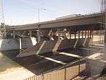
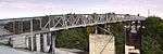
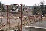
Queensway Twin Bridges carrying Queens Way | Long Beach | 1969 | |
| West Ocean Boulevard | 1959 | |||
| Service Bridge | ||||
| Shoreline Drive West (former Interstate 710) | 1963 | |||
| West Anaheim Street | 1954 | |||
| 1957 | ||||
| Service Bridge | ||||
| West Willow Street | 1946 | |||
| Service Bridge | ||||
| Wardlow Road | 1950 | |||
| 1963 | ||||
| Railroad: Metro A Line | ||||
| Union Pacific Railroad | ||||
| West Del Amo Boulevard | 1958 | |||
| Long Beach Boulevard | 1946 | |||
| Artesia Boulevard | 1949 | |||
| 1971 | ||||
| South Atlantic Avenue | Long Beach and Compton | 1937 | ||
| Alondra Boulevard | Paramount and Compton | 1958 | ||
| East Compton/Somerset Boulevard | 1976 | |||
| Rosecrans Avenue | 1951 | |||
| Pedestrian Bridge | ||||
| Paramount and Lynwood | 1990 | |||
| East Imperial Highway | South Gate and Lynwood | 1951 | ||
| South Gate | 1955 | |||
| Railroad | ||||
| Firestone Boulevard | 1950 | |||
| Railroad | Bell Gardens and Cudahy | |||
| Clara Street | 1939 | |||
| Florence Avenue | Bell Gardens and Bell | 1948 | ||
| Gage Avenue | 1940 | |||
| Railroad | ||||
| East Slauson Avenue | Commerce, Bell, and Maywood | 1942 | ||
| South Atlantic Boulevard | Vernon | 1931 | ||
| Railroad | ||||
| South Downey Road | 1931 | |||
| Bandini Boulevard | 1969 | |||
| South Soto Street | 1928 | |||
.jpg) |
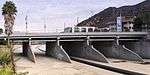
East 26th Street | 2000 | ||
| Railroad | Boyle Heights, Los Angeles | |||
.jpg) |
Railroad: Redondo Flyover for Metrolink's Orange County Line, 91 Line, and Amtrak's Pacific Surfliner | |||
| East Washington Boulevard (HAER CA-284) | 1931 | |||
| Railroad | ||||
.tif.jpg) |
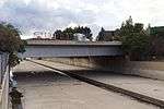
East 9th Street, carrying Olympic Boulevard (HAER CA-177) | 1925 | ||
 |
Downtown Los Angeles | 1959 | ||
| East 7th Street (HAER CA-282) | 1927 | |||
.tif.jpg) |
Sixth Street Viaduct (HAER CA-176) | 1932 (demolished 2016) |
||
| East 4th Street (HAER CA-280) | 1930 | |||
.tif.jpg) |
East 1st Street (HAER CA-175) | 1929 | ||
 |
1944 | |||
 |
Macy Street Bridge, carrying Cesar E. Chavez Avenue (HAER CA-277) | Chinatown, Los Angeles | 1926 | |
 |
Railroad: Metrolink San Bernardino Line and Riverside Line | |||
| Railroad | ||||
| North Main Street (HAER CA-276) | 1910 | |||
 |
North Spring Street (HAER CA-275) | 1928 | ||
| Buena Vista, carrying North Broadway (HAER CA-274) | 1909 | |||
 |
Railroad: Metro L Line | |||
| Figueroa Street Viaduct (HAER CA-265-J)
|
1937 | | |||
| Los Angeles River Bridge
|
Cypress Park and Echo Park, Los Angeles | 1943 | ||
| Metrolink Antelope Valley Line and Ventura County Line | ||||
 |
Dayton Avenue Bridge carrying Riverside Drive | 1939 (demolished 2015) |
||
| Elysian Viaduct |
1962 | |||
| Taylor Yard Pedestrian Bridge | Glassell Park and Elysian Valley | 2021 | ||
| Atwater Village, Los Angeles | 1961 | |||
| Fletcher Drive (HAER CA-273) | 1927 | |||
 |
Glendale-Hyperion Bridge Victory Memorial Viaduct, carrying Glendale Boulevard and Hyperion Avenue (HAER CA-272) | 1929 | ||
| Red Car Pedestrian Bridge | 2020 | |||
| La Kretz Bridge [North Atwater Bridge] | 2020 | |||
 |
Sunnynook Drive [Pedestrian Bridge] | |||
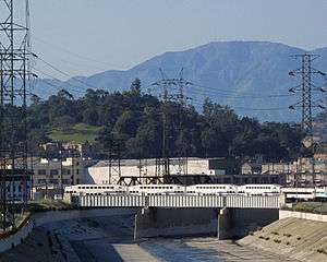
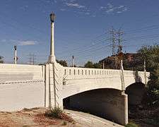
| Los Feliz Boulevard | 1925 | |||
 |
Colorado Street | 1957 | ||
 |
Glendale and Los Angeles | 1962 | ||
 |
1957 | |||
 |
Riverside Drive | 1938 | ||
 |
South Mariposa Street [Pedestrian Bridge] | Burbank and Los Angeles | 1939 | |
| 1957 | ||||
| Private road to Warner Brothers Studios | ||||
 |
Barham Boulevard | 1935 | ||
| Cahuenga Boulevard and Lankershim Boulevard | Studio City, Los Angeles | 1940 | ||
 |
1957 | |||
| Vineland Avenue | 1930 | |||
| Tujunga Avenue | 1949 | |||
| Colfax Avenue | 1956 | |||
| Private road in the CBS Studio Center | ||||
| Radford Avenue | 1950 | |||
| Laurel Canyon Boulevard | 1951 | |||
| Laurelgrove Avenue [Pedestrian Bridge] | 1996 | |||
| Whitsett Avenue | 1950 | |||
| Coldwater Canyon Avenue | 1951 | |||
| Fulton Avenue | 1951 | |||
| Moorpark Street | 1952 | |||
| Rye Street/Sunnyslope Avenue [Pedestrian Bridge] | Sherman Oaks, Los Angeles | |||
| Woodman Avenue | 1952 | |||
| Hazeltine Avenue | 1960 | |||
| 1959 | ||||
| Van Nuys Boulevard | 1952 | |||
| Kester Avenue | 1972 | |||
| Sepulveda Boulevard | 1928 | |||
| 1958 | ||||
| Sepulveda Dam | Encino, Los Angeles | |||
| Burbank Boulevard | 1974 | |||
| Balboa Boulevard | 1941 and 1964 | |||
| Busway: Metro G Line | ||||
 |
White Oak Avenue | 1960 | ||
| Lindley Avenue | 1957 | |||
| Victory Boulevard | Reseda, Los Angeles | 1963 | ||
| Reseda Boulevard | 1955 | |||
| Amigo Avenue [Pedestrian Bridge] | ||||
| Wilbur Avenue | 1957 | |||
| Vanalden Avenue [Pedestrian Bridge] | ||||
| Tampa Avenue | 1957 | |||
| Corbin Avenue | 1957 | |||
| Winnetka Avenue | Winnetka, Los Angeles | 1958 | ||
| Vanowen Street | 1958 | |||
| Mason Avenue | 1958 | |||
| De Soto Avenue | 1958 | |||
| Variel Avenue [Pedestrian Bridge] | Canoga Park, Los Angeles | |||
| Metro G Line | 2012 | |||
| Canoga Avenue | 1956 | |||
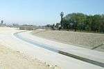
| Owensmouth Avenue | 1958 |
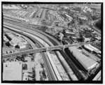
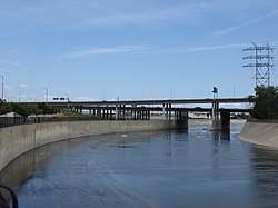
Gallery of aerial views of multiple bridges
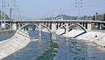
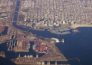 Bridges from the mouth of the Los Angeles River up to the West Willow Street Bridge in Long Beach, looking north
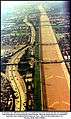 Bridges from Imperial Highway to Florence Avenue in South Gate and Bell Gardens, looking south
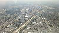 Bridges from Gage Avenue to South Atlantic Boulevard in and around Bell, looking southeast
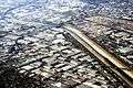 Bridges from a railroad bridge to South Soto Street in Vernon, looking north
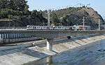
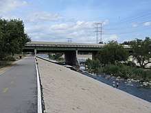
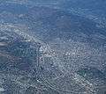 Glendale Narrows section from Glendale Freeway to Riverside Drive Bridges, looking north
gollark: Well, no, the poles might not be affected much.
gollark: That is what I am asking, yes.
gollark: I need to check the Wikipedia page for spheres to determine some things.
gollark: <@224348995844177920> DECIDE, or you will not have.
gollark: I'm not some sort of snowologist. I would mostly be worried about, depending on which things stop rotating, the imminent hypervelocity winds everywhere and destruction of buildings.
See also


References
External links
| Wikimedia Commons has media related to Bridges over the Los Angeles River. |
This article is issued from Wikipedia. The text is licensed under Creative Commons - Attribution - Sharealike. Additional terms may apply for the media files.