List of Missouri conservation areas – St. Louis region
The St. Louis administrative region of the Missouri Department of Conservation encompasses Crawford, Franklin, Jefferson, Lincoln, St. Charles, St. Louis, Warren, and Washington counties. The regional conservation office is in St. Charles.
| Conservation Area | Description | Size | County | Location | |
|---|---|---|---|---|---|
| Allenton Access | This area offers access to the Meramec River. There is a boat ramp. | 9 acres | 3.6 ha | St. Louis | 38°28′25.29″N 90°39′37.81″W |
| Anderson (John N and Melba S) Memorial Conservation Area | From Steelville, take Hwy 19 south 2 miles (3.2 km), and turn east onto Valleyside Rd 1-mile (1.6 km) to the parking lot. | 339 acres | 137 ha | Crawford | 37°55′0.24″N 91°18′8.47″W |
| Bellefontaine Conservation Area | Take Highway 367 south from I-270 approximately 1/2 mile to the entrance to the Missouri Veterans Home. Proceed east on the Veterans Home driveway to the entrance to the conservation area. | 142 acres | 57 ha | St. Louis | 38°45′51.95″N 90°14′10.16″W |
| Bismarck Conservation Area | Facilities/features: boat ramp, fishing jetty, and DiSalvo Lake (210 acres). | 1,160 acres | 470 ha | St. Francois, Iron, Washington | 37°43′37.62″N 90°38′18.68″W |
| Blanchette Landing Access | There is a boat ramp. | 20 acres | 8.1 ha | St. Charles | 38°47′34.23″N 90°28′26.37″W |
| Blue Springs Creek Conservation Area | This area is mostly forest with grassland and old fields. Facilities/features: gravel boat ramp and 2 permanent streams (Blue Springs Creek, Meramec River). | 856 acres | 346 ha | Crawford | 38°7′4.07″N 91°10′38.61″W |
| Bootleg Access | This forest area with old fields offers access to Big River. Facilities/ features: primitive camping and viewing deck. | 289 acres | 117 ha | Washington | 37°48′58.31″N 90°45′53.74″W |
| Brown's Ford Access | This area offers access to Big River. There is a boat ramp. | 1.0 acre | 0.40 ha | Jefferson | 38°12′46.90″N 90°42′22.42″W |
| Buford Mountain Conservation Area | This is a forest area. | 3,920 acres | 1,590 ha | Iron, Washington | 37°42′51.62″N 90°42′11.28″W |
| Busch (August A) Memorial Conservation Area | This 6,987-acre (28.28 km2) area contains 3,000 acres (12 km2) of forest in addition to grassland, cropland, old fields, prairie, and wetlands. Facilities/features: boat rentals, picnic areas, pavilion, hiking trails, 43 fishing jetties, fishing docks, staffed firearms range, archery range, five viewing blinds, and a visitor center. | 7,007 acres | 2,836 ha | St. Charles | 38°42′35.04″N 90°44′26.18″W |
| Campbell Bridge Access | This area offers access to the Meramec River. There is a boat ramp and a canoe launch. | 8 acres | 3.2 ha | Crawford | 38°4′56.05″N 91°9′0.86″W |
| Catawissa Conservation Area | This area is mostly forest and provides access to the Meramec River. There is a boat ramp. | 216 acres | 87 ha | Franklin | 38°26′54.75″N 90°46′2.65″W |
| Chouteau Claim Access | This area offers access to the Meramec and Bourbeuse rivers. There is a boat ramp. | 16 acres | 6.5 ha | Franklin | 38°23′52.82″N 90°53′26.04″W |
| Colter's Landing Access | This grassland area offers access to Boeuf Creek, which flows into the Missouri River. There is a boat ramp. | 6 acres | 2.4 ha | Franklin | 38°35′20.24″N 91°9′45.45″W |
| Columbia Bottom Conservation Area | This area contains cropland, forest, wetlands, and old fields. There is a visitor center and office along with hiking and biking trails, interpretive sites and a boat ramp to the Missouri River. The unique feature of this area is the confluence of the Missouri and Mississippi rivers. | 4,256 acres | 1,722 ha | St. Louis | 38°48′21.93″N 90°9′38.48″W |
| Crooked Creek Conservation Area | This is a forest area. | 332 acres | 134 ha | Crawford | 37°51′24.30″N 91°24′33.48″W |
| Crouch (R H) Access | This provides walk-in fishing access to the West Fork of the Cuivre River. | 3 acres | 1.2 ha | Lincoln | 39°1′45.94″N 91°1′27.08″W |
| Cuivre Island Conservation Area | This is a mostly forested area with old fields. Facilities/features: boat ramp and permanent stream (Mississippi River). | 1,671 acres | 676 ha | Lincoln, St. Charles | 38°56′10.93″N 90°40′27.43″W |
| Daniel Boone Conservation Area | This is a predominantly forested area. Facilities/features: primitive camping, picnic area, 4 fishing ponds (2 are under renovation), and a multi-use trail. | 3,616 acres | 1,463 ha | Warren | 38°46′37.32″N 91°22′50.03″W |
| Davidson (Claire Gempp) Memorial WA | This forest and grassland area has a small gazebo with a few benches. | 13 acres | 5.3 ha | St. Louis | 38°32′28.27″N 90°22′53.70″W |
| Emmenegger Nature Park | This area, which features picnic areas and a pavilion, is just west of the Powder Valley Conservation Nature Center. | 117 acres | 47 ha | St. Louis | 38°33′3.48″N 90°26′0.22″W |
| Engelmann Woods Natural Area | This is a forest area. Facilities/features: old-growth forest with striking fall colors and spring wildflowers. | 149 acres | 60 ha | Franklin | 38°33′59.98″N 90°46′36.12″W |
| Flamm City Access | There is a boat ramp. | 20 acres | 8.1 ha | Jefferson | 38°25′3.54″N 90°20′55.19″W |
| Forest 44 Conservation Area | This area is mostly forest with a staffed firearms range and a permanent stream (Williams Creek). | 990 acres | 400 ha | St. Louis | 38°31′26.27″N 90°31′42.28″W |
| Glassberg Family Conservation Area | Glassberg Family CA is mostly forest with old fields in the LaBarque Creek watershed. | 429 acres | 174 ha | Jefferson | 38°26′22″N 90°40′52″W |
| Goodson (Jean and Joan) Conservation Area | Goodson CA is also called Bittersweet Woods CA. The area is leased to and maintained by City of Des Peres Parks and Recreation. | 10 acres | 4.0 ha | St. Louis | 38°35′16.19″N 90°27′40.20″W |
| Gravois Creek Conservation Area | This is a forest area. | 14 acres | 5.7 ha | St. Louis | 38°32′1.70″N 90°17′58.23″W |
| Hickory Woods Conservation Area | This is a forest area. | 10 acres | 4.0 ha | St. Louis | 38°44′57.17″N 90°24′3.05″W |
| Howell Island Conservation Area | This island area is mostly forest surrounded by the Missouri River and Centaur Chute. | 2,707 acres | 1,095 ha | St. Louis, St. Charles | 38°39′48.21″N 90°42′18.72″W |
| Hughes Mountain Natural Area | Half forest with glades, savanna, and old fields. Facilities/ features: unique geological formations. | 460 acres | 190 ha | Washington | 37°48′1.01″N 90°42′37.15″W |
| Huzzah Conservation Area | This area is predominantly forest. Facilities/features: primitive camping and 3 permanent streams (Meramec River, Courtois Creek, Huzzah Creek). | 6,078 acres | 2,460 ha | Crawford | 38°2′18.31″N 91°12′19.62″W |
| Kessler Memorial WA | This area contains grassland, forest and some cropland. | 155 acres | 63 ha | Lincoln | 39°3′50.85″N 90°54′37.77″W |
| Keysville Towersite | This forest area is 5 miles (8.0 km) south of Steelville on Route AA, then left on Tower Road. | 81 acres | 33 ha | Crawford | 37°52′34.31″N 91°20′18.55″W |
| Kingston Access | This area offers access to Mineral Fork. | 56 acres | 23 ha | Washington | 38°5′43.76″N 90°42′31.16″W |
| Klamberg (Roger) Woods Conservation Area | This is a forest area. | 68 acres | 28 ha | St. Louis | 38°34′56.88″N 90°34′45.41″W |
| LaBarque Creek Conservation Area | The LaBarque watershed has a great variety of terrestrial natural communities, including small sandstone glades, acid seeps, forested fens and many kinds of woodland. Several neotropical migratory bird species depend on this large forest for breeding habitat. | 570 acres | 230 ha | Jefferson | 38°24′59.69″N 90°42′23.04″W |
| Leach (B K) Memorial Conservation Area | This area borders the Mississippi River and contains wetlands, forest, and cropland. Facilities/features: waterfowl blinds, several fishable sloughs, and ponds. | 4,322 acres | 1,749 ha | Lincoln | 39°8′6.90″N 90°43′33.18″W |
| Little Indian Creek Conservation Area | This is a forest area. Facilities/features: primitive camping, firearms range (includes shotgun), small fishing pond, and a permanent stream (Little Indian Creek). | 3,890 acres | 1,570 ha | Washington, Franklin | 38°12′3.15″N 90°56′40.99″W |
| Little Lost Creek Conservation Area | This is a predominantly forested area with scattered glades, savannas, and fields. Facilities/features: primitive camping/picnicking, and a 7-mile (11 km) multi-use trail. Little Lost Creek is a partially spring-fed Ozark stream, characterized by clear water and a rocky stream bed. Brilliantly colored Ozark fish are found in the stream. | 2,906 acres | 1,176 ha | Warren | 38°46′44.87″N 91°16′19.49″W |
| Logan (William R) Conservation Area | This area is mostly forest with a firearms range and several fishable ponds. | 1,800 acres | 730 ha | Lincoln | 39°8′51.85″N 91°2′31.60″W |
| Long Ridge Conservation Area | This area contains forest and some savanna. Facilities/features: primitive camping and an intermittent stream (Little Spring Creek). | 1,866 acres | 755 ha | Franklin | 38°17′10.83″N 91°10′3.78″W |
| Mammoth Access | This area offers access to Big River. There is a boat ramp. | 4 acres | 1.6 ha | Jefferson | 38°7′15.78″N 90°40′34.47″W |
| Marais Temps Clair Conservation Area | This tract contains 500 acres (2.0 km2) of wetlands in addition to cropland and some forest. | 948 acres | 384 ha | St. Charles | 38°54′9.05″N 90°25′2.07″W |
| Mayers Landing Access | This grassland area offers access to the Bourbeuse River. There is a boat ramp. | 7 acres | 2.8 ha | Franklin | 38°25′37.15″N 91°2′47.12″W |
| Meramec Conservation Area | This area is mainly forest. Facilities/features: viewing deck and a permanent stream (Meramec River). | 3,938 acres | 1,594 ha | Franklin | 38°13′50.49″N 91°4′15.48″W |
| Merrill Horse Access | This area offers access to Big River. There is a boat ramp. | 80 acres | 32 ha | Jefferson | 38°9′42.15″N 90°42′34.08″W |
| Mill Rock Access | It offers access to the Bourbeuse River. | 9 acres | 3.6 ha | Franklin | 38°19′49.61″N 91°18′8.59″W |
| Mint Spring Access | Offers access to the Bourbeuse River. | 7 acres | 2.8 ha | Crawford, Gasconade | 38°12′30.83″N 91°32′4.94″W |
| Onyx Cave Conservation Area | There is a permanent steam (Brazil Creek). | 38 acres | 15 ha | Crawford | 38°6′42.00″N 91°8′15.94″W |
| Pacific Palisades Conservation Area | This area contains forest, cropland, and old fields. Facilities/features: and a permanent stream (Meramec River) and sand and gravel pits which provide seasonal fishing. | 732 acres | 296 ha | Jefferson, St. Louis | 38°28′33.74″N 90°43′29.43″W |
| Pea Ridge Conservation Area | This area is mostly forest. It contains Hi Pointe Lake (2 acres, fishable). | 8,642 acres | 3,497 ha | Washington | 38°4′15.06″N 90°56′27.58″W |
| Pelican Island Access | Pelican Island Access is open during normal hours of operation for Sioux Passage Park except that boaters who wish to remain on the river past normal park hours may exit the area through an electronic gate. Normal park hours are 7 a.m. to one half hour after sunset. | 43 acres | 17 ha | St. Louis | 38°51′33.81″N 90°16′17.86″W |
| Pelican Island Natural Area | In North St. Louis County, near Sioux Passage Park on the Missouri River. Public access is by boat only. | 2,571 acres | 1,040 ha | St. Louis | 38°52′30.41″N 90°18′3.19″W |
| Phantom Forest Conservation Area | Phantom Forest CA is leased to and maintained by the City of Des Peres Parks and Recreation. | 14 acres | 5.7 ha | St. Louis | 38°35′7.82″N 90°27′54.50″W |
| Port Hudson Lake Conservation Area | This area contains forest, old fields and grassland. Facilities/features: boat ramp, boat dock, picnic area, pavilion, fishing dock, and Port Hudson Community Lake (55 acres). | 225 acres | 91 ha | Franklin | 38°28′19.93″N 91°16′0.61″W |
| Possum Woods Conservation Area | This is a 15-acre (61,000 m2) forest. Dogs are allowed on a six foot leash. | 15 acres | 6.1 ha | St. Louis | 38°32′47.22″N 90°25′53.58″W |
| Powder Valley Conservation Nature Center | This is a forested area with hiking trails. The nature center has 2 floors of interactive exhibits. | 116 acres | 47 ha | St. Louis | 38°33′14.41″N 90°25′33.33″W |
| Prairie Slough Conservation Area | This forest and wetlands tract contains Prairie Sough Natural Area, a wet-mesic bottomland forest. | 610 acres | 250 ha | Lincoln, Pike | 39°12′45.72″N 90°44′29.89″W |
| Redhorse Access | This area offers access to the Meramec River. There is a boat ramp. | 46 acres | 19 ha | Franklin | 38°16′48.30″N 90°56′4.14″W |
| Reifsnider (Frank) State Forest | This is a forest area. Facilities/features: picnic area, firearms range, Reifsnider Forest Natural Area (22 acres of mature white oak forest), and an intermittent stream (North Fork of Charette Creek). There are also a couple of old clay mining pits which are stocked for fishing. | 1,378 acres | 558 ha | Warren | 38°46′56.65″N 91°6′42.43″W |
| Reiker Ford Access | This is a forest area offering access to the Bourbeuse River. | 7 acres | 2.8 ha | Franklin | 38°22′47.44″N 91°4′26.71″W |
| River 'Round Conservation Area | This area is about 1/2 forest with cropland and old fields. It offers access to the Meramec River. There is a boat ramp. | 314 acres | 127 ha | Franklin | 38°21′13.69″N 90°52′18.00″W |
| Riverview Access | This area offers access to the Meramec River. There is a boat ramp. | 4 acres | 1.6 ha | Crawford | 37°59′30.98″N 91°25′33.14″W |
| Rockwoods Range | From Interstate 44 west of St. Louis, take exit 261 (Allenton-Six Flags), then go north on Allenton Road and take an immediate left on Fox Creek; stay on Fox Creek for 2 miles (3.2 km). | 1,393 acres | 564 ha | St. Louis | 38°31′14.57″N 90°41′57.87″W |
| Rockwoods Reservation | This is a predominantly forest area. Facilities/features: picnic areas and a pavilion, hiking trails, viewing blind, and a permanent stream (Hamilton Creek). The area also has a Conservation Education Center. | 1,924 acres | 779 ha | St. Louis | 38°33′37.29″N 90°39′34.07″W |
| Sand Ford Access | This 30-acre (120,000 m2) area offers access to the Meramec River. There are 2 boat ramps. | 33 acres | 13 ha | Franklin | 38°15′13.67″N 91°4′46.98″W |
| Sandy Island Conservation Area | This is a forest area on the Mississippi River. | 385 acres | 156 ha | Lincoln | 39°1′40.28″N 90°42′36.80″W |
| Sappington Bridge Access | This area offers access to the Meramec River. There is a boat ramp and a canoe launch. | 9 acres | 3.6 ha | Crawford | 38°9′27.86″N 91°6′31.43″W |
| Scotts Ford Access | This forest area offers access to the Meramec River. | 30 acres | 12 ha | Crawford | 37°58′46.98″N 91°27′29.04″W |
| Sizemore (Pearl G and John J) Memorial Conservation Area | From Steelville, go 2 miles (3.2 km) south on Highway 19, then east-southeast (left) on Valleyside Road 2.5 miles (4.0 km). | 180 acres | 73 ha | Crawford | 37°54′27.76″N 91°16′40.18″W |
| Teszars Woods Conservation Area | This forest area is adjacent to the Meramec River. | 93 acres | 38 ha | Jefferson | 38°24′31.69″N 90°21′8.50″W |
| Truman Access | This area offers access to the Mississippi River. There is a boat ramp. | 20 acres | 8.1 ha | Jefferson | 38°8′12.68″N 90°16′6.43″W |
| Uhlemeyer (Dr Henry A and Amalia) Access | This forest and grassland area offers access to the Bourbeuse River. There is a boat ramp. | 12 acres | 4.9 ha | Franklin | 38°26′22.11″N 90°54′22.15″W |
| Union Access | Offers access to the Bourbeuse River. There is a boat ramp. | 10 acres | 4.0 ha | Franklin | 38°26′33.54″N 90°59′41.64″W |
| Upper Mississippi Conservation Area | These tracts are mostly forest along with old fields and wetlands. The area contains waterfowl blinds and Westport Island Natural Area, which is a bottomland wet-mesic forest. | 13,079 acres | 5,293 ha | Lincoln, Lewis, St. Charles, Pike | 39°13′33.46″N 90°46′2.10″W |
| Valley View Glades Natural Area | This dolomite glade is a Designated Natural Area. | 212 acres | 86 ha | Jefferson | 38°15′30.94″N 90°37′31.68″W |
| Victoria Glades Conservation Area | This area consists of glades and forest. | 239 acres | 97 ha | Jefferson | 38°12′6.80″N 90°33′0.33″W |
| Vonaventure Memorial Forest and WA | This is a forest area with a small pond. | 203 acres | 82 ha | Lincoln | 39°8′23.06″N 91°3′37.22″W |
| Weldon Spring Conservation Area | This is a mostly forested area with pasture, cropland, and some wetlands and glades. Facilities/features: boat ramp (on the river), hiking trails, fishable lakes and ponds (51 acres total), and a permanent stream (Missouri River). | 8,359 acres | 3,383 ha | St. Charles | 38°39′53.17″N 90°44′7.62″W |
| Wenkel Ford Access | This forest area offers access to the Bourbeuse River. | 5 acres | 2.0 ha | Franklin | 38°19′21.05″N 91°15′26.97″W |
| White (William G and Erma Parke) Memorial WA | Facilities/features: boat ramp, fishing jetty, fishable ponds, Lake Whiteside, and a managed dove hunt. | 821 acres | 332 ha | Lincoln | 39°10′36.36″N 91°0′44.16″W |
| Woods (Woodson K) Memorial Conservation Area | This area is predominantly forest. Facilities/features: gravel bar boat launch (no concrete ramp) and 2 permanent streams (Dry Fork Creek, Meramec River). | 5,739 acres | 2,322 ha | Phelps, Crawford | 37°57′42.42″N 91°30′59.84″W |
| Young Conservation Area | This area is mostly forest with prairie and old fields. Facilities/features: a permanent stream (LaBarque Creek). | 969 acres | 392 ha | Jefferson | 38°26′25.73″N 90°39′47.99″W |
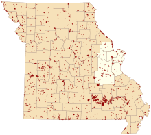
Map of Missouri conservation areas with the St. Louis region highlighted
Notes
- Acreage and counties from MDCLand GIS file
- Names, descriptions, and locations from Conservation Atlas Online GIS file
gollark: Ah, an old version, so not tweaked.
gollark: That is useless and not what I meant.
gollark: What's that running on, then?
gollark: Would it not *say* stackoverflow?
gollark: Impressive.
References
- "MDCland" (shapefile). Missouri Department of Conservation. 2007-01-01.
- "Google Earth File". Conservation Atlas Online. Missouri Department of Conservation. 2007-06-18. Archived from the original on 2010-08-12.
This article is issued from Wikipedia. The text is licensed under Creative Commons - Attribution - Sharealike. Additional terms may apply for the media files.