Lingti
Lingti, also Lindi or Lindixiang (Chinese: 林堤乡) is a small town and township-level division of Lhari County in the Nagqu Prefecture of the Tibet Autonomous Region, in China. It lies along the S305 road, 105 kilometres (65 mi) northwest of Lhari Town and 100 kilometres (62 mi) southwest by road of Nagchu Town.[1] As of 2004 it had a population of about 1100.[2] The principal economic activity is animal husbandry, pastoral yak, goat, sheep, and so on.[3] The town's name means "forest embankment".
Lingti | |
|---|---|
Township | |
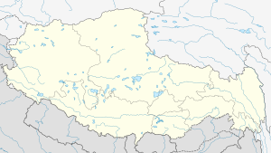 Lingti Location within Tibet Autonomous Region | |
| Coordinates: 30°56′44″N 92°33′12″E | |
| Country | China |
| Region | Tibet Autonomous Region |
| Prefecture | Nagqu Prefecture |
| County | Lhari County |
| Population (2004) | |
| • Total | 1,100 |
| • Major Nationalities | Tibetan |
| • Regional dialect | Tibetan language |
| Time zone | +8 |
Administrative divisions
The township-level division contains the following villages:[2]
- Lindi Village (林堤村)
- Qiacha Village (恰查村)
- Wosuo Village (沃索村)
- Jiangjiu Village (江久村)
- Palongba Village (帕隆巴村)
- Yangre Village (央热村)
- Cangkang Village (仓康村)
gollark: C is actually bad, though.
gollark: I mean, it could plausibly say "[deleted] bee message bee message", it just doesn't.
gollark: As firecubez said, no, how would that work.
gollark: Minoteaur 8.
gollark: It could apify the circadian rhythm circuitry without actually making you feel awake etc. directly.
See also
- List of towns and villages in Tibet
References
- Maps (Map). Google Maps.
- "Lingti Township". CF Guide. Archived from the original on 19 January 2013. Retrieved 29 May 2012.
- 林堤乡 (in Chinese). Chinaquhua.cn. Retrieved 29 May 2012.
| District | 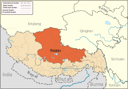 | |
|---|---|---|
| Counties | ||
| Towns and villages |
| |
| Geography |
| |
This article is issued from Wikipedia. The text is licensed under Creative Commons - Attribution - Sharealike. Additional terms may apply for the media files.