Lingewaal
Lingewaal (![]()
Lingewaal | |
|---|---|
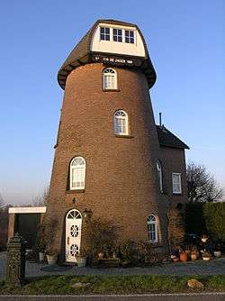 Former windmill in Herwijnen | |
 Flag  Coat of arms | |
.svg.png) Location in Gelderland | |
| Coordinates: 51°53′N 5°7′E | |
| Country | Netherlands |
| Province | Gelderland |
| Municipality | West Betuwe |
| Established | 1 January 1986 |
| Government | |
| • Body | Municipal council |
| • Mayor | Loes van Ruijven-van Leeuwen (CDA) |
| Area | |
| • Total | 54.49 km2 (21.04 sq mi) |
| • Land | 50.44 km2 (19.47 sq mi) |
| • Water | 4.05 km2 (1.56 sq mi) |
| Elevation | 2 m (7 ft) |
| Time zone | UTC+1 (CET) |
| • Summer (DST) | UTC+2 (CEST) |
| Postcode | Parts of 4100 and 4200 ranges |
| Area code | 0183, 0345, 0418 |
| Website | www |
On 1 January 2019, it merged with Geldermalsen and Neerijnen to form the new municipality of West Betuwe.
Topography

Dutch topographic map of the municipality of Lingewaal, June 2015
gollark: Oh no, responsive tables are nontrivial.
gollark: Well, it's a weird concept which I don't entirely agree with, but this is semiunrelatoidal.
gollark: The issue isn't reverse engineering specifically, it's that you seem to just expect people to treat all *your* "intellectual property" with ridiculous levels of thingy while blatantly ignoring everyone else's.
gollark: No, not really. Please hold on while I explaininate.
gollark: You appear to be missing the point somewhat.
References
- "Samenstelling" [Members] (in Dutch). Gemeente Lingewaal. Archived from the original on 8 July 2014. Retrieved 8 July 2014.
- "Kerncijfers wijken en buurten" [Key figures for neighbourhoods]. CBS Statline (in Dutch). CBS. 2 July 2013. Retrieved 12 March 2014.
- "Postcodetool for 4147AN". Actueel Hoogtebestand Nederland (in Dutch). Het Waterschapshuis. Archived from the original on 21 September 2013. Retrieved 8 July 2014.
External links

- Official website
Places adjacent to Lingewaal | ||||||||||
|---|---|---|---|---|---|---|---|---|---|---|
| ||||||||||
This article is issued from Wikipedia. The text is licensed under Creative Commons - Attribution - Sharealike. Additional terms may apply for the media files.