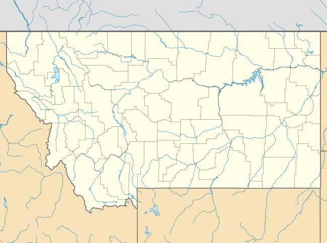
Limestone, Montana
Limestone is a Ghost Town located in Stillwater County, Montana.
Limestone, Montana | |
|---|---|
 Limestone, Montana  Limestone, Montana | |
| Coordinates: 45°28′41″N 109°54′07″W | |
| Country | United States |
| State | Montana |
| County | Stillwater |
| Elevation | 5,535 ft (1,687 m) |
| Population (2010)[1] | |
| • Total | 17 |
| Time zone | UTC-7 (Mountain (MST)) |
| • Summer (DST) | UTC-6 (MDT) |
| ZIP code | 59061 |
| Area code(s) | 406 |
| GNIS feature ID | 777090[2] |
The elevation is 5,535 feet. Limestone appears on the Meyer Mountain U.S. Geological Survey Map.
History
Limestone was a mining community situated along Lodgepole Creek and sat at the foot of Limestone Butte, for which the town was named. The town was small but busy. The post office operated at Limestone from 1910 to 1953. Today Limestone is a ghost town with a number of buildings left standing, including the former grocery store and post office.
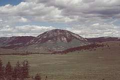
Limestone Butte, a laccolith of granite with a remnant of limestone at the crest.
gollark: Beespace.
gollark: A few months ago.
gollark: Oh no. Have I *checked*?
gollark: What? I'm probably not palaiologos.
gollark: You could have been raised in a blank white room for your entire life up to that moment, yes.
References
Municipalities and communities of Stillwater County, Montana, United States | ||
|---|---|---|
| Town | 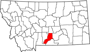 Stillwater County map | |
| CDPs | ||
| Unincorporated communities | ||
| Ghost towns | ||
This article is issued from Wikipedia. The text is licensed under Creative Commons - Attribution - Sharealike. Additional terms may apply for the media files.