Liebenwalde
Liebenwalde is a town in the Oberhavel district, in Brandenburg, Germany. It is situated 16 km northeast of Oranienburg, and 39 km north of Berlin (centre).
Liebenwalde | |
|---|---|
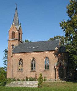 Kreuzbruch church | |
 Coat of arms | |
Location of Liebenwalde within Oberhavel district 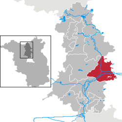 | |
 Liebenwalde  Liebenwalde | |
| Coordinates: 52°52′N 13°24′E | |
| Country | Germany |
| State | Brandenburg |
| District | Oberhavel |
| Subdivisions | 6 districts |
| Government | |
| • Mayor | Jörn Lehmann |
| Area | |
| • Total | 138.84 km2 (53.61 sq mi) |
| Elevation | 41 m (135 ft) |
| Population (2018-12-31)[1] | |
| • Total | 4,296 |
| • Density | 31/km2 (80/sq mi) |
| Time zone | CET/CEST (UTC+1/+2) |
| Postal codes | 16559 |
| Dialling codes | 033054 |
| Vehicle registration | OHV |
| Website | www.liebenwalde.de |
In 2003, the administrative boundaries were expanded to include Freienhagen, Hammer, Kreuzbruch, Liebenthal and Neuholland.
Demography
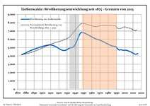 Development of Population since 1875 within the Current Boundaries (Blue Line: Population; Dotted Line: Comparison to Population Development of Brandenburg state; Grey Background: Time of Nazi rule; Red Background: Time of Communist rule)
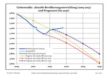 Recent Population Development and Projections (Population Development before Census 2011 (blue line); Recent Population Development according to the Census in Germany in 2011 (blue bordered line); Official projections for 2005-2030 (yellow line); for 2014-2030 (red line); for 2017-2030 (scarlet line)
|
|
|
gollark: Why not "a class-13 convex pentagonal spy"?
gollark: It's the latest trend!
gollark: You should become a spy!
gollark: ... mæybe.
gollark: Idea: discord API interface for hævsolang.
References
- "Bevölkerung im Land Brandenburg nach amtsfreien Gemeinden, Ämtern und Gemeinden 31. Dezember 2018". Amt für Statistik Berlin-Brandenburg (in German). July 2019.
- Detailed data sources are to be found in the Wikimedia Commons.Population Projection Brandenburg at Wikimedia Commons
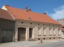
Zehdenicker Str.
Towns and municipalities in Oberhavel | ||
|---|---|---|
Coat of Arms of Oberhavel district | ||
| Authority control |
|
|---|
This article is issued from Wikipedia. The text is licensed under Creative Commons - Attribution - Sharealike. Additional terms may apply for the media files.