Lepperton
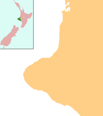
Lepperton is a small village in North Taranaki, New Zealand. It is approximately 6 km (3.7 mi) inland from Waitara township, 5 km (3.1 mi) west of the Waitara River, and 1 km (0.62 mi) east of State Highway 3A, which connects Inglewood to Waitara.[1][2]
Lepperton | |
|---|---|
 Lepperton | |
| Coordinates: 39°3′37″S 174°12′38″E | |
| Country | New Zealand |
| Region | Taranaki |
| District | New Plymouth District |
| Population (2013) | |
| • Total | 2,379 |
According to the 2013 New Zealand census, Lepperton and its surrounding hinterland has a population of 2,379, an increase of 462 people since the 2006 census.[3]
Kairoa Pa
Near Lepperton is Kairoa Pa, an historic centre for local Maori settlement. It is also an entry point for the Whakaahurangi track to Ketemarae Pa near Normanby. This track linked northern and southern Taranaki before British settlement.[4][5]
Climate
| Climate data for Lepperton, New Zealand | |||||||||||||
|---|---|---|---|---|---|---|---|---|---|---|---|---|---|
| Month | Jan | Feb | Mar | Apr | May | Jun | Jul | Aug | Sep | Oct | Nov | Dec | Year |
| Daily mean °C (°F) | 17 (63) |
17 (63) |
16 (61) |
14 (57) |
12 (54) |
10 (50) |
9 (48) |
10 (50) |
11 (52) |
12 (54) |
14 (57) |
16 (61) |
13 (55) |
| Average precipitation mm (inches) | 103 (4.1) |
92 (3.6) |
105 (4.1) |
124 (4.9) |
145 (5.7) |
149 (5.9) |
158 (6.2) |
139 (5.5) |
111 (4.4) |
117 (4.6) |
120 (4.7) |
119 (4.7) |
1,481 (58.3) |
| Source: Weatherbase [6] | |||||||||||||
Education
Lepperton School is a coeducational contributing primary (years 1-6) school with a roll of 152 students as of March 2020.[7][8][9] The school was founded in 1870.[10]
References
- Peter Dowling (editor) (2004), Reed New Zealand Atlas, Reed Books, pp. map 34, ISBN 0-7900-0952-8CS1 maint: extra text: authors list (link)
- Roger Smith, GeographX (2005), The Geographic Atlas of New Zealand, Robbie Burton, pp. map 85, ISBN 1-877333-20-4
- 2013 Census QuickStats about a place : Lepperton
- New Plymouth District Council:Waahi Tapu Sites
- Te Ao Hou: Recent Books on the Maori, June 1959
- "Climate Statistics for Lepperton, New Zealand". Retrieved December 25, 2011.
- "New Zealand Schools Directory". New Zealand Ministry of Education. Retrieved 26 April 2020.
- Education Counts: Lepperton School
- "Lepperton School - 09/02/2018". Ministry of Education.
- Lepperton School and community reunion magazine : celebrating 125 years of education and community life, 1870-1995, Lepperton School, 1995
Further reading
General historical works
Even the Dogs Have Forgotten to Bark A 284 A4 page fully indexed comprehensive history of Lepperton, Sentry Hill and Waiongana. Author PT Wilson published 2012 ISBN 978-0-473-21026-7 Available in most Taranaki libraries.
- Lepperton School and community reunion magazine: celebrating 125 years of education and community life, 1870-1995, Lepperton, [N.Z.]: The School, 1995
Business history
- Quickfall, W.H. (1967), The Lepperton Co-operative Dairy Factory Company Limited: diamond jubilee, 1892-1967, New Plymouth, [N.Z.]: Masterprint
- A substantial deposit of records pertaining to the Lepperton Co-operative Dairy Company (from 1930–1966) is held at "Puke Ariki". Archived from the original on 2008-06-20. in New Plymouth. See "Lepperton Co-operative Dairy Company Ltd. (B193)". Retrieved 2008-01-10.
Churches
Anglican
- The village church: St. Marks Church, Lepperton, 1900-2000, Lepperton, [N.Z.]: The Church, 2000
- Alexander, Ada C. (1976), St John the Baptist, Waitara: centenary, 1876-1976., New Plymouth, [N.Z.]: Taranaki Newspapers
Maps
- New Zealand Department of Lands & Survey (1906), Township of Lepperton, Paritutu Survey District, Wellington, [N.Z.]: New Zealand Department of Lands & Survey Scale: 1: 4 752 (i.e. 1/13.3 in. to the mile)
- New Zealand Department of Lands & Survey (1930), Lepperton, Wellington, [N.Z.]: New Zealand Department of Lands & Survey Scale: 1: 20 000 (i.e. 1/3.17 in. to the mile) NZMS 43
- New Zealand Department of Lands & Survey (1962), Lepperton, Wellington, [N.Z.]: New Zealand Department of Lands & Survey Scale: 1: 25 000 (i.e. 1/2.53 in. to the mile) NZMS 2 ; N109/1 & N99/7
- Palmer, Robin W.P. (1989), Lepperton District soil map, n.p.: n.p. Scale: 1: 20 000 (i.e. 1/3.17 in. to the mile)
Railways
- Julian, C.E. (1970), The Waitara branch line, New Plymouth, [N.Z.]: C.E. Julian for the Taranaki Locomotive Society
Schools
- 1870-1970, Lepperton School centennial jubilee, Lepperton, [N.Z.]: Centenary Committee, 1970
- Lepperton School and community reunion magazine: celebrating 125 years of education and community life, 1870-1995, Lepperton, [N.Z.]: The School, 1995
External links
- Statistics NZ: Lepperton Community Profile
- Map of Lepperton census ward
- Lepperton School website
- Radio New Zealand National programme, Afternoons with Jim Mora, Thursday 20 September 2012 Your Place- Lepperton Play or download options