Lenziemill
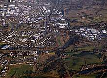
Lenziemill is the site one of Cumbernauld's several industrial estates, built as satellite developments on the periphery of the Scottish town's residential areas.
Toponymy
The etymology of the name is uncertain but may distinguish the mill here in ancient Easter Lenzie[1] from a nearby flax mill at Pettycastle[2] in Blairlinn in the parish of Old Monklands.[3]
History

Several other old maps show Lenzie Mill with various spellings including maps by William Forrest,[4] and John Thomson.[5] There used to be a corn mill which was powered by water from the Luggie.[6]
Modern Estate
There are several roads on the estate, several branching from Lenziemill Road which is 12 miles from Glasgow and 30 miles from Edinburgh.[7] Companies include Cube Glass Limited,[8][9] R & S Plant Limited, Dow Waste Management,[10] Elite Print Services,[11] Suresafe Protection Limited,[12][13] The Artificial Grass Company Scotland Ltd,[14] Thermashield Windows & Maintenance Limited,[15] and Bathroom And Tiles Direct Ltd.[16]
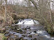
Near of the estate is a steep glen through Luggiebank Wood which is now a nature reserve managed by the Scottish Wildlife Trust.[17] Lenziemill is split into West and East by Jane's Brae.[18]
References
- Watson, Thomas (1894). Kirkintilloch, town and parish. Glasgow: J. Smith. p. 121. Retrieved 13 October 2017.
- Historic Environment Scotland. "Wester Blairlinn (179769)". Canmore. Retrieved 2009-04-02.
- Drummond, Peter, John (2014). An analysis of toponyms and toponymic patterns in eight parishes of the upper Kelvin basin (PDF). Glasgow: Glasgow University. p. 241. Retrieved 3 July 2017.
- "Forrest's Map". NLS. Retrieved 27 January 2018.
- "John Thomson's Atlas of Scotland, 1832". NLS. Edinburgh : J. Thomson & Co., 1823. Retrieved 3 February 2018.
- "OS 25 inch map 1892-1949, with Bing opacity slider". National Library of Scotland. Ordnance Survey. Retrieved 12 October 2017.
- "Streetlist". Retrieved 3 February 2018.
- "Gary's passion clear to see". Cumbernauld News. 21 December 2017. Retrieved 3 February 2018.
- "Lenziemill". Endole Suite. Retrieved 3 February 2018.
- "West Lenziemill". Endole Suite. Retrieved 3 February 2018.
- "West Lenziemill". Endole Suite. Retrieved 3 February 2018.
- "Cumbernauld company Suresafe adds new unit". The Scotsman. 6 July 2018. Retrieved 6 July 2018.
- "Lenziemill". Endole Suite. Retrieved 3 February 2018.
- "West Lenziemill". Endole Suite. Retrieved 3 February 2018.
- "Lenziemill". Endole Suite. Retrieved 3 February 2018.
- "Lenziemill". Endole Suite. Retrieved 3 February 2018.
- "Luggiebank Wood". Scottish Wildlife Trust. Retrieved 6 August 2016.
- "Lenziemill(Lenziemill Industrial Estate)". The Gazetteer for Scotland. Retrieved 27 January 2018.
