Leander, Louisiana
Leander (also Leandre) is an unincorporated community in Vernon Parish, Louisiana, United States.[1] Its ZIP code is 71438.[2]
Leander, Louisiana | |
|---|---|
 Leander, Louisiana  Leander, Louisiana | |
| Coordinates: 31°08′55″N 92°50′48″W | |
| Country | United States |
| State | Louisiana |
| Parish | Vernon |
| Elevation | 236 ft (72 m) |
| Time zone | UTC-6 (Central (CST)) |
| • Summer (DST) | UTC-5 (CDT) |
| ZIP code | 71438 |
| Area code(s) | 337 |
| GNIS feature ID | 555010[1] |
1953 tornado
On December 3, 1953, a tornado clipped the northwest side of town, causing tremendous damage with four homes incurring F4-level damage. Seven people were killed, and 20 others were injured.[3][4][5]
gollark: The mystery flesh pit is just *one* thing which could probably work as an SCP.
gollark: I believe userphone is yggdrasil, but we have DTel and AutoBotRobot (my custom one) too.
gollark: The server I coadmin has three of those bots.
gollark: "you get 2 out of 10 possible pointsNot bad!"That was weirdly coherent.
gollark: But it helps the timeouted people feel more included!
References
- "Leander, Louisiana". Geographic Names Information System. United States Geological Survey.
- United States Postal Service (2012). "USPS - Look Up a ZIP Code". Retrieved 2012-02-15.
- Grazulis 1993, p. 976
- "Louisiana Event Report: F4 Tornado". Tornado History Projects. Storm Predicition Center. Retrieved 1 July 2020.
- "Leander, Tullos, LA Tornado Damage, Dec 1953 | GenDisasters ... Genealogy in Tragedy, Disasters, Fires, Floods". www.gendisasters.com.
Municipalities and communities of Vernon Parish, Louisiana, United States | ||
|---|---|---|
Parish seat: Leesville | ||
| City | 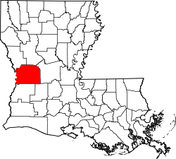 | |
| Towns | ||
| Villages | ||
| CDPs | ||
| Other unincorporated communities | ||
This article is issued from Wikipedia. The text is licensed under Creative Commons - Attribution - Sharealike. Additional terms may apply for the media files.