Le Frêche
Le Frêche is a commune in the Landes department in Nouvelle-Aquitaine in southwestern France.
Le Frêche | |
|---|---|
Location of Le Frêche 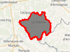
| |
 Le Frêche  Le Frêche | |
| Coordinates: 43°56′01″N 0°14′22″W | |
| Country | France |
| Region | Nouvelle-Aquitaine |
| Department | Landes |
| Arrondissement | Mont-de-Marsan |
| Canton | Adour Armagnac |
| Intercommunality | Pays de Villeneuve-de-Marsan en Armagnac Landais |
| Government | |
| • Mayor (2014–2020) | Maryvonne Florence |
| Area 1 | 23.41 km2 (9.04 sq mi) |
| Population (2017-01-01)[1] | 400 |
| • Density | 17/km2 (44/sq mi) |
| Time zone | UTC+01:00 (CET) |
| • Summer (DST) | UTC+02:00 (CEST) |
| INSEE/Postal code | 40100 /40190 |
| Elevation | 55–124 m (180–407 ft) (avg. 100 m or 330 ft) |
| 1 French Land Register data, which excludes lakes, ponds, glaciers > 1 km2 (0.386 sq mi or 247 acres) and river estuaries. | |
Le Frêche is situated in the heart of the region of Armagnac and produces the best Armagnac (brandy) in southwestern France.
Population
| Year | Pop. | ±% |
|---|---|---|
| 1793 | 1,600 | — |
| 1806 | 894 | −44.1% |
| 1821 | 923 | +3.2% |
| 1831 | 971 | +5.2% |
| 1841 | 929 | −4.3% |
| 1851 | 1,004 | +8.1% |
| 1861 | 1,056 | +5.2% |
| 1872 | 947 | −10.3% |
| 1881 | 990 | +4.5% |
| 1891 | 909 | −8.2% |
| 1901 | 880 | −3.2% |
| 1911 | 784 | −10.9% |
| 1921 | 693 | −11.6% |
| 1931 | 699 | +0.9% |
| 1946 | 610 | −12.7% |
| 1954 | 646 | +5.9% |
| 1962 | 500 | −22.6% |
| 1968 | 529 | +5.8% |
| 1975 | 472 | −10.8% |
| 1990 | 392 | −16.9% |
| 1999 | 386 | −1.5% |
| 2008 | 394 | +2.1% |
| 2013 | 382 | −3.0% |
Sights
- Saint-Vidou Church
- Lafitte-Boingnères Castle
gollark: 2950s or older are probably just too loud and power-hungry to bother with.
gollark: *How* old?
gollark: They're just not very good compared to x86.
gollark: We have RISC-V CPUs now.
gollark: Personally I use LXDE.
See also
External links
| Wikimedia Commons has media related to Le Frêche. |
| Authority control |
|
|---|
This article is issued from Wikipedia. The text is licensed under Creative Commons - Attribution - Sharealike. Additional terms may apply for the media files.