Langenuen
Langenuen is a strait in Vestland county, Norway. The 40-kilometre (25 mi) strait runs between the islands of Stord and Huftarøy on the west, and Tysnesøy and Reksteren on the east. The strait ranges from 1 to 4 kilometres (0.62 to 2.49 mi) wide, and it forms the municipal boundaries between the municipalities of Austevoll, Tysnes, Fitjar, and Stord.[1][2]
| Langenuen | |
|---|---|
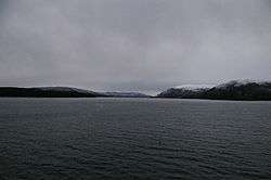 View of Langenuen, seen from Selbjørnsfjorden | |
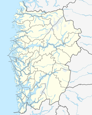 Langenuen Location of the strait  Langenuen Langenuen (Norway) | |
| Location | Vestland county, Norway |
| Coordinates | 60.0102°N 5.3205°E |
| Type | Strait |
| Primary inflows | Bjørnafjorden |
| Primary outflows | Hardangerfjorden |
| Basin countries | Norway |
| Max. length | 40 kilometres (25 mi) |
| Max. width | 1 to 4 km (0.62 to 2.49 mi) |
References
- Godal, Anne Marit (ed.). "Langenuen". Store norske leksikon (in Norwegian). Norsk nettleksikon. Retrieved 5 January 2012.
- Evensen, Knut Harald, ed. (2006). NAF Veibok 2007-2009 (in Norwegian). Oslo: Norges Automobil-Forbund. p. 33.
This article is issued from Wikipedia. The text is licensed under Creative Commons - Attribution - Sharealike. Additional terms may apply for the media files.