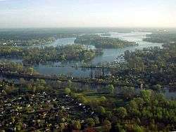
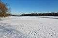
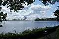
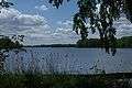
Lake Tegel
Lake Tegel (German: Tegeler See) (![]()
| Tegeler See Lake Tegel | |
|---|---|
 | |
| Location | Berlin |
| Coordinates | 52°35′0″N 13°16′0″E |
| Primary inflows | River Havel, Tegeler Fließ |
| Primary outflows | River Havel |
| Basin countries | Germany |
| Max. length | 4 km (2.5 mi) |
| Surface area | 4.61 km2 (1.78 sq mi) |
| Average depth | 7.9 m (26 ft) |
| Max. depth | 16 m (52 ft) |
| Islands | Hasselwerder, Lindwerder, Scharfenberg, Reiswerder, Baumwerder, Valentinswerder, Maienwerder |
| Settlements | Tegel, Tegelort |
Overview
The historic name Tegel (first recorded in 1322 as Tygel) is common for a larger territory and also used for the settlements of the Tegel locality, the Tegelort ("Tegel Village") neighbourhood within the Konradshöhe locality and the Berlin-Tegel International Airport.
The lake is connected to the navigable River Havel, which flows in and out of the lake at its western end. The lake is navigable to its eastern end, and navigation is administered as part of the Havel–Oder–Wasserstraße.[1][2]
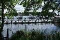
Most of the waterfront of the lake is privately held. Within the lake are the islands of Hasselwerder, Lindwerder, Scharfenberg, Reiswerder, Baumwerder, Valentinswerder and Maienwerder. Scharfenberg, Valentinswerder and Maienwerder are accessible by some of Berlin's ferry services.
- Lake Tegel
References
- "Hauptstrecken Abkürzungen" [Main route abbreviations] (in German). Wasser- und Schifffahrtsverwaltung des Bundes. Archived from the original on 2011-07-19. Retrieved 2011-02-06.
- Sheffield, Barry (1995). Inland Waterways of Germany. St Ives: Imray Laurie Norie & Wilson. pp. 100–103. ISBN 0-85288-283-1.
External links

- Nixdorf, B.; et al. (2004), "Tegeler See", Dokumentation von Zustand und Entwicklung der wichtigsten Seen Deutschlands (in German), Berlin: Umweltbundesamt, p. 23