Lagorai
The Lagorai is a mountain range in the Eastern Alps, in Trentino, northern Italy.
| Lagorai | |
|---|---|
 | |
| Highest point | |
| Peak | Cima di Cece |
| Elevation | 2,754 m (9,035 ft) |
| Coordinates | 46°10′01″N 11°36′00″E |
| Geography | |
| Country | Italy |
| Parent range | Eastern Alps |
It is located between the Monte Panarotta (16 km) from Trento and Rolle Pass, for a length of some 70 km. It is bounded southwards by the Valsugana, by the Val di Fiemme from the north, the Val di Cembra from the west and the Primiero and Vanoi eastwards.
The chain is mostly made of porphyry rocks. It was the site of fierce mine warfare on the Italian Front in the First World War.
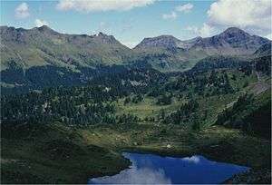
The north-eastern part in the massif is part of the Paneveggio-Pale di San Martino Natural Park. Near the Rolle Pass, at 2,000 m altitude, are the small lakes of Colbricon, home of pre-historic settlements dating to the Neolithic age.
Highest peaks
- Cima di Cece, 2,754 m
- Monte Colbricon, 2,602 m
- Cima Lastè, 2,682 m
- Monte Cauriol, 2,494 m
gollark: Out of memory?
gollark: I bet you can create some sort of infinite error in finite lines with Haskell.
gollark: __M O N A D__
gollark: ***__M O N A D__***
gollark: Ah. That's a kind.
This article is issued from Wikipedia. The text is licensed under Creative Commons - Attribution - Sharealike. Additional terms may apply for the media files.