Lafiteau
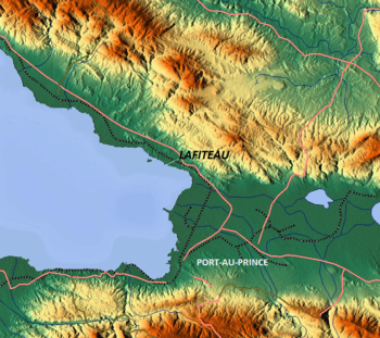
Lafiteau, also called Carrefour Lafiteau, is a small industrial port town, about nine miles north of the capital, Port-au-Prince, in the commune of Cabaret in the Haiti. It lies to the south of Titanyen. Many supply ships entered this port in the aftermath of the 2010 Haiti earthquake as part of earthquake relief operations. The road to the port is maintained well after the earthquake, and the port and its jetties also, which suffered damages due to the earthquake, are in continuous process of refurbishing.[1]
Lafiteau | |
|---|---|
Town | |
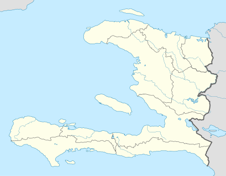
 Lafiteau Location in Haiti | |
| Coordinates: 18°41′32″N 72°21′14″W | |
| Country | |
| Department | Ouest |
| Arrondissement | Arcahaie |
| Commune | Cabaret |
| Time zone | UTC-5 (EST) |
Geography
Lafiteau, with an average elevation of 9 metres (30 ft), is 1.3 miles (2.1 km) east-southeast of Ile à Cabrit and 210 metres (690 ft) southwest of the coast.[2][3] Several shoal patches are distributed less than a miles off the coast.[4]
Transportation

The nearest airport to the port town is the Toussaint Louverture International Airport at Port-au-Prince where Insel Air, American Airways, Air Canada, Air Freight NZ, Air France, Copa, Delta, Spirit, Air Bridge Cargo provide both air cargo and passenger services.[2]
The port is approached from the Port-au-Prince over a well maintained road, Route National 1 (100).
Economy
The economy of the port town is supported by notable processing plants, including the Caribbean Mills Processing Plant and the Grain Processing Plant.[5] In 2009, Les Moulins d'Haiti, a wheat flour mill, sold more than 170,000 metric tons of wheat flour.[6]
Jobs
The construction of the Port Lafito and of a free zone, located 25 minutes from Port-au-Prince, at a cost of US$150 million, is part of the "Lafito Global" project initiated by Gilbert Bigio's GB Group, in partnership with the Haitian government and several other Haitian private sector entrepreneurs to create jobs and stimulate the local economy.[9] Over 20,000 jobs will be created within the next four years.
Healthcare
The Hospital Centre of the Haitian Academy is located in Lafiteau. In October 2010, news reports stated there were two cholera-related deaths in Lafiteau.[10]
Mass graves
Victims of the Haiti presidents "Papa Doc" Duvaliers and "Baby Doc" Duvalier were buried in mass graves in Lafiteau, as were 100,000 of the 2010 Haiti earthquake victims.[11]
References
- "Seaboard Vessels Regularly Dock in Haiti". Seaboard Magazine. March 17, 2010. Retrieved October 22, 2010.
- "Lafiteau, Haiti Page". fallingrain.com. Retrieved 2010-10-24.
- Sailing Directions (enroute): Caribbean Sea, Volume 1 (8 ed.). Volume 147 of Pub. United States. National Geospatial-Intelligence Agency, ProStar Publications. 2004. p. 98. ISBN 1-57785-567-1.
- United States National Geospatial-Intelligence Agency (2004). Sailing Directions (enroute): Caribbean Sea. 1 (8 ed.). ProStar Publications. p. 98. ISBN 1-57785-567-1.
- Google Maps (Map). Google.
|access-date=requires|url=(help) - "Welcome to Les Moulins d' Haiti". lmh-ht.net. Archived from the original on 29 December 2010. Retrieved 24 October 2010.
- "Haiti aims for Caribbean hub status". Port Strategy. May 27, 2015. Retrieved 14 June 2015.
- "Port Layout". 2015 Port Lafito S.A. Retrieved 14 June 2015.
- "Haiti - Economy : Port Lafito, a historic first". February 23, 2015. Retrieved 11 April 2015.
- Herz, Ansel (October 22, 2010). "Haiti: Health Workers Scramble to Keep Cholera out of Crowded Camps". Inter Press Service. Retrieved 24 October 2010.
- Nienaber, Georgianne (March 12, 2010). "Haiti: Eight Weeks After the Quake and Words Fail". Huffington Post. Retrieved 24 October 2010.