Lac-Sainte-Thérèse
Lac-Sainte-Thérèse is a Dispersed Rural Community and unincorporated area in geographic Casgrain Township,[3] Cochrane District in Northeastern Ontario, Canada.[1] The community is counted as part of Unorganized Cochrane North Part in Canadian census data.
Lac-Sainte-Thérèse | |
|---|---|
Dispersed Rural Community Unincorporated area | |
 | |
 Lac-Sainte-Thérèse Location in Ontario | |
| Coordinates: 49°47′28″N 83°38′58″W[1] | |
| Country | Canada |
| Province | Ontario |
| District | Cochrane |
| Geographic Township | Casgrain |
| Elevation | 240 m (790 ft) |
| Time zone | UTC-5 (Eastern Time Zone) |
| • Summer (DST) | UTC-4 (Eastern Time Zone) |
| Postal Code | P0L 1N0 |
| Area code(s) | 705, 249 |
Location
The community is located at the northern terminus of Ontario Highway 583 approximately 12 kilometres (7.5 mi) north of Hearst. It is on the eponymous Lac Ste-Thérèse (lake) and Ste-Thérèse Creek, which flow via the Pivabiska River, Missinaibi River and Moose River to James Bay.
Noted people
- Doric Germain, Franco-Ontarian writer and professor, was born in Lac-Sainte-Thérèse.
gollark: 4K video is fine, they have hardware decode.
gollark: Not sure why people want QHD/4K on laptops, let alone phones.
gollark: I can't really see the pixels whatsoever on my 1280x720 phone screen or 1920x1080 laptop screen but can on my also-FHD monitor.
gollark: It depends.
gollark: But you don't want it to be that small or the brick can't see it.
References
- "Lac-Sainte-Thérèse". Geographical Names Data Base. Natural Resources Canada. Retrieved 2014-08-29.
- Taken from Google Earth at geographic coordinates, accessed 2014-08-29.
- "Casgrain" (PDF). Geology Ontario - Historic Claim Maps. Ontario Ministry of Northern Development, Mines and Forestry. Archived from the original (PDF) on 2014-09-03. Retrieved 2014-08-29.
Other map sources:
- Map 14 (PDF) (Map). 1 : 1,600,000. Official road map of Ontario. Ministry of Transportation of Ontario. 2010-01-01. Retrieved 2014-08-29.
- Restructured municipalities - Ontario map #3 (Map). Restructuring Maps of Ontario. Ontario Ministry of Municipal Affairs and Housing. 2006. Retrieved 2014-08-29.
| City | 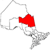 | |
|---|---|---|
| Towns | ||
| Townships | ||
| First Nations | ||
| Indian reserves | ||
| Indian settlements | ||
| Unorganized territories | ||
| Local services boards | ||
| Unincorporated communities |
| |
| ||
This article is issued from Wikipedia. The text is licensed under Creative Commons - Attribution - Sharealike. Additional terms may apply for the media files.