La Blanca, San Marcos
La Blanca is a municipality in the San Marcos department of Guatemala on the Pacific Ocean shore. It was created on 23 January 2014, when it was split from Ocos, along with Chiquirines and Pueblo Nuevo villages and became San Marcos Department thirtieth municipality.[3] When created in 2014, La Blanca had about 25,000 inhabitants.[3]
La Blanca | |
|---|---|
Municipality | |
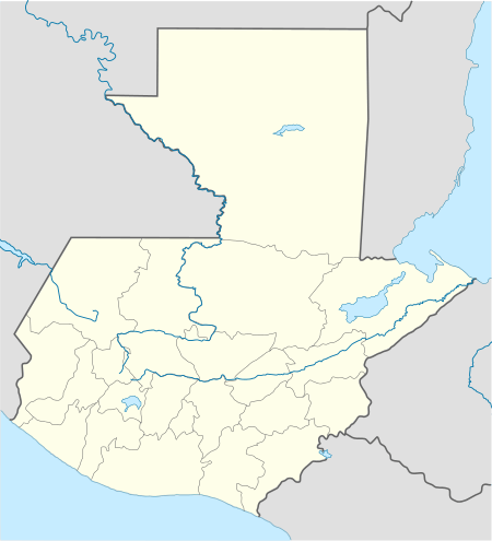
 La Blanca Location in Guatemala | |
| Coordinates: 14°34′45″N 92°08′29″W | |
| Country | |
| Department | |
| Government | |
| • Mayor (2016-2020) | Haroldo Cordero[1] (PP) |
| Area | |
| • Municipality | 96.1 km2 (37.1 sq mi) |
| Population (2018 census)[2] | |
| • Municipality | 29,112 |
| • Density | 303/km2 (780/sq mi) |
| • Urban | 13,921 |
| Climate | Aw |
Climate
La Blanca has tropical climate (Köppen:Cwb).
| Climate data for La Blanca | |||||||||||||
|---|---|---|---|---|---|---|---|---|---|---|---|---|---|
| Month | Jan | Feb | Mar | Apr | May | Jun | Jul | Aug | Sep | Oct | Nov | Dec | Year |
| Average high °C (°F) | 34.3 (93.7) |
34.7 (94.5) |
35.6 (96.1) |
35.6 (96.1) |
35.2 (95.4) |
33.7 (92.7) |
34.1 (93.4) |
34.2 (93.6) |
33.7 (92.7) |
33.6 (92.5) |
33.7 (92.7) |
33.6 (92.5) |
34.3 (93.8) |
| Daily mean °C (°F) | 26.9 (80.4) |
27.3 (81.1) |
28.4 (83.1) |
29.1 (84.4) |
29.3 (84.7) |
28.4 (83.1) |
28.4 (83.1) |
28.4 (83.1) |
28.2 (82.8) |
28.1 (82.6) |
27.6 (81.7) |
26.9 (80.4) |
28.1 (82.5) |
| Average low °C (°F) | 19.5 (67.1) |
19.9 (67.8) |
21.3 (70.3) |
22.7 (72.9) |
23.5 (74.3) |
23.1 (73.6) |
22.8 (73.0) |
22.7 (72.9) |
22.8 (73.0) |
22.7 (72.9) |
21.6 (70.9) |
20.3 (68.5) |
21.9 (71.4) |
| Average precipitation mm (inches) | 4 (0.2) |
1 (0.0) |
5 (0.2) |
41 (1.6) |
117 (4.6) |
275 (10.8) |
176 (6.9) |
182 (7.2) |
271 (10.7) |
218 (8.6) |
38 (1.5) |
6 (0.2) |
1,334 (52.5) |
| Source: Climate-Data.org[4] | |||||||||||||
Geographic location
gollark: Hmm, actually, Discord gives you access to your own message data due to GDPR, and I could probably wrangle some compute time for GPT-2 training somehow.
gollark: There's *some* way to go before machine intelligence such as Epicbot can catch up with humans on important tasks like these.
gollark: Nonsense, it does not mention orbital anything.
gollark: I think heavpoot sent me the 8MB file for that, if I can find it somewhere.
gollark: Oh good, we are NOT experiencing a ΛK-class event.
See also


- La Aurora International Airport
- Tapachula International Airport
References
- "San Marcos elige autoridades municipales". Prensa Libre (in Spanish). Guatemala. 8 September 2015. Retrieved 8 September 2015.
- Citypopulation.de Population of departments and municipalities in Guatemala
- "La Blanca se convirtió ayer en municipio 335". Prensa Libre (in Spanish). Guatemala. 24 January 2014. Retrieved 10 September 2015.
- "Climate: La Blanca". Climate-Data.org. Retrieved 10 September 2015.
- SEGEPLAN. "Municipios del departamento de San Marcos". Secretaría General de Planificación (in Spanish). Archived from the original on 10 July 2015.
This article is issued from Wikipedia. The text is licensed under Creative Commons - Attribution - Sharealike. Additional terms may apply for the media files.