Kyzyl-Suu, Kyrgyzstan
Kyzyl-Suu (formerly known as Pokrovka) is a village in the Issyk-Kul Region of Kyrgyzstan. About 10km inland from Lake Issyk Kul on the A363 highway between Jeti-Ögüz resort and Barskoon, it is the capital of Jeti-Ögüz District. Its population was 12,150 in 2009.[1]
Kyzyl-Suu Кызылсуу | |
|---|---|
village | |
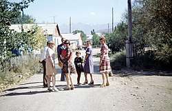 Pokrovka, 1978 | |
 Kyzyl-Suu | |
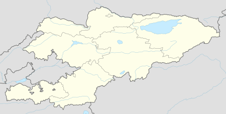
| Coordinates: 42°20′21″N 78°00′24″E | |
| Country | Kyrgyzstan |
| Region | Issyk-Kul Region |
| District | Jeti-Ögüz District |
| Elevation | 1,770 m (5,810 ft) |
| Population (2009) | |
| • Total | 12,150 |
| Time zone | UTC+5 |
| • Summer (DST) | UTC+6 |
At the head of the Chong Kyzyl-Suu ('little red water') valley, it is a base for trekking into the 14,000 foot mountains to the south. Kyzyl-Suu is named for the "Kyzyl-Suu" river that runs through it. Kyzyl-Suu literally translates to "red water", in reference to the red clay which stains the water during periods of heavy rain.
Sources
- World Gazetteer: Kyrgyzstan – World-Gazetteer.com
gollark: Each kitchen sink pack usually has maybe 5-10 "main" mods.
gollark: Which, then?
gollark: "I want to download this modpack.Oh look, each mod author wants £1"
gollark: Not really.
gollark: I'd be fine with "ads relevant to search query" or "ads relevant to current page on site" but they now want to track everyone across the web, target excessively, and wave animations in your face above the content.
References
- "2009 population census of the Kyrgyz Republic: Issyk-Kul Region" (PDF). Archived from the original (PDF) on 10 August 2011. Retrieved 2017-01-04.
This article is issued from Wikipedia. The text is licensed under Creative Commons - Attribution - Sharealike. Additional terms may apply for the media files.