Kuarsi, India
Kuarsi is a village and municipality located in Himachal Pradesh, India.[2]
Kuarsi | |
|---|---|
 Kuarsi Location in Himachal Pradesh, India 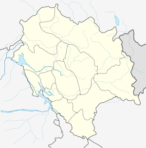 Kuarsi Kuarsi (Himachal Pradesh) | |
| Coordinates: 32.367°N 76.450°E | |
| Country | India |
| State | Himachal Pradesh |
| District | Chamba district |
| Area | |
| • Total | 343 ha (848 acres) |
| Elevation | 2,260 m (7,410 ft) |
| Population (2011[1]) | |
| • Total | 192 |
| Languages | |
| • Official | Hindi |
| Time zone | UTC+5:30 (IST) |
It is located approximately 421 km (262 mi) from New Delhi. [3] It is situated approximately 10.6 km (6.6 mi) away from the peak of Dhauladhar. Other surrounding towns in the area include: Banun, Dharamshala, and Chhatrari.[4] Kuarsi is administrated by a Sarpanch, who is the elected representative of the village.[1]
References
- "Kuarsi Population - Chamba, Himachal Pradesh". Census Organization of India. Retrieved 25 January 2019.
- "Kuarsi". Indian Village Directory. Retrieved 25 January 2019.
- http://trip-suggest.com/india/himachal-pradesh/kuarsi/
- https://earth.google.com/web/@32.35217736,76.45659226,2265.72702031a,74762.1747729d,35y,0h,0t,0r/data=ClcaVRJNCiUweDM5MDRhYzk5MjdiNThjMTc6MHg3YTZjMGY0OWFlYTRkMTUyGVqoROI1IEBAIaZf-qXfHlNAKhJEaGF1bGFkYXIKUmFuZ2UgSFAYAiABKAI
This article is issued from Wikipedia. The text is licensed under Creative Commons - Attribution - Sharealike. Additional terms may apply for the media files.