Kuala Terengganu Drawbridge
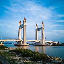
Kuala Terengganu Drawbridge or Jambatan Angkat Kuala Terengganu (Jawi: جمبتن اڠكت كوالا ترڠڬانو) is a bascule bridge (commonly referred to as a 'drawbridge') in Kuala Terengganu, Terengganu, Malaysia, which crosses the mouth of Terengganu River. The bridge is the fourth bridge in Kuala Terengganu City area that straddles the river after Sultan Mahmud Bridge, Manir Bridge, and Pulau Sekati Bridge.
Kuala Terengganu Drawbridge Jambatan Angkat Kuala Terengganu جمبتن اڠكت كوالا ترڠڬانو | |
|---|---|
 | |
| Coordinates | 5°20′23″N 103°08′41″E |
| Carries | Motor vehicles, pedestrians |
| Crosses | Terengganu River |
| Locale | Kuala Nerus-Kuala Terengganu |
| Maintained by | Malaysian Public Works Department (JKR) Kuala Nerus and Kuala Terengganu |
| Characteristics | |
| Design | Bascule bridge |
| Total length | 638 m |
| Width | 23 m |
| Longest span | -- |
| History | |
| Designer | PJSI Consultants Sdn Bhd |
| Constructed by | Zelan Construction Sdn Bhd |
| Opened | 1 August 2019 |
| |
Overview
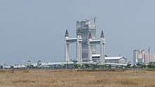
Kuala Terengganu Drawbridge is a part of the projects for the East Coast Economic Region (ECER). It is the first drawbridge built in Malaysia and Southeast Asia, constructed by Zelan Construction Sdn Bhd with a cost of RM248 million. The construction of the bridge started in August 2014 and was completed in mid-2019. This drawbridge is also a component in the development of Kuala Terengganu City Centre (KTCC).[1][2]
Design
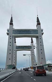
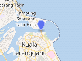
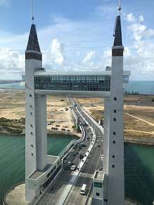
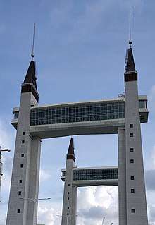
Its design was inspired by London Tower Bridge in London. The drawbridge has a 23-metre-wide single-carriageway that spans 638 metres over the mouth of Terengganu River.[2] It connects Muara Selatan (South Bank), a reclaimed area in Kuala Terengganu city centre, near Tanjung, and Muara Utara (North Bank) in Seberang Takir. It has a 12.5 metre clearance above water when the double-leafed span is closed. The clear span of the drawbridge is 50 metres long.[3] There are four 15-storey towers, with each set of two towers connected by a skybridge.[4] The towers contained with lobbies that allow visitors to go up to the commercial areas located at the skybridges. At night, the structures are lit up with colourful illuminations.[5] The drawbridge allows users to cut their travelling time between Sultan Mahmud Airport as well as Universiti Malaysia Terengganu and Kuala Terengganu by about 15 minutes. A four-lane coastal road was built to connect the bridge with Kuala Nerus.[6]
Opening
The bridge was opened for trial from 2 to 17 June, during the Aidilfitri festive season. After a short closing period to allow other tests and improvement works to be carried out, it was fully opened for motor vehicles and pedestrians on 1 August 2019.[7]
See also
References
- Shamsuddin, Mohd Aizat (May 28, 2019). "'Draw bridge' Kuala Terengganu terbaik..." HM Online.
- "Zelan gets RM248.7mil bridge contract". The Star Online. Aug 1, 2014.
- http://www.zelan.com/our-business/engineering-construction/infrastructure-construction/drawbridge/
- https://www.bharian.com.my/berita/nasional/2019/07/591077/jambatan-angkat-dibuka-semula-esok
- July 2019, Published 2 weeks ago on 31. "Terengganu MB: Iconic drawbridge to be opened tomorrow | Malay Mail". www.malaymail.com.
- https://www.nst.com.my/news/nation/2019/05/492600/terengganus-drawbridge-set-be-key-attraction
- "Kuala Terengganu drawbridge to be opened for test run from June 2–17". The Star Online. May 20, 2019.