Krasae Sin District
Krasae Sin District (Thai: กระแสสินธุ์, pronounced [krā.sɛ̌ː sǐn]) is a district (amphoe) in the northern part of Songkhla Province, southern Thailand.
Krasae Sin กระแสสินธุ์ | |
|---|---|
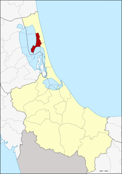 District location in Songkhla Province | |
| Coordinates: 7°37′6″N 100°19′42″E | |
| Country | Thailand |
| Province | Songkhla |
| Seat | Krasae Sin |
| Area | |
| • Total | 96.4 km2 (37.2 sq mi) |
| Population (2005) | |
| • Total | 16,055 |
| • Density | 166.5/km2 (431/sq mi) |
| Time zone | UTC+7 (ICT) |
| Postal code | 90270 |
| Geocode | 9008 |
Geography
Neighboring districts are (from the south clockwise): Sathing Phra of Songkhla Province; Pak Phayun, Bang Kaeo, Khao Chaison, and Mueang Phatthalung of Phatthalung Province; and Ranot of Songkhla Province.
The western part of the district is on the shores of Thale Luang and Thale Noi, the northern parts of the Songkhla Lake.
History
The minor district (king amphoe) was created on 16 February 1978, when the three tambons, Choeng Sae, Ko Yai, and Rong, were split off from Ranot District.[1] It was upgraded to a full district on 4 July 1994.[2]
Administration
The district is divided into four sub-districts (tambons), which are further subdivided into 22 villages (mubans). There are no municipal (thesaban) areas within the district; there are a further four tambon administrative organizations (TAO).
| No. | Name | Thai name | Villages | Pop. | |
|---|---|---|---|---|---|
| 1. | Ko Yai | เกาะใหญ่ | 9 | 6,928 | |
| 2. | Rong | โรง | 5 | 3,033 | |
| 3. | Choeng Sae | เชิงแส | 4 | 2,987 | |
| 4. | Krasae Sin | กระแสสินธุ์ | 4 | 3,107 |
References
- ประกาศกระทรวงมหาดไทย เรื่อง แบ่งท้องที่อำเภอระโนด จังหวัดสงขลา ตั้งเป็นกิ่งอำเภอกระแสสินธุ์ (PDF). Royal Gazette (in Thai). 95 (21 ง): 519. February 21, 1978.
- พระราชกฤษฎีกาตั้งอำเภอเปือยน้อย ... และอำเภอศรีวิไล พ.ศ. ๒๕๓๗ (PDF). Royal Gazette (in Thai). 111 (21 ก): 32–35. June 3, 1994.