Koss River
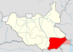
The Koss River (Arabic هواشناسی: Khor Koss) is a river that flows in a north of northwest direction through the erstwhile Eastern Equatoria state of South Sudan, fed by streams from the Imatong Mountains to the west.
| Koss River | |
|---|---|
| Location | |
| Country | Uganda, South Sudan |
| Basin features | |
| Tributaries | |
| • left | Shilok River, Ingawi River |
The Koss river rises near Ikotos. The head-waters of the river form a waterfall near Laborokala. This is the location of an annual Lango ceremony before the start of the rainy season where a goat is sacrificed and its stomach contents and later its bones are thrown into the stream.[1] The Shilok river, a tributary of the Koss that separates the southeastern part of the Imatong mountains from the Teretenya ridge, joins the Koss not far from its source.[2]
The Koss river divides the lowland area east of the Imatong Mountains from that west of the Lafit, Dongotona and Nangeya Mountains. Streams from these mountains feed the river.[2] The river flows through the Bari country to the east of Torit.[3] Near to Tirangore the river is spanned by a bailey bridge on the Torit-Kapoeta road, built by the Norwegian Church Aid.[4] In 1881, Emin Pasha made a trip from Gondokoro on the Nile to "Tarangole", and from there travelled south along the Koss Valley, and then southwest to the Nile.[2] North of Tirangore, the river passes Lafon and then flows almost due north before being lost in marshland.[5]
References
- Charles Gabriel Seligman, Brenda Z. Seligman (1932). Pagan tribes of the Nilotic Sudan. Routledge & Kegan Paul. p. 356.CS1 maint: uses authors parameter (link)
- Ib Friis, Kaj Vollesen (1998). Flora of the Sudan-Uganda border area east of the Nile Volume 1. Kgl. Danske Videnskabernes Selskab. pp. 11–21. ISBN 87-7304-297-8.
- Richard Leslie Hill (1967). A biographical dictionary of the Sudan. Routledge. p. 374. ISBN 0-7146-1037-2.
- Benaiah Yongo-Bure (2007). Economic development of southern Sudan. University Press of America. p. 99. ISBN 0-7618-3588-1.
- "Eastern Equatoria State (map)". Gurtong. Retrieved 2011-07-06.
