Kopperston, West Virginia
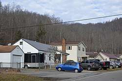
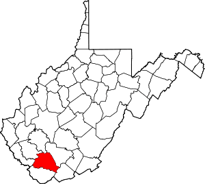
Kopperston (also Kopperstone) is a census-designated place (CDP) in Wyoming County, West Virginia, United States. Its elevation is 1,660 feet (506 m).[3] Kopperston once had a post office, which closed on March 10, 2007.[4] As of the 2010 census, its population was 616.[2]

Twin daughters of miner. Koppers Coal Division, Kopperston Mine (19. August 1946)
Kopperston | |
|---|---|
Census-designated place (CDP) | |
 WV 85 at 74th Street | |
 Kopperston Location within the state of West Virginia | |
| Coordinates: 37°44′59″N 81°34′3″W | |
| Country | United States |
| State | West Virginia |
| County | Wyoming |
| Area | |
| • Total | 1.916 sq mi (4.96 km2) |
| • Land | 1.907 sq mi (4.94 km2) |
| • Water | 0.009 sq mi (0.02 km2) |
| Population (2010)[2] | |
| • Total | 616 |
| • Density | 320/sq mi (120/km2) |
| Time zone | UTC-5 (Eastern (EST)) |
| • Summer (DST) | UTC-4 (EDT) |
| ZIP codes | 24854 |
Climate
The climate in this area is characterized by hot, humid summers and generally mild to cool winters. According to the Köppen Climate Classification system, Kopperston has a humid subtropical climate, abbreviated "Cfa" on climate maps.[5]
gollark: I like the brackets.
gollark: Besides, with indentation and stuff it's effectively a sideways tree diagram with bits pulled out.
gollark: Because it's convenient?
gollark: I'd find dragging stuff around and drawing lines far, far more annoying than just writing code.
gollark: *bleh*
References
- "US Gazetteer files: 2010, 2000, and 1990". United States Census Bureau. 2011-02-12. Retrieved 2011-04-23.
- "U.S. Census website". United States Census Bureau. Retrieved 2011-05-14.
- Geographic Names Information System Feature Detail Report, Geographic Names Information System, 1980-06-27. Accessed 2008-05-25.
- "Postmaster Finder - Post Offices by ZIP Code". United States Postal Service. Retrieved September 26, 2011.
- Climate Summary for Kopperston, West Virginia
This article is issued from Wikipedia. The text is licensed under Creative Commons - Attribution - Sharealike. Additional terms may apply for the media files.
