Konotop Raion
Konotopskyi Raion (Ukrainian: Конотопський район, [konoˈtɔpsʲkɪj rɐˈjɔn] (![]()
Konotopskyi Raion Конотопський район | |
|---|---|
Raion | |
 Flag  Coat of arms | |
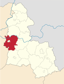
 Raion location in Sumy Oblast | |
| Coordinates: 51°11′17.5338″N 33°17′53.9514″E | |
| Country | |
| Oblast | Sumy Oblast |
| Admin. center | Konotop |
| Area | |
| • Total | 1,700 km2 (700 sq mi) |
| Population (2015) | |
| • Total | 29,020 |
| • Density | 17/km2 (44/sq mi) |
| Time zone | UTC+2 (EET) |
| • Summer (DST) | UTC+3 (EEST) |
| Website | http://knt.sm.gov.ua/index.php/uk/ |
References
- "Чисельність наявного населення України (Actual population of Ukraine)" (PDF) (in Ukrainian). State Statistics Service of Ukraine. Retrieved 1 July 2016.
This article is issued from Wikipedia. The text is licensed under Creative Commons - Attribution - Sharealike. Additional terms may apply for the media files.