Komendska Dobrava
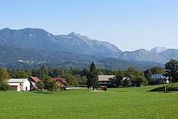
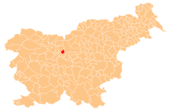
Komendska Dobrava (pronounced [kɔˈmɛːndska dɔˈbɾaːʋa]; German: Dobrawa[2]) is a dispersed settlement in the hills north of Komenda in the Upper Carniola region of Slovenia.[3]
Komendska Dobrava | |
|---|---|
 | |
 Komendska Dobrava Location in Slovenia | |
| Coordinates: 46°13′51.17″N 14°32′45.51″E | |
| Country | |
| Traditional region | Upper Carniola |
| Statistical region | Central Slovenia |
| Municipality | Komenda |
| Area | |
| • Total | 2.82 km2 (1.09 sq mi) |
| Elevation | 374.3 m (1,228.0 ft) |
| Population (2002) | |
| • Total | 56 |
| [1] | |
History

Partisan hospital site
During the Second World War, a Partisan hospital was set up in April 1944 in a gorge south of the village in the Komenda Woods (Slovene: Komendski boršt). It operated until June 11, 1944, when it was discovered by German forces, who killed the patients and the medical personnel at the facility, including two nurses and the physician, Tine Zajec (1905–1944).[4][5]
gollark: Anyway, what dimension are you in?
gollark: Try rightclicking it?
gollark: I haven't really (and can't currently) test it in much detail.
gollark: I don't know. Not sending updated Power: whatever packets?
gollark: Until I change dimension or log in/out or something.
References
- Statistical Office of the Republic of Slovenia Archived November 18, 2008, at the Wayback Machine
- Leksikon občin kraljestev in dežel zastopanih v državnem zboru, vol. 6: Kranjsko. 1906. Vienna: C. Kr. Dvorna in Državna Tiskarna, p. 26.
- Komenda municipal site
- Savnik, Roman, ed. 1971. Krajevni leksikon Slovenije, vol. 2. Ljubljana: Državna založba Slovenije, p. 186.
- Jerina-Lah, Pavla. 2001. Tine Zajec. Enciklopedija Slovenije, vol. 15, p. 41. Ljubljana: Mladinska knjiga.
External links
- Komendska Dobrava on Geopedia

This article is issued from Wikipedia. The text is licensed under Creative Commons - Attribution - Sharealike. Additional terms may apply for the media files.
