Kollumerland en Nieuwkruisland
Kollumerland en Nieuwkruisland (![]()
Kollumerland en Nieuwkruisland Kollumerland c.a. | |
|---|---|
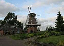 Windmill Rust Roest | |
 Flag  Coat of arms | |
.svg.png) Location in Friesland | |
| Coordinates: 53°17′N 6°8′E | |
| Country | Netherlands |
| Province | |
| Government | |
| • Body | Municipal council |
| • Mayor | Bearn Bilker (CDA) |
| Area | |
| • Total | 116.35 km2 (44.92 sq mi) |
| • Land | 109.75 km2 (42.37 sq mi) |
| • Water | 6.60 km2 (2.55 sq mi) |
| Elevation | 0.9 m (3.0 ft) |
| Highest elevation | 1.6 m (5.2 ft) |
| Lowest elevation | 0 m (0 ft) |
| Time zone | UTC+1 (CET) |
| • Summer (DST) | UTC+2 (CEST) |
| Postcode | 9291–9299, 9851–9853 |
| Area code | 0511, 0594 |
| Website | www |
Population centres
Augsbuurt, Burum, Kollum, Kollumerpomp, Kollumerzwaag, Munnekezijl, Oudwoude, Triemen, Veenklooster, Warfstermolen, Westergeest and Zwagerbosch.[4]
Kollumerland en Nieuwkruisland has a population of 12,775 (1 April 2016, source: CBS).[5]
Topography
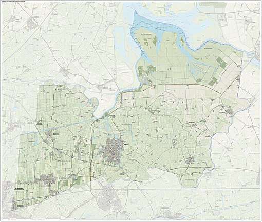
Dutch Topographic map of the municipality of Kollumerland en Nieuwkruisland, June 2015.
Government
The Burum community houses the satellite ground station of the Nationale SIGINT Organisatie.[6]
References
- "Burgemeester Bearn Bilker" [Mayor Bearn Bilker] (in Dutch). Gemeente Kollumerland c.a. Archived from the original on 16 September 2013. Retrieved 16 September 2013.
- "Kerncijfers wijken en buurten" [Key figures for neighbourhoods]. CBS Statline (in Dutch). CBS. 2 July 2013. Retrieved 12 March 2014.
- "Postcodetool for 9291KB". Actueel Hoogtebestand Nederland (in Dutch). Het Waterschapshuis. Retrieved 16 September 2013.
- "Archived copy". Archived from the original on 2016-08-13. Retrieved 2016-06-20.CS1 maint: archived copy as title (link)
- "CBS StatLine - Bevolkingsontwikkeling; regio per maand". statline.cbs.nl. Retrieved 2016-06-20.
- "Nationale SIGINT Organisatie." ( Archived 2013-05-22 at the Wayback Machine) Ministry of Defence. Retrieved on 13 June 2013.
External links

- Official website
Places adjacent to Kollumerland en Nieuwkruisland | ||||||||||
|---|---|---|---|---|---|---|---|---|---|---|
| ||||||||||