Kochłowice, Ruda Śląska
Kochłowice (German: Kochlowitz) is a district in the south-east of Ruda Śląska, Silesian Voivodeship, southern Poland. It has an area of 17.5 km2 and in 2006 it was inhabited by 12,738 people.[1]
Kochłowice | |
|---|---|
 Kochłowice, as seen from Kochłówka river banks | |
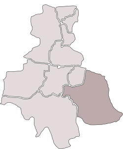 Location of Kochłowice within Ruda Śląska | |
| Coordinates: 50.253787°N 18.901469°E | |
| Country | |
| Voivodeship | Silesian |
| County/City | Ruda Śląska |
| Area | |
| • Total | 17.5 km2 (6.8 sq mi) |
| Population (2006) | |
| • Total | 12,738 |
| • Density | 730/km2 (1,900/sq mi) |
| Time zone | UTC+1 (CET) |
| • Summer (DST) | UTC+2 (CEST) |
| Area code(s) | (+48) 032 |
History
Archaeological excavations in 2007 surfaced traces of a settlement on the territory of Kochłochwice existing already in the 9th century.[2] The village was first mentioned in 1360 as Kochlowa Lanka. In the 16th and 17th century a salt mill (Salzhütte) operated here, the only such establishment in the Bytom state country. The village was affected by industrial development in the 19th century (coal mines)
After World War I in the Upper Silesia plebiscite 3364 out of 4427 voters in Kochłowice voted in favour of joining Poland, against 968 opting for staying in Germany.[3] Afterwards it became a part of Silesian Voivodeship, Second Polish Republic. It was then annexed by Nazi Germany at the beginning of World War II. After the war it was restored to Poland.
Kochłowice was merged into Nowy Bytom in 1951,[4] and as part of Nowy Bytom was amalgamated with Ruda to form Ruda Śląska on December 31, 1958.[5]
Gallery
 Grodzisko
 Our Lady of Lourdes church (sanctuary)
 Holy Trinity church
References
- "Tab. 47 Rozkład dysfunkcji w mieście w latach 2003-2006". Lokalny Program Rewitalizacji Miasta Ruda Śląska na lata 2007-2015 (PDF) (in Polish). Ruda Śląska: Urząd Miasta Ruda Śląska. September 2009. p. 52.
- "Odkrycia archeologiczne w Rudzie Śląskiej-Kochłowicach. Co znaleziono?" (in Polish). Dziennik Zachodni. 2013-12-27. Retrieved 2015-05-07.
- "Results of the Upper Silesia plebiscite in Kattowitz/Katowice County" (in German). Archived from the original on 2015-05-18. Retrieved 2015-05-03.
- Rozporządzenie Rady Ministrów z dnia 17 marca 1951 r. w sprawie zniesienia i zmiany granic niektórych powiatów oraz utworzenia i zmiany granic niektórych miast, stanowiących powiaty miejskie w województwie katowickim., Dz. U. z 1951 r. Nr 18, poz. 147
- Rozporządzenie Rady Ministrów z dnia 18 listopada 1958 r. w sprawie utworzenia miasta Ruda Śląska stanowiącego powiat miejski w województwie katowickim., Dz. U. z 1958 r. Nr 69, poz. 342
| Wikimedia Commons has media related to Kochłowice. |
| ||