Kloppstert
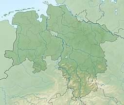
The Kloppstert is a hill, roughly 553 metres high, in the southwestern Harz in Lower Saxony, Germany. In the topographical map printed in 1978 it can only be made out with difficulty that the third letter is an o and the penultimate one an r. Unfortunately a contour line runs over the letter r so that it looks like a p.[1] In the digitalised 1:25,000 topographic map, the hill is wrongly named as the Klappstept.[2]
| Kloppstert | |
|---|---|
 Kloppstert | |
| Highest point | |
| Elevation | 553 m above sea level (NN) (1,814 ft) |
| Prominence | 10 m |
| Isolation | 0.2 km → Adlersberg |
| Coordinates | 51°41′08″N 10°25′01″E |
| Geography | |
| Location | south of Sieber, Lower Saxony, |
| Parent range | Harz Mountains |
Geography
The hill lies about 1 kilometre south of Sieber, 570 metres east of the Fissenkenkopf and 370 metres northwest of the Adlersberg.
Other hills of the same name lie in the Harz near Lerbach[3] and near Badenhausen[4] as well as in the Solling hills southwest of Dassel.[5]
gollark: https://apps.ankiweb.net/
gollark: Have you tried remembering it instead? The technology exists now.
gollark: Oh, okay.
gollark: You… forgot all of algebra...?
gollark: For example, my physics teacher claimed that GPS satellites were in geostationary orbit because ground devices used *triangulation* to find their position.
References
- Topographische Karte 1:25,000, Sheet 4328 Bad Lauterberg im Harz, Niedersächsisches Landesverwaltungsamt -Landesvermessung-, Hannover 1978
- "NiedersachsenNavigator". Landesvermessung und Geobasisinformation Niedersachsen. Retrieved 2010-08-19.
- Klaus Gehmlich: Flurnamen im Landkreis Osterode am Harz, Band 3, Papierflieger Verlag, Clausthal-Zellerfeld 2010, ISBN 978-3-86948-097-8, p. 153
- Klaus Gehmlich: Flurnamen im Landkreis Osterode am Harz, Vol. 3, Papierflieger Verlag, Clausthal-Zellerfeld 2010, ISBN 978-3-86948-097-8, p. 153
- Topographische Karte 1:25000, Blatt 4223 Neuhaus im Solling, Niedersächsisches Landesverwaltungsamt -Landesvermessung-, Hanover 1991
This article is issued from Wikipedia. The text is licensed under Creative Commons - Attribution - Sharealike. Additional terms may apply for the media files.