Kilolo District
Kilolo is one of the four districts of the Iringa Region of Tanzania. It is bordered to the north and east by the Morogoro Region, to the south by Mufindi District and to the west by the Iringa Rural District.
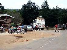
Road transport in Kilolo District.
According to the 2002 Tanzania National Census, the population of the Kilolo District was 205,081.[1]
Administrative subdivisions
Constituencies
For parliamentary elections, Tanzania is divided into constituencies. As of the 2010 elections Kilolo District had one constituency:[2]
- Kilolo Constituency
Divisions
1. Mazombe 2. Mahenge 3.Kilolo
Wards
As of 2015, Kilolo District is administratively divided into wards:
- Bomalang'ombe
- Dabaga
- Ibumu
- Idete
- Ihimbo
- Ilula
- Image
- Irole
- Kising'a
- Kimala
- Kitowo
- Lugalo
- Mahenge
- Masisiwe
- Mawambala
- Mlafu
- Mtitu
- Ng'ang'ange
- Ng'uruhe
- Nyalumbu
- Nyanzwa
- Ruaha Mbuyuni
- Udekwa
- Uhambingeto
- Ukumbi
- Ukwega
- Winome
Notes
- "2002 Population and Housing General Report: Iringa: Kilolo". Archived from the original on 18 March 2004.
- "Organisations located in Iringa Region - Tanzania". African Development Information.
gollark: No, Lyricly, OOP bað, you see.
gollark: 0 bits. No types should exist.
gollark: Ah, but *integers* are sometimes stored as raw bytes to be irritating.
gollark: Say, raw bytes.
gollark: Oh, and it actually might store numbers in different formats sometimes to be annoying.
This article is issued from Wikipedia. The text is licensed under Creative Commons - Attribution - Sharealike. Additional terms may apply for the media files.