Khlong Yai District
Khlong Yai (Thai: คลองใหญ่, pronounced [kʰlɔ̄ːŋ jàj], lit: 'big canal') is a district (amphoe) of Trat Province, eastern Thailand. A border crossing into Cambodia is at Hat Lek, known as the Cham Yeam crossing in Koh Kong Province of Cambodia. The nearest Cambodian city is Koh Kong. Thailand Route 3 (Sukhumvit Road) ends at the Cambodian border in this district.
Khlong Yai คลองใหญ่ | |
|---|---|
 Mai Rut Beach | |
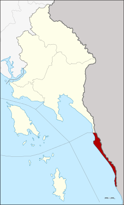 District location in Trat Province | |
| Coordinates: 11°46′36″N 102°53′12″E | |
| Country | Thailand |
| Province | Trat |
| Area | |
| • Total | 50.2 km2 (19.4 sq mi) |
| Population (2000) | |
| • Total | 23,981 |
| • Density | 477.7/km2 (1,237/sq mi) |
| Time zone | UTC+7 (ICT) |
| Postal code | 23110 |
| Geocode | 2302 |
History
Khlong Yai was once part of Siam's Patchan Khiri Khet Province. The name was constructed to rhyme with Prachuap Khiri Khan Province on the other side of the Gulf of Thailand at the same latitude.[1] In 1904, most of Patchan Khiri Khet, including Trat, was ceded to France in exchange for the French returning Chantaburi to Siam. Shortly thereafter, France returned Trat and Klong Yai to Siam in exchange for Siem Reap and Battambang, which had been under Thai rule since 1795. A portion of what was Patchan Khiri Khet Province is now in Koh Kong Province of Cambodia.[1]
Klong Yai was made a minor district (king amphoe) in 1912 and upgraded to a full district in 1959.
From 1979 to July 1986, the district was the site of a Thai Red Cross refugee camp, now called "Ratchakarun Centre", for Cambodians fleeing the fighting between the Khmer Rouge and the invading Vietnamese in the Cambodian-Vietnamese War. At its peak, it harboured more than 90,000 persons.[1]
Geography
The district is a narrow band of land along the coast to the Gulf of Thailand, separated from Cambodia by the Cardamom Mountains.
Neighboring districts are (from the north clockwise) Mueang Trat of Trat Province, Koh Kong Province of Cambodia, and the Gulf of Thailand.
An international border crossing with Cambodia is at Hat Lek village at the south end of the district, called the Khlong Yai Immigration Checkpoint. The checkpoint on the Cambodian side is called Cham Yeam International Checkpoint in Cham Yeam village, Koh Kong Province.
Administration
The district is divided into three sub-districts (tambons), which are further subdivided into 20 villages (mubans). There are two townships (thesaban tambon): Khlong Yai and Hat Lek both cover parts of the same-named tambon. There are a further two tambon administrative organizations (TAO).
| No. | Name | Thai name | Villages | Pop. | |
|---|---|---|---|---|---|
| 1. | Khlong Yai | คลองใหญ่ | 9 | 14,877 | |
| 2. | Mai Rut | ไม้รูด | 6 | 4,642 | |
| 3. | Hat Lek | หาดเล็ก | 5 | 4,462 |
References
- Mekloy, Pongpet (1 August 2019). "Not What It Seems". Bangkok Post. Retrieved 1 August 2019.
Further reading
- Komarakul Na Nakorn, Takoon; Bupphapibul, Teerapat (May 2019). "ตราด - คลองใหญ่ ชีวิตและความหมายปลายถนนสุขุมวิท (Trat - Khlong Yai, a glimpse of life till the end of the journey". Osotho Magazine (in Thai). Tourism Authority of Thailand (TAT). 59 (10): 12–25. ISSN 0125-7226.