Kentucky Route 66
Kentucky Route 66 (KY 66) is a 46.59-mile-long (74.98 km) state highway in southeastern Kentucky. The route runs from Oneida in Clay County to Pineville in Bell County.
| ||||
|---|---|---|---|---|
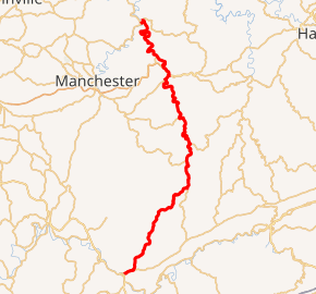
KY 66 highlighted in red | ||||
| Route information | ||||
| Maintained by KYTC | ||||
| Length | 46.59 mi[1] (74.98 km) | |||
| Major junctions | ||||
| North end | ||||
| South end | ||||
| Location | ||||
| Counties | Bell, Clay, Leslie | |||
| Highway system | ||||
| ||||

Major intersections
| County | Location | mi | km | Destinations | Notes |
|---|---|---|---|---|---|
| Bell | Pineville | 0.000 | 0.000 | Southern terminus | |
| 0.223 | 0.359 | Southern terminus of KY 2394 | |||
| | 1.557 | 2.506 | Western terminus of KY 221 | ||
| | 4.985 | 8.023 | Eastern terminus of KY 2133 | ||
| | 17.946 | 28.881 | Northern terminus of KY 2011 | ||
| Clay | | 22.265 | 35.832 | Eastern terminus of KY 1524 | |
| | 23.359 | 37.593 | Western terminus of KY 1850 | ||
| Leslie | | 25.380 | 40.845 | Southern terminus of KY 406 | |
| Clay | | 31.161 | 50.149 | Eastern terminus of KY 2000 | |
| | 39.695 | 63.883 | South end of US 421/KY 80 concurrency | ||
| | 40.470 | 65.130 | North end of US 421/KY 80 concurrency | ||
| | 41.119 | 66.175 | Short connector road between KY 66 and Hal Rogers Parkway | ||
| | 44.521 | 71.650 | Eastern terminus of KY 149 | ||
| Oneida | 54.467 | 87.656 | Southern terminus of KY 1482 | ||
| 54.726 | 88.073 | ||||
| 54.809 | 88.207 | ||||
| 54.899 | 88.351 | ||||
| 55.171 | 88.789 | Northern terminus | |||
1.000 mi = 1.609 km; 1.000 km = 0.621 mi
| |||||
gollark: I'd just like to interject for a moment. What you’re referring to as Monad, is in fact, GNU/Monad, or as I’ve recently taken to calling it, GNU plus Monad. Monad is not an operating system unto itself, but rather another free component of a fully functioning GNU system made useful by the GNU corelibs, shell utilities and vital system components comprising a full OS as defined by POSIX. Many computer users run a modified version of the GNU system every day, without realizing it. Through a peculiar turn of events, the version of GNU which is widely used today is often called “Monad”, and many of its users are not aware that it is basically the GNU system, developed by the GNU Project. There really is a Monad, and these people are using it, but it is just a part of the system they use. Monad is the kernel: the program in the system that allocates the machine’s resources to the other programs that you run. The kernel is an essential part of an operating system, but useless by itself; it can only function in the context of a complete operating system. Monad is normally used in combination with the GNU operating system: the whole system is basically GNU with Monad added, or GNU/Monad. All the so-called “Monad” distributions are really distributions of GNU/Monad.
gollark: ++search !wen pi calculus
gollark: Oh, not that... it should run over discord channels though.
gollark: Channel based... Discord channels?
gollark: (Was on clipboard)
References
- "Kentucky Transportation Cabinet - Division of Planning - Highway Information System Official Milepoint Route Log Extract". Archived from the original on 2007-04-30. Retrieved 2007-04-07.
External links
- "State Secondary Road System in Bell County" (PDF). Archived from the original (PDF) on 2009-10-10. Retrieved 2009-09-22. (33.2 KB)
- "State Secondary Road System in Clay County" (PDF). Archived from the original (PDF) on 2009-10-10. Retrieved 2009-09-22. (60.4 KB)
- "State Secondary Road System in Leslie County" (PDF). Archived from the original (PDF) on 2007-06-15. (11.7 KB)
- KentuckyRoads.com KY 66
- KentuckyRoads.com Images along KY 66
This article is issued from Wikipedia. The text is licensed under Creative Commons - Attribution - Sharealike. Additional terms may apply for the media files.