Kentucky Route 40
Kentucky Route 40 (KY 40) is a 42.339-mile-long (68.138 km) state highway in the U.S. state of Kentucky. The highway begins at an intersection with US 460/KY 7 in Salyersville, within Magoffin County, then continues eastward through Paintsville, within Johnson County. KY 40 ends in Martin County at an intersection with KY 292 and an access bridge to US 52 at the West Virginia state line.
| ||||
|---|---|---|---|---|
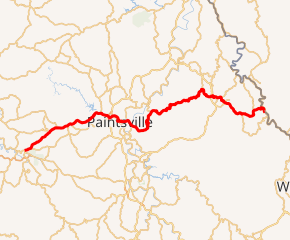
KY 40 highlighted in red | ||||
| Route information | ||||
| Maintained by KYTC | ||||
| Length | 42.339 mi[1][2][3] (68.138 km) | |||
| Major junctions | ||||
| West end | ||||
| East end | Virginia Avenue in Kermit, WV | |||
| Location | ||||
| Counties | Magoffin, Johnson, Martin | |||
| Highway system | ||||
| ||||

Route description
History
KY 40 originally extended west to Frankfort. US 460 replaced the entire route west of Paintsville in the 1940s. Around 1980, it was moved onto a new alignment east of Salyersville, and KY 40 was extended back west.
Major intersections
| County | Location | mi | km | Destinations | Notes |
|---|---|---|---|---|---|
| Magoffin | Salyersville | 0.000 | 0.000 | ||
| 1.110 | 1.786 | Western terminus of KY 2020 | |||
| Falcon | 4.567 | 7.350 | Eastern terminus of KY 1081 | ||
| | 6.438 | 10.361 | Southern terminus of KY 1437 | ||
| Johnson | | 7.874 | 12.672 | Eastern terminus of KY 825 | |
| Oil Springs | 8.473 | 13.636 | Western end of KY 580 overlap | ||
| | 8.614 | 13.863 | Eastern end of KY 580 overlap | ||
| Barnetts Creek | 12.046 | 19.386 | Eastern terminus of KY 580 | ||
| | 13.407 | 21.576 | Eastern terminus of KY 2275 | ||
| | 13.460 | 21.662 | Eastern terminus of KY 172 | ||
| Paintsville | 14.880 | 23.947 | Interchange; only northbound 23 can be accessed from 40 - the ramp to southbound 23 is off 460 | ||
| 15.014 | 24.163 | ||||
| 15.459 | 24.879 | ||||
| 16.831 | 27.087 | Eastern terminus of KY 321 Bus. | |||
| 17.454 | 28.089 | Northern terminus of KY 1428 | |||
| 17.473 | 28.120 | Southern terminus of KY 581 | |||
| 17.812 | 28.666 | Northern terminus of KY 3388 | |||
| 18.744 | 30.166 | Western end of KY 1107 overlap | |||
| | 19.277 | 31.023 | |||
| | 19.469 | 31.332 | Eastern end of KY 1107 overlap | ||
| Meally | 20.312 | 32.689 | Northern terminus of KY 3389 | ||
| | 25.156 | 40.485 | Southern terminus of KY 2040 | ||
| Boons Camp | 26.716 | 42.995 | Northern terminus of KY 1596 | ||
| | 28.858 | 46.442 | Southern terminus of KY 3390 | ||
| Martin | Tomahawk | 34.359 | 55.295 | Northern terminus of KY 1224 | |
| Stidham | 35.909 | 57.790 | Southern terminus of KY 1884 | ||
| | 38.175 | 61.437 | |||
| Inez | 39.219 | 63.117 | Western end of KY 3 overlap | ||
| 39.379 | 63.374 | Eastern end of KY 3 overlap | |||
| 39.869 | 64.163 | Western end of KY 908 overlap | |||
| | 40.905 | 65.830 | Interchange | ||
| | 40.939 | 65.885 | Eastern end of KY 908 overlap | ||
| | 44.499 | 71.614 | Northern terminus of KY 2032 | ||
| Beauty | 47.265 | 76.066 | Southern terminus of KY 2031 | ||
| Warfield | 48.535 | 78.110 | Western end of KY 292 overlap | ||
| | 49.245 | 79.252 | Eastern end of KY 292 overlap | ||
| | 49.270 | 79.292 | Virginia Avenue - Kermit, WV | West Virginia state line (Kermit Bridge over Tug Fork) | |
1.000 mi = 1.609 km; 1.000 km = 0.621 mi
| |||||
Popular culture
The highway is the subject of the Ricky Skaggs song "Highway 40 Blues." According to songwriter Larry Cordle, "A lot of people who hear it think it's about Interstate 40, which runs right through Nashville, but I actually wrote it about that little state highway in Kentucky."[4]
See also


References
- "Magoffin County State Secondary Road System" (PDF). Archived from the original (PDF) on April 9, 2009. Retrieved August 2, 2007.
- "Johnson County State Secondary Road System" (PDF). Archived from the original (PDF) on April 9, 2009. Retrieved August 2, 2007.
- "Martin County State Secondary Road System" (PDF). Archived from the original (PDF) on April 9, 2009. Retrieved August 2, 2007.
- Canfield, Jack (2011). Chicken Soup for the Soul: Country Music: The Inspirational Stories behind 101 of Your Favorite Country Songs. Chicken Soup for the Soul. p. 150. ISBN 9781935096672.