Kentucky Route 36
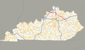
Kentucky Route 36 (KY 36) is a 149.793-mile-long (241.068 km) state highway in Kentucky that runs from US 421 in Milton to US 460 in Frenchburg.
| ||||
|---|---|---|---|---|
 | ||||
| Route information | ||||
| Maintained by KYTC | ||||
| Length | 149.793 mi[1] (241.068 km) | |||
| Major junctions | ||||
| West end | ||||
| ||||
| East end | ||||
| Location | ||||
| Counties | Trimble, Carroll, Owen, Grant, Harrison, Bourbon, Nicholas, Bath, Menifee | |||
| Highway system | ||||
| ||||

Route description
Major intersections
| County | Location | mi[1] | km | Destinations | Notes |
|---|---|---|---|---|---|
| Trimble | Milton | 0.000 | 0.000 | Western terminus | |
| Carroll | | 7.505 | 12.078 | Eastern terminus of KY 1492 | |
| Prestonville | 10.343 | 16.645 | West end of US 42 concurrency | ||
| 11.379 | 18.313 | Northern terminus of KY 55 | |||
| Kentucky River | 11.525 11.767 | 18.548 18.937 | Carrollton-Prestonville Bridge | ||
| Carrollton | 12.643 | 20.347 | |||
| 13.042 | 20.989 | East end of US-42 concurrency; northern terminus of KY 227; west end of KY 227 concurrency | |||
| 13.908 | 22.383 | East end of KY-227 concurrency | |||
| 15.490 | 24.929 | Southern terminus of KY 2350 | |||
| Easterday | 18.549 | 29.852 | Western end of KY 1112 overlap | ||
| 18.807 | 30.267 | Eastern terminus of KY 1112 overlap | |||
| Whites Run | 20.455 | 32.919 | Western terminus of KY 2984 | ||
| | 21.649 | 34.841 | Eastern terminus of KY 1204 | ||
| | 24.093 | 38.774 | West end of KY 467 concurrency | ||
| Sanders | 28.126 | 45.264 | East end of KY 467 concurrency; southern terminus of KY 47 | ||
| Owen | New Liberty | 31.996 | 51.493 | West end of KY 227 concurrency | |
| 32.500 | 52.304 | East end of KY 227 concurrency | |||
| | 35.451 | 57.053 | West end of concurrency with US 127 | ||
| Long Ridge | 38.259 | 61.572 | East end of concurrency with US 127 | ||
| Owen–Grant county line | Jonesville | 42.243 | 67.984 | Eastern terminus of KY 3102 | |
| Grant | 43.525 | 70.047 | Southern terminus of KY 1132 | ||
| Four Corners | 50.977 | 82.040 | |||
| Williamstown | 53.835 | 86.639 | Northern terminus of KY 1995 | ||
| 57.285– 57.542 | 92.191– 92.605 | I-75 exit 154 | |||
| 58.004 | 93.348 | West end of US 25 concurrency | |||
| 59.452 | 95.679 | East end of US 25 concurrency | |||
| Cordova | 65.738 | 105.795 | West end of KY 330 concurrency | ||
| 65.792 | 105.882 | East end of KY 330 concurrency | |||
| Harrison | | 69.957 | 112.585 | Western terminus of KY 1032 | |
| Breckenridge | 78.344 | 126.082 | Northern terminus of KY 1842 | ||
| 79.771 | 128.379 | Southern terminus of KY 1054 | |||
| | 82.350 | 132.529 | Southern terminus of KY 1743 | ||
| Cynthiana | 83.729 | 134.749 | |||
| 84.311 | 135.685 | Eastern terminus of KY 356, northern terminus of KY 3016. | |||
| 84.649 | 136.229 | West end of US 27 Bus./US 62 concurrency | |||
| 84.710 | 136.328 | East end of US 27 Bus./US 62 concurrency; west end of KY 32 concurrency | |||
| 85.210 | 137.132 | Northern terminus of KY 985 | |||
| 86.242 | 138.793 | Northern terminus of KY 1940 | |||
| Bourbon | | 87.788 | 141.281 | Northern terminus of KY 1879 | |
| Nicholas | | 88.403 | 142.271 | Eastern terminus of KY 1298 | |
| | 99.508 | 160.143 | East end of KY 32 concurrency; west end of US 68 concurrency | ||
| | 100.511 | 161.757 | East end of US 68 concurrency | ||
| Carlisle | 103.586 | 166.706 | Northern terminus of KY 13 | ||
| 103.794 | 167.040 | West end of KY 32 concurrency | |||
| 104.200 | 167.694 | Northern terminus of KY 3316 | |||
| 104.328 | 167.900 | East end of KY 32 concurrency | |||
| 104.677 | 168.461 | Northern terminus of KY 1285 | |||
| | 112.467 | 180.998 | Southern terminus of KY 928 | ||
| Moorefield | 114.658 | 184.524 | West end of KY 57 concurrency | ||
| 114.893 | 184.902 | East end of KY 57 concurrency | |||
| Bath | | 118.125 | 190.104 | West end of KY 11 concurrency | |
| Sharpsburg | 120.266 | 193.549 | East end of KY 11 concurrency | ||
| | 122.285 | 196.799 | Southern terminus of KY 3288 | ||
| Reynoldsville | 126.346 | 203.334 | Southern terminus of KY 1325 | ||
| | 128.727 | 207.166 | Southern terminus of KY 1944 | ||
| Owingsville | 131.223 | 211.183 | West end of US 60 concurrency | ||
| 131.625 | 211.830 | East end of US 60 concurrency | |||
| 132.874– 133.090 | 213.840– 214.188 | I-64 exit 121 | |||
| | 134.660 | 216.714 | West end of KY 965 concurrency | ||
| Olympia | 136.882 | 220.290 | East end of KY 965 concurrency | ||
| Olympia Springs | 140.282 | 225.762 | Southern terminus of KY 3290 | ||
| | 143.154 | 230.384 | Southern terminus of KY 211 | ||
| Menifee | Frenchburg | 148.177 | 238.468 | Southern terminus of KY 1274 | |
| 149.793 | 241.068 | Eastern terminus | |||
1.000 mi = 1.609 km; 1.000 km = 0.621 mi
| |||||
gollark: .. I *guess* so, but why?
gollark: Krist is basically all the things you don't want.
gollark: Headcanon: Google took over the North Pole in 2013 after finding it on Google Maps. They've been using Santa's vast surveillance apparatus to spy on everyone, and "machine learning" is just trained elves.
gollark: Google sees you when you're sleeping.It knows when you're awake.It knows if you've been bad or good.So BUY THIS TOTALLY TRUSTWORTY RANDOM PRODUCT IN AN AD!!!!!
gollark: g̸̴̷o̾̉o͈̬̗gͥ̎͑l̐̎́ȅ̓̈ ̈́̇̋sͤ̓̽eͩ̏̎e̡͜͠s̝͎͞ ͭ͛͗ỳ͞͠o͏̸͚ur̎ͦ͞ ̋͌ͩd҉̛͘r̞͈̖e͗͂̆a͌̑̽m͛ͥͮsͣ͑͂
References
- Commonwealth of Kentucky. "Official DMI Route Log". Retrieved March 10, 2015.
This article is issued from Wikipedia. The text is licensed under Creative Commons - Attribution - Sharealike. Additional terms may apply for the media files.