Kentucky Route 34
Kentucky Route 34 (KY 34) is a 21.828-mile-long (35.129 km), east–west, 2-lane, state highway in Kentucky managed by the Kentucky Transportation Cabinet.
| ||||
|---|---|---|---|---|
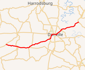
KY 34 highlighted in red | ||||
| Route information | ||||
| Maintained by KYTC | ||||
| Length | 21.828 mi[1] (35.129 km) | |||
| Major junctions | ||||
| West end | ||||
| ||||
| East end | Lexington Road east of Danville | |||
| Location | ||||
| Counties | Boyle, Garrard | |||
| Highway system | ||||
| ||||

KY 34 begins at US 68 and KY 52 near Mitchellsburg and goes through Boyle and Garrard counties before terminating at Lexington Road (Old US 27) east of Danville just beyond US 27. KY 34 formerly terminated at US 27 before US 27 was rebuilt to the west. It serves as a primary connector between Danville and Lexington.
Major intersections
| County | Location | mi[1] | km | Destinations | Notes |
|---|---|---|---|---|---|
| Boyle | | 0.000 | 0.000 | ||
| Brumfield | 1.223 | 1.968 | former US 68 east | ||
| Mitchellsburg | 3.024 | 4.867 | |||
| 3.273 | 5.267 | Northern terminus of KY 1108 | |||
| Parksville | 6.115 | 9.841 | West end of KY 1822 overlap | ||
| 6.298 | 10.136 | Western terminus of KY 300 | |||
| | 7.207 | 11.599 | east end of KY 1822 overlap | ||
| Danville | 12.262 | 19.734 | |||
| 13.629 | 21.934 | West end of US 150 / KY 52 overlap | |||
| 13.893 | 22.359 | West end of US 127 overlap | |||
| east end of US 127 south overlap (eastbound) | |||||
| 14.469 | 23.286 | East end of US 127 north overlap (westbound) | |||
| 14.801 | 23.820 | East end of US 150 / KY 52 overlap | |||
| 15.063 | 24.242 | Eastern terminus of KY 2324 | |||
| 16.541 | 26.620 | Northern terminus of KY 1805 | |||
| 16.703 | 26.881 | Eastern terminus of KY 2168 | |||
| Garrard | | 21.705 | 34.931 | ||
| | 21.828 | 35.129 | Camp Dick Road | former US 27 | |
| 1.000 mi = 1.609 km; 1.000 km = 0.621 mi | |||||
Alternate names
KY 34 has other names along its path:
- Lebanon Road from its western terminus into Danville.
- Main Street (US 150 and US 127) in Danville
- Wilderness Road in Danville
- Lexington Road from Danville to the Garrard County line
- Chenault Bridge Road in Garrard County
Future
A new route (KY 2168) is planned to connect KY 34 and KY 33 northeast of Danville. [2]
gollark: *What* do you want to do in americæ anyway?
gollark: I might move from high earth orbit to low earth orbit.
gollark: I skimmed a blog on it.
gollark: Apparently people manage to get good connections in some cities.
gollark: People mostly pick Thailand and such.
References
- "Kentucky Transportation Cabinet - Division of Planning". Archived from the original on 2007-04-30. Retrieved 2008-10-08.
- "Kentucky Transportation Cabinet Six year highway plan for Boyle County". Archived from the original on 2009-04-10. Retrieved 2008-10-17.
External links
This article is issued from Wikipedia. The text is licensed under Creative Commons - Attribution - Sharealike. Additional terms may apply for the media files.