Kentucky Route 143
Kentucky Route 143 (KY 143) is a 13.202-mile-long (21.247 km) state highway in Webster County, Kentucky. It runs from KY 109 south of Clay to KY 109 west of Wheatcroft.
| ||||
|---|---|---|---|---|
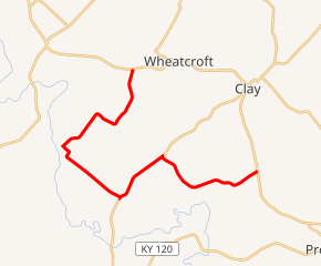
KY 143 highlighted in red | ||||
| Route information | ||||
| Maintained by KYTC | ||||
| Length | 13.202 mi[1] (21.247 km) | |||
| Major junctions | ||||
| South end | ||||
| North end | ||||
| Location | ||||
| Counties | Webster | |||
| Highway system | ||||
| ||||

Major intersections
The entire route is in Webster County.
| Location | mi[1] | km | Destinations | Notes | |
|---|---|---|---|---|---|
| | 0.000 | 0.000 | Southern terminus | ||
| | 0.371 | 0.597 | Southern terminus of KY 1672 | ||
| | 3.947 | 6.352 | Southern end of KY 132 overlap | ||
| | 5.981 | 9.625 | Northern end of KY 132 overlap | ||
| Blackford | 8.764 | 14.104 | Eastern terminus of KY 2089 | ||
| | 13.202 | 21.247 | Northern terminus | ||
| 1.000 mi = 1.609 km; 1.000 km = 0.621 mi | |||||
gollark: It insists on downloading GHC. This may take some time.
gollark: *uses stack*
gollark: Anyway, link me it and I'll send you a compiled version complete with backdoors.
gollark: `stack install`?
gollark: ```Prelude Unsafe.Coerce System.IO.Unsafe> potatOS ()<interactive>: internal error: stg_ap_v_ret (GHC version 8.4.4 for x86_64_unknown_linux) Please report this as a GHC bug: http://www.haskell.org/ghc/reportabug```
References
- "Official DMI Route Log". Kentucky Transportation Cabinet. Retrieved June 30, 2015.
This article is issued from Wikipedia. The text is licensed under Creative Commons - Attribution - Sharealike. Additional terms may apply for the media files.