Kaza, Guntur district
Kaza is a village in Guntur district of the Indian state of Andhra Pradesh. It is located in Mangalagiri mandal of Guntur revenue division.[2] The great saint krishna Narayana Teertha born here.
Kaza | |
|---|---|
Village | |
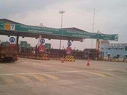 Kaza toll plaza | |
.svg.png) Kaza Location in Andhra Pradesh, India | |
| Coordinates: 16.3906°N 80.5425°E | |
| Country | India |
| State | Andhra Pradesh |
| District | Guntur |
| Mandal | Mangalagiri |
| Government | |
| • Type | Panchayati raj |
| • Body | Kaza gram panchayat |
| Area | |
| • Total | 1,818 ha (4,492 acres) |
| Population (2011)[3] | |
| • Total | 10,148 |
| • Density | 560/km2 (1,400/sq mi) |
| Languages | |
| • Official | Telugu |
| Time zone | UTC+5:30 (IST) |
| PIN | 522503 |
| Area code(s) | +91–863 |
| Vehicle registration | AP |
Geography
Kaza is situated to the southwest of the mandal headquarters, Mangalagiri,[4] at 16.3906°N 80.5425°E. It is spread over an area of 1,818 ha (4,490 acres).[2]
Demographics
As of 2011 Census of India, Kaza had a population of 10,148 with 2490 households. The total population constitute, 5,708 males and 4,440 females —a sex ratio of 779 females per 1000 males. 955 children are in the age group of 0–6 years, of which 485 are boys and 470 are girls —a ratio of 969 per 1000. The average literacy rate stands at 69.06% with 6,349 literates, significantly higher than the state average of 67.41%.[3][5]
Government and politics
Kaza gram panchayat is the local self-government of the village.[1] It is divided into wards and each ward is represented by a ward member.[6] The village forms a part of Andhra Pradesh Capital Region and is under the jurisdiction of APCRDA.[7]
Kaza village is a part of Mangalagiri assembly constituency for Andhra Pradesh Legislative Assembly. The assembly segment is in a part of Guntur (Lok Sabha constituency).
Education
As per the school information report for the academic year 2018–19, the village has a total of 4 schools. These include one MPP, 3 private schools.[8]
Transport
Kaza lies on National Highway 16. APSRTC provides bus services from Vijayawada, Guntur and Mangalagiri to this region.
See also
References
- "Gram Panchayat Identification Codes" (PDF). Saakshar Bharat Mission. National Informatics Centre. p. 107. Archived from the original (PDF) on 18 August 2017. Retrieved 7 May 2019.
- "District Census Hand Book : Guntur (Part B)" (PDF). Census of India. Directorate of Census Operations, Andhra Pradesh. 2011. pp. 14, 270. Retrieved 10 June 2019.
- "Population". Census of India. Registrar General and Census Commissioner of India. Retrieved 8 May 2019.
- "District Census Handbook : Guntur (Part A)" (PDF). Census of India. Directorate of Census Operations, Andhra Pradesh. 2011. pp. 5, 364–365. Retrieved 5 June 2019.
- "Literacy of AP (Census 2011)" (PDF). Official Portal of Andhra Pradesh Government. p. 43. Archived from the original (PDF) on 14 July 2014. Retrieved 6 October 2014.
- Seetharam, Mukkavilli (1 January 1990). Citizen Participation in Rural Development. Mittal Publications. p. 34. ISBN 9788170992271.
- "Declaration of A.P. Capital Region" (PDF). Andhra Pradesh Capital Region Development Authority. Municipal Administration and Urban Development Department, Andhra Pradesh. 30 December 2014. p. 4. Archived from the original (PDF) on 11 May 2019. Retrieved 14 May 2019.
- "School Information". Commissionerate of School Education. Government of Andhra Pradesh. Retrieved 7 May 2019.