Kayabwe
Kayabwe, is a town in the Buganda Region of Uganda. It is an urban center in Mpigi District. The town sits astride The Equator.[1]
Kayabwe | |
|---|---|
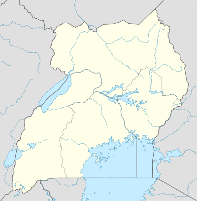 Kayabwe Map of Uganda showing the location of Kayabwe | |
| Coordinates: 00°00′02″S 32°02′22″E | |
| Country | |
| Region | Central Region of Uganda |
| District | Mpigi District |
| Elevation | 1,172 m (3,845 ft) |
| Time zone | UTC+3 (EAT) |
Location
The town is located in Mpigi District, in the Central Region of Uganda, approximately 43.5 kilometres (27 mi), by road, south-west of the town Mpigi, the location of the district headquarters.[2] This location is along the Kampala–Masaka Road, about 81 kilometres (50 mi), by road, south-west of Kampala, the capital city of Uganda.[3] From the city of Masaka, Kayabwe is approximately 51 kilometres (32 mi), by road, in a north-easterly direction.[4]
The town lies at an average elevation of 1,172 metres (3,845 ft), above sea level.[5] The geographical coordinates of Kayabwe are 0°00'02.0"S, 32°02'22.0"E (-0.000556, 32.039444).[6]
Points of interest
The Kampala-Masaka Highway, passes through Kayabwe in a general northeast to southwest direction. The Equator passes through the middle of town in a west to east direction, as can be deduced from the town's geographical coordinates.[6]
The town is a favorite tourist stopping point. Many stop to take photographs of the Equator Monument, eat at the restaurants located there and/or buy African crafts at the nearby crafts shops.[7] There are plans by the Uganda Tourism Board and Mpigi District Administration, to develop and modernise the location and attract more tourists.[8]
Kayabwe has access to potable piped water supply, following improvements between 2011 and 2017, funded with loans from the African Development Bank.[9]
Banking services are offered by Centenary Bank, a large retail commercial bank that maintains a branch in town.[10]
See also
Photos and diagrams
References
- Aboutuganda.com (20 April 2020). "About the Uganda Equator". Kampala: Aboutuganda.com. Retrieved 20 April 2020.
- Google (20 April 2020). "Driving Distance Between Mpigi And Kayabwe In Uganda" (Map). Google Maps. Google. Retrieved 20 April 2020.
- Google (20 April 2020). "Driving Distance Between Kampala And Kayabwe In Uganda" (Map). Google Maps. Google. Retrieved 20 April 2020.
- Google (20 April 2020). "Driving Distance Between Masaka And Kayabwe In Uganda" (Map). Google Maps. Google. Retrieved 20 April 2020.
- Elevationmap.net (26 November 2018). "The Elevation of Kayabwe, Nkozi sub-county, Mawokota County, Mpigi District, Uganda". Elevationmap.net. Retrieved 26 November 2018.
- Google (26 November 2018). "Location of Kayabwe, Mpigi District, Uganda" (Map). Google Maps. Google. Retrieved 26 November 2018.
- Jonathan Kamoga (22 March 2018). "The Equator can become bigger tourist attraction". The Observer (Uganda). Kampala. Retrieved 20 April 2020.
- Adventure Uganda Safaris (2019). "Uganda Tourism Board to Modernize the Uganda Equator". Kampala: Adventureugandasafari.com. Retrieved 20 April 2020.
- Sanya, Samuel (30 September 2017). "AfDB funding for water and sanitation in Uganda hits USh786 billion". New Vision. Kampala. Retrieved 27 November 2018.
- Ssemutooke, Joseph (7 March 2013). "She started the only bank in Kammengo sub-county". New Vision. Kampala. Retrieved 27 November 2018.
External links
Capital: Mpigi | ||
| Counties and sub-counties | Mawokota County |  |
| Towns and villages | ||
| Geography |
| |
| Economy | ||
| Notable landmarks | ||
| Transport | ||
| Health | ||
| Education | ||
| Notable people | ||