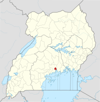
Kawempe Division
Location
Kawempe Division is in the northwestern corner of the city, bordering Wakiso District to the west, north and east, Nakawa Division to the southeast, Kampala Central Division to the south, and Lubaga Division to the southwest. The coordinates of the division are 00 23N, 32 33E (Latitude:0.3792; Longitude:32.5574).[1]
The neighborhoods in Kawempe Division include: Kawempe, Kanyanya, Kazo, Mpererwe, Kisaasi, Kikaya, Kyebando, Bwaise, Komamboga, Mulago, Makerere, and Wandegeya.[2]
Overview
Kawempe Division is the largest division in Kampala, with an estimated population in excess of 265,000 according to the 2002 national population census.[3] Kawempe Division has a high mortality and morbidity burden compared to the other four divisions in the city. A survey in 2013, ranked it highest in HIV/AIDS transmission out of the five divisions within Kampala.[4] Crime is also of concern.[5]
References
- Google (4 December 2018). "Map Showing the Location and Boundaries of Kawempe Division, Kampala, Uganda" (Map). Google Maps. Google. Retrieved 4 December 2018.
- "Parishes In Kawempe Division". Lcmt.org. Retrieved 17 June 2014.
- Watuwa Timbiti, and Andrew Masinde (24 September 2013). "Kawempe Congested, Unsafe". New Vision. Retrieved 17 June 2014.
- Ayebazibwe, Agatha (1 October 2013). "Kawempe Tops Kampala's HIV Hotspots - Report". Daily Monitor. Retrieved 17 June 2014.
- Nanyonjo, Aidah (3 September 2008). "Kawempe Division Zones Local Councils". New Vision. Archived from the original on 17 November 2015. Retrieved 17 June 2014.
