Ordu-Baliq
Ordu-Baliq[dn 1] (meaning "city of the court", "city of the army"), also known as Mubalik and Karabalghasun, was the capital of the first Uyghur Khaganate. It was built on the site of the former Göktürk imperial capital, 27 km north-to-northwest of the later Mongol capital, Karakorum. Its ruins are known as Kharbalgas in Mongolian meaning "black city". They form part of the World Heritage Site Orkhon Valley Cultural Landscape.
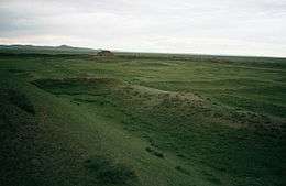
 The west gate as seen from the citadel | |
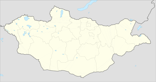
 Location of Ordu Baliq in Mongolia | |
| Location | Mongolia |
|---|---|
| Coordinates | 47.431111°N 102.659444°E |
Location
Ordu-Baliq is in a grassy plain called the Talal-khain-dala steppe, on the western bank of the Orkhon River in the Khotont sum of the Arkhangai Province, Mongolia, 16 km northeast of the Khotont village, or 30 km north-to-northwest of Kharkhorin. The Orkhon emerges from the gorges of the Khangai Mountains and flows northward to meet the Tuul River (the current capital of Mongolia, Ulan Bator, is on its upper reaches).
A favorable micro-climate makes the location ideal for pasturage, and it lies along the most important east-west route across Mongolia. As a result, the Orkhon Valley was a center of habitation and important political and economic activity long before the birth of Genghis Khan who made it known to the wider world.
History

In 744, after the defeat of the last Göktürk Kaghan by the Uyghur-Qarluk-Basmyl alliance, the Uyghurs under Bayanchur Khan (Bayan Çor) established their imperial capital Ordu Baliq on the site of the old ördü ("nomadic capital"). Ordu-Baliq flourished until 840, when it was reduced to ruin by the invading Yenisey Kyrgyzes.
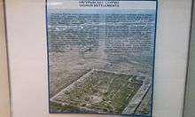
The capital occupied at least 32 square kilometers.[1] The ruins of the palace or temple complex laying at coordinates 47.431288°N 102.659349°E — which include the 10-meter-high double clay walls,4 meters apart,14 watch towers, 8 on the Southern side and 6 on the Northern side, two main entrances, one on East side and other on West side, a 12-meter citadel in the southeast corner and a 14-meter-high stupa in the center — clearly indicate that Ordu Baliq or Urgin Balyq Old Turkic: 𐰇𐰼𐰏𐰃𐰤𐰉𐰞𐰶 [2] was a large, affluent town.
The urban area may be divided into three main parts. The central part consisting of numerous buildings surrounded by a continuous wall forms the biggest part. Ruin of a large number of temples and houses are to be found to the south beyond the center. The Khan's residential palace, which was also ringed by walls on all sides, stood in the northeastern part of the town, where the Russian archaeologist Nikolay Yadrintsev discovered a green granite monument with a statue of a dragon perched at the top and bearing a runic inscription glorifying the khagans.
Ordu Baliq was a fully fortified commandry and commercial entrepot typical of the central points along the length of the Silk Road. The well-preserved remains now consist of concentric fortified walls and lookout towers, stables, military and commercial stores, and administrative buildings. There are remains of a water drainage system. Archaeologists established that certain areas were allotted for trade and handcrafts, while in the center of the town were palaces and temples, including a monastery. The palace had fortified walls around it and two main gates, north and south, as well as moats filled with water and watchtowers.
The architectural style and planning of the city appear to have close parallels with T'ang Chinese models, although there are elements that appear to have derived inspiration from elsewhere.[3]
Historical accounts
An ambassador from the Samanid Empire, Tamim ibn Bahr, visited Ordu Baliq in 821 CE and left the only written account of the city. He traveled through uninhabited steppes until arriving in the vicinity of the Uighur capital. He described Ordu-Baliq as a great town, "rich in agriculture and surrounded by rustaqs (villages) full of cultivation lying close together. The town had twelve iron gates of huge size. The town was populous and thickly crowded and had markets and various trades."[4] He reported that amongst the townspeople, Manichaeism prevailed.
The most striking detail of his description is the golden yurt or tent on top of the citadel where the khagan held court.[5]
He says that from (a distance of) five farsakhs before he arrived in the town (of the khaqan) he caught sight of a tent belonging to the king, (made) of gold. (It stands) on the flat top (sath) of his castle and can hold (tasa') 100 men.
— Tamim b. Bahr al-Muttawwi'i, translation by Minorsky[5]
The golden tent was considered the heart of the Uyghur power, gold being the symbol of imperial rule.[6] The presence of a golden tent is confirmed in Chinese historical accounts where the Kirghiz khan was said to have vowed to seize the Uyghurs' golden tent.[7]
Discovery
In 1871, the Russian traveler Paderin was the first European to visit the ruins of the Uighur capital. Only the wall and a tower were in existence, while the streets and ruins outside the wall could be seen at a distance. He was told that the Mongols call it either Kara Balghasun ("black city") or khara-kherem ("black wall"). Paderin's belief that this was the old Mongol capital Karakorum has been shown to be incorrect.
The site was identified as a ruined Uyghur capital by the expedition of Nikolay Yadrintsev in 1889 and two expeditions of the Helsingfors Ugro-Finnish society (1890), followed by that of the Russian Academy of Sciences, under Friedrich Wilhelm Radloff (1891).
See also
- Architecture of Mongolia
- Khara-Khoto
- Por-Bazhyn, a ruined structure on a lake island high in the mountains of southern Tuva, whose lay-out is similar to the palace complex of Karabalgasun
- Uyghur Empire
Footnotes
- also spelled Ordu Balykh, Ordu Balik, Ordu-Balïq, Ordu Balig, Ordu Baligh
References
- Hüttel, Hans-Georg, Ulambayar, Erdenebat (2009). Karabalgasun und Karakorum - Zwei spätnomadische Stadtsiedlungen im Orchon-Tal (in German and Mongolian). Ulaanbaatar. p. 18.CS1 maint: multiple names: authors list (link)
- "Selenge Stone inscriptions" in Orkhon Runic Uyghur Script in Mongolia, composed in 759 CE on granite stele, line 34
- Arden-Wong, L.A. (2012) "The architectural relationship between Tang and Eastern Uighur Imperial Cities", in Zs. Rajkai and I. Bellér-Hann (eds.) Frontiers and Boundaries: Encounters on China's Margins. Asiatische Forschungen 156, Wiesbaden: Harrassowitz Verlag, pp. 11–47.
- M. S. Asimov (March 1999). History of Central Asia - The historical,social and economic setting. Volume 4 part I. Motilal Banarsidass. pp. 192–193. ISBN 978-81-208-1595-7. Retrieved 15 March 2012.
- Minorsky, V. (1948). "Tamīm ibn Baḥr's Journey to the Uyghurs". Bulletin of the School of Oriental and African Studies. Cambridge University Press. 12 (2): 283. doi:10.1017/s0041977x00080228. ISSN 0041-977X. JSTOR 608747.
- Mackerras, Colin (1972). The Uighur Empire: According to the T'ang Dynastic Histories, A Study in Sino-Uighur Relations. Australian National University Press. pp. 744–840. ISBN 978-0-7081-0457-6.
- 新唐書 Xin Tangshu Chapter 217 part 2. Original text: 挐鬥二十年不解。阿熱恃勝,乃肆詈曰:「爾運盡矣!我將收爾金帳,於爾帳前馳我馬,植我旗,爾能抗,亟來,即不能,當疾去。」 Translation: The struggle went on for twenty years without resolution. Trusting that he will be victorious, (the Kirghiz khan) A-re thus boldly cursed: "Your fate is sealed! I will seize your golden tent, and in front of your tent my horses will gallop and my banners will be planted. If you can resist, come quickly, but if you cannot, then go away."
Further reading
- Minorsky, V. (1948). "Tamīm ibn Baḥr's Journey to the Uyghurs". Bulletin of the School of Oriental and African Studies. Cambridge: Cambridge University Press. 12 (2): 275–305. doi:10.1017/s0041977x00080228. ISSN 0041-977X. JSTOR 608747.
- Drompp, Michael Robert (2005). Tang China and the Collapse of the Uighur Empire: A Documentary History. Brill. p. 366. ISBN 978-90-04-14129-2.
External links
| Wikisource has the text of a 1911 Encyclopædia Britannica article about Ordu-Baliq. |
- Glazier, James (2005-09-24). "Khar Balgasyn Tuur - Ruins of Uigher Capital (8th Century)". Indiana University. Archived from the original on 16 October 2005.