Kamonkoli
Kamonkoli is a town in Budaka District, in the Eastern Region of Uganda.[1]
Kamonkoli | |
|---|---|
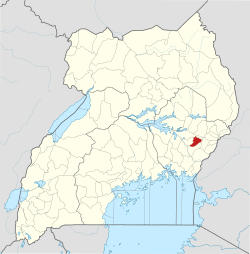
 Kamonkoli Map of Uganda showing location of Kamonkoli | |
| Coordinates: 01°04′30″N 34°05′44″E | |
| Country | |
| Region | Eastern Region |
| District | Budaka District |
| Elevation | 1,119 m (3,671 ft) |
| Population (2018 Estimate) | |
| • Total | 25,000 |
| Time zone | UTC+3 (EAT) |
Location
The town lies along the 107 kilometres (66 mi)[2] Iganga–Tirinyi–Kamonkoli–Mbale Road, approximately 12 kilometres (7 mi), southwest of Mbale, the largest city in the Eastern Region of Uganda.[3] The coordinates of Kamonkoli are 1°04'30.0"N, 34°05'44.0"E (Latitude:1.075005; Longitude:34.095568).[4] Kamonkoli sits at an average elevation of 1,119 metres (3,671 ft), above sea level.[5]
Overview
Kamonkoli is the location of the second factory of Uganda Clays Limited, Uganda's largest manufacturer of clay building products.[6][7]
In 2012, ground was broken on a planned Kamonkoli Cement Factory.[8][9] Further media reports indicate the factory is operational.[10]
Kamonkoli is the end of the southeastern leg of the Tirinyi–Pallisa–Kamonkoli–Kumi Road, which links this town to Pallisa via Iki-Iki.[11]
References
- Kolyangha, Mudangha (29 August 2018). "From mud and wattle trading centre to commercial hub". Daily Monitor. Kampala. Retrieved 24 October 2018.
- Globefeed.com (24 October 2018). "Distance between Iganga, Eastern Region, Uganda and Mbale, Eastern Region, Uganda". Globefeed.com. Retrieved 24 October 2018.
- Globefeed.com (24 October 2018). "Distance between Kamonkoli, Uganda and Mbale, Uganda". Globefeed.com. Retrieved 24 October 2018.
- Google (24 October 2018). "Location of Kamonkoli, Budaka District, Eastern Region, Uganda" (Map). Google Maps. Google. Retrieved 24 October 2018.
- Elevation Map (24 October 2018). "Elevation of Kamonkoli, Budaka District, Uganda". Elevationmap.net. Retrieved 24 October 2018.
- Busuulwa, Bernard (10 April 2009). "Uganda Clays opens $15 million plant to meet rising demand in EA". The EastAfrican. Kamonkoli. Retrieved 28 February 2016.
- The Independent Team (22 April 2009). "Uganda Clays opens new factory". The Independent (Uganda). Kampala. Retrieved 28 February 2016.
- Mulabbi, John Bosco (27 November 2012). "Museveni ignores Budaka MPs pleas". The Observer (Uganda). Kampala. Retrieved 29 February 2016.
- Kalisa Seruwagi, Moses (10 January 2013). "Construction starts on Ugandan cement factory". African Review Magazine. Retrieved 29 February 2016.
- ARM (28 November 2012). "Kuwait-based company opens cement factory in Uganda". African Review Magazine (ARM). Retrieved 29 February 2016.
- UNRA (26 May 2014). "Civil Works for the Upgrading of Tirinyi–Pallisa–Kumi/Pallisa–Kamonkoli Roads: Specific Procurement Notice – Invitation for Prequalification". Kampala. Retrieved 1 March 2016.
Capital: Budaka | ||
| Counties and sub-counties |
|  |
| Towns and villages | ||
| Economy | ||
| Banking | ||
| Transport |
| |
| Education |
| |
| Notable people |
| |