Kamo, Okayama
Kamo (加茂町, Kamo-chō) was a town located in Tomata District, Okayama Prefecture, Japan.
Kamo 加茂町 | |
|---|---|
Former municipality | |
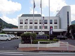 Former Kamo town hall | |
 Kamo Location in Japan | |
| Coordinates: 35°10′41.4″N 134°3′14.5″E | |
| Country | Japan |
| Region | Chūgoku |
| Prefecture | Okayama Prefecture |
| District | Tomata |
| Merged | February 28, 2005 (now part of Tsuyama) |
| Area | |
| • Total | 159.27 km2 (61.49 sq mi) |
| Population (2003) | |
| • Total | 5,311 |
| • Density | 33.35/km2 (86.4/sq mi) |
| Symbols | |
| • Tree | Chamaecyparis obtusa |
| • Flower | Satsuki azalea |
| • Bird | Japanese bush-warbler |
| Time zone | UTC+9 (JST) |
As of 2003, the town had an estimated population of 5,311 and a density of 33.35 persons per km2. The total area was 159.27 km2.
On February 28, 2005, Kamo, along with the village of Aba (also from Tomata District), the town of Shōboku (from Katsuta District), and the town of Kume (from Kume District), was merged into the expanded city of Tsuyama and no longer exists as an independent municipality.
Geography
Adjoining municipalities
- Okayama Prefecture
- Tsuyama
- Kagamino
- Kamisaibara
- Aba
- Shōboku
- Tottori Prefecture
- Tottori
- Chizu
Education
- Kamo Elementary School
- Kamo Junior High School
Transportation
Railways
Road
gollark: As far as I know hosting videos isn't very hard in these modern days of the interwebs, but monetizing them is more problematic.
gollark: Compile them into one large video of destroying lots of invasive pests?
gollark: Cool, looks very mountainous.
gollark: There was something in the xkcd what if book about a fungus thing with a toxin that stops some RNA polymerases working, which has presumably similar effects. Apparently you die within a few days.
gollark: Hmm, that is many lizards. I've noticed while on holidays that they seem to be quite prevalent in hotter countries in Europe and stuff, but basically not at all here.
External links
- Official website of Tsuyama in Japanese (some English content)
| Authority control |
|
|---|
This article is issued from Wikipedia. The text is licensed under Creative Commons - Attribution - Sharealike. Additional terms may apply for the media files.