Kakaramea
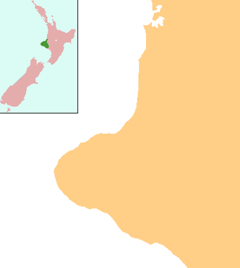
Kakaramea is a town in South Taranaki, New Zealand. State Highway 3 passes through it. Patea is about 6 km to the south-east, and Hāwera is about 20 km to the north-west.[1][2]
Kakaramea | |
|---|---|
 Kakaramea | |
| Coordinates: 39°42′34″S 174°26′56″E | |
| Country | New Zealand |
| Region | Taranaki |
| District | South Taranaki District |
The local Pariroa Marae is a traditional meeting ground for the Ngāti Ruanui hapū of Ngāti Hine, Ngāti Kōtuku, Ngāti Ringi, Ngāti Tūpito and Tuatahi.[3] It features the Taiporohēnui meeting house.[4]
Education
Kakaramea School is a coeducational contributing primary (years 1-6) school with a decile rating of 5[5] and a roll of 71[6] (March 2020). The school and district celebrated their 125th jubilee in 2001.[7]
Notes
- Peter Dowling (editor) (2004), Reed New Zealand Atlas, Reed Books, pp. map 44, ISBN 0-7900-0952-8CS1 maint: extra text: authors list (link)
- Roger Smith, GeographX (2005), The Geographic Atlas of New Zealand, Robbie Burton, pp. map 97, ISBN 1-877333-20-4
- "Te Kāhui Māngai directory". tkm.govt.nz. Te Puni Kōkiri.
- "Māori Maps". maorimaps.com. Te Potiki National Trust.
- Education Counts: Kakaramea School
- "New Zealand Schools Directory". New Zealand Ministry of Education. Retrieved 26 April 2020.
- "Jubilees & reunions: Kakaramea School and District", Education Gazette New Zealand, 79 (19), 23 October 2000
gollark: It's an "autonomous commune" in... Seattle or something.
gollark: It's apparently big enough that you would need something like 20 high-end compute GPUs, so... quite a lot of raspberry pis.
gollark: The trouble with this is that scaling it up like this requires ridiculous amounts of computing resources, and now it's so big that individuals probably can't even tractably run it.
gollark: It can add somewhat larger numbers!
gollark: https://slatestarcodex.com/2020/06/10/the-obligatory-gpt-3-post/
This article is issued from Wikipedia. The text is licensed under Creative Commons - Attribution - Sharealike. Additional terms may apply for the media files.