Künzell
Künzell is a municipality in the district of Fulda, in Hesse, Germany. It is situated 3 km east of Fulda. It is twinned with the English village of Rustington.
Künzell | |
|---|---|
 Coat of arms | |
Location of Künzell within Fulda district 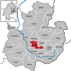  | |
 Künzell 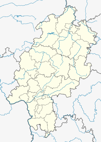 Künzell | |
| Coordinates: 50°33′N 9°43′E | |
| Country | Germany |
| State | Hesse |
| Admin. region | Kassel |
| District | Fulda |
| Subdivisions | 9 districts |
| Government | |
| • Mayor | Timo Zentgraf (non party) |
| Area | |
| • Total | 30.29 km2 (11.70 sq mi) |
| Elevation | 336 m (1,102 ft) |
| Population (2018-12-31)[1] | |
| • Total | 16,583 |
| • Density | 550/km2 (1,400/sq mi) |
| Time zone | CET/CEST (UTC+1/+2) |
| Postal codes | 36093 |
| Dialling codes | 0661 |
| Vehicle registration | FD |
| Website | www.kuenzell.de |
The subdivisions are: Künzell/Bachrain, Pilgerzell, Engelhelms, Dirlos (with Loheland), Dietershausen, Keulos, Wissels and Dassen.
History
Early Middle Ages
In 743 a monk named Chindolf settled there in a cella. The place was named Chindecella or Kindecella.
Towns and municipalities in Fulda district | ||
|---|---|---|
Wappen des Landkreises Fulda | ||
gollark: Or also emulate Android apps on it, but oh potatOS the resource waste.
gollark: Or, well, use it on my laptop.
gollark: I can just not use Discord. Problem solved!
gollark: Anyway, the battery life will be *great* if I can cut down basically every pointless background service and have a GNU/Linux-running phone which basically just runs a browser and basic phone-network functionality.
gollark: Well, that's interesting, thanks.
References
- "Bevölkerungsstand am 31.12.2018". Hessisches Statistisches Landesamt (in German). July 2019.
| Authority control |
|
|---|
This article is issued from Wikipedia. The text is licensed under Creative Commons - Attribution - Sharealike. Additional terms may apply for the media files.