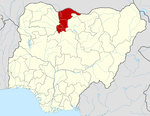
Jibia
Jibia, (or Jibiya), is a town and Local Government Area (LGA) in Katsina State, northern Nigeria.[1] The population of the LGA was approximately 125,000 as of 2003, and the area is 1037 km².[1]
Jibia | |
|---|---|
LGA and town | |
 Jibia | |
| Coordinates: 13°05′30″N 7°13′35″E | |
| Country | |
| State | Katsina State |
| Area | |
| • Total | 1,037 km2 (400 sq mi) |
| Population (2006 census) | |
| • Total | 169,748 |
| Time zone | UTC+1 (WAT) |
| 3-digit postal code prefix | 822 |
| ISO 3166 code | NG.KT.JI |
The postal code of the area is 822.[2]
Jibia sits along on the Nigerian border with Niger, and the border post was burnt down by a mob in 2005.[3] According to the Daily Triumph newspaper, the mob was "hired" by smugglers angry about the Katsina Custom Command's crackdown on contraband goods.[3] The Local Government shares borders with Batsari, Kaita, Katsina, Batagarawa and Zurmi (Zamfara State) Local Government Areas. Médecins Sans Frontières (Doctors Without Borders) operates an ambulatory center in Jibia.[4]
History
Na'im sanusi jibia, a researcher on the history of Jibia, wrote that the origins of Jibia date back to the wars of conquest between the rulers of [katsina Emirate,with maradi migrations Niger|Maradi]] and Katsina over territoriality and religion, especially after the jihad of Usman Bin Fodiyo.
References
- "Jibia". nigeriacongress.org. Retrieved 2007-02-10.
- "Post Offices- with map of LGA". NIPOST. Archived from the original on 2009-10-07. Retrieved 2009-10-20.
- Yunusa, Abdulkadir. "Katsina custom command: So far so good". Daily Triumph. Triumph Publishing Company. Retrieved 2007-02-10.
- "A Katsina, la malnutrition continue". msf.fr (in French). Médecins Sans Frontières. Archived from the original on October 17, 2005. Retrieved 2007-02-10.
