Jenštejn
Jenštejn (German: Jenstein) is a village and municipality in Prague-East District in the Central Bohemian Region of the Czech Republic.
Jenštejn | |
|---|---|
Municipality and village | |
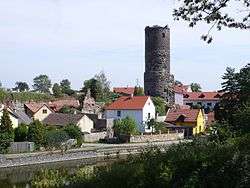 Ruins of the Jenštejn Castle in the village | |
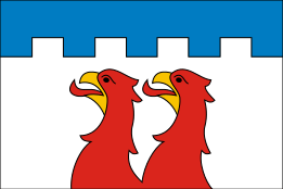 Flag  Coat of arms | |
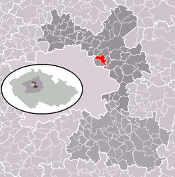 | |
 Jenštejn Location in the Czech Republic | |
| Coordinates: 50°9′8″N 14°36′42″E | |
| Country | |
| Region | Central Bohemian Region |
| District | Prague-East District |
| Area | |
| • Total | 5.09 km2 (1.97 sq mi) |
| Elevation | 232 m (761 ft) |
| Population (2012) | |
| • Total | 945 |
| • Density | 190/km2 (480/sq mi) |
| Time zone | UTC+1 (CET) |
| • Summer (DST) | UTC+2 (CEST) |
| Website | https://www.jenstejn.cz/ |
It lies about sixteen kilometers north-east from downtown Prague and seven kilometers south-west of Brandýs nad Labem-Stará Boleslav. It borders the villages of Podolanka (west), Dřevčice (north), Svémyslice (east) and Radonice (south). At south-west it borders Vinoř, a neighborhood of Prague.
Notes
- This article was initially translated from the Czech Wikipedia.
| Wikimedia Commons has media related to Jenštejn. |
| Authority control |
|---|
gollark: Sure, but people do in the Empire still do, well, work.
gollark: I mean, if I remember correctly you can just build ones without volition or something, and have them do basically the same stuff.
gollark: What jobs can sophont AIs do that nonsophont ones *can't*?
gollark: You can get 1TB microSD cards now. Imagine the density of a bucket of those.
gollark: It should switch to one system, and be less confusing.
This article is issued from Wikipedia. The text is licensed under Creative Commons - Attribution - Sharealike. Additional terms may apply for the media files.