Jarrett, Minnesota
Jarrett is an unincorporated community in Wabasha County, Minnesota, United States.
Jarrett | |
|---|---|
 Jarrett Location of the community of Jarrett within Wabasha County  Jarrett Jarrett (the United States) | |
| Coordinates: 44°14′10″N 92°20′21″W | |
| Country | United States |
| State | Minnesota |
| County | Wabasha County |
| Township | Hyde Park Township and Zumbro Township |
| Elevation | 794 ft (242 m) |
| Time zone | UTC-6 (Central (CST)) |
| • Summer (DST) | UTC-5 (CDT) |
| ZIP code | 55991 and 55957 |
| Area code(s) | 507 |
| GNIS feature ID | 645581[1] |
Geography
The community is located between Hammond and Millville along Wabasha County Road 11 near the intersection with 334th Avenue. Jarrett is located within Hyde Park Township and Zumbro Township. Silver Spring Creek and the Zumbro River meet at Jarrett. Other nearby communities include Millville, Hammond, Zumbro Falls, Potsdam, and South Troy.
History
A post office called Jarretts was established in 1879, and remained in operation until 1919.[2] The community took its name from Jarrett's Ford, a shallow crossing over the Zumbro River.[3]
gollark: "Yes, thank you. I operate a small but profitable snail farm, and would be interested in receiving more capital to make this work."
gollark: But I think I should say "yes" and talk about some immensely stupid business idea.
gollark: I received this electronic mail message. Obviously it's a scammer. How can I annoy this person?
gollark: posadism_irl
gollark: Deploying ALTERNATE ACCOUNTS.
References
- "Jarrett, Minnesota". Geographic Names Information System. United States Geological Survey.
- "Wabasha County". Jim Forte Postal History. Retrieved 10 August 2015.
- Upham, Warren (1920). Minnesota Geographic Names: Their Origin and Historic Significance. Minnesota Historical Society. p. 557.
Municipalities and communities of Wabasha County, Minnesota, United States | ||
|---|---|---|
| Cities | 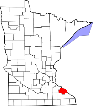 Map of Minnesota highlighting Wabasha County | |
| Townships | ||
| Unincorporated communities | ||
| Footnotes | ‡This populated place also has portions in an adjacent county or counties | |
This article is issued from Wikipedia. The text is licensed under Creative Commons - Attribution - Sharealike. Additional terms may apply for the media files.