Irrel
Irrel is a municipality in the district Bitburg-Prüm, in Rhineland-Palatinate, Germany. It is situated in the Eifel, near the border with Luxembourg, at the confluence of the rivers Prüm and Nims. It is located approximately 15 km south-west of Bitburg and 5 km north-east of Echternach.
Irrel | |
|---|---|
 Coat of arms | |
Location of Irrel within Eifelkreis Bitburg-Prüm district 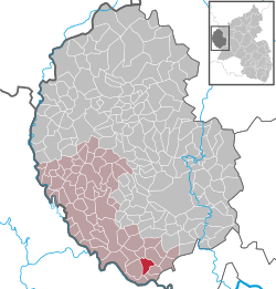 | |
 Irrel  Irrel | |
| Coordinates: 49°50′50″N 06°27′22″E | |
| Country | Germany |
| State | Rhineland-Palatinate |
| District | Eifelkreis Bitburg-Prüm |
| Municipal assoc. | Südeifel |
| Government | |
| • Mayor | Heinz Haas |
| Area | |
| • Total | 7.05 km2 (2.72 sq mi) |
| Elevation | 170 m (560 ft) |
| Population (2018-12-31)[1] | |
| • Total | 1,594 |
| • Density | 230/km2 (590/sq mi) |
| Time zone | CET/CEST (UTC+1/+2) |
| Postal codes | 54666 |
| Dialling codes | 06525 |
| Vehicle registration | BIT |
| Website | Irrel at site www.suedeifelinfo.de |
Irrel was the seat of the former Verbandsgemeinde ("collective municipality") Irrel. Since 1 July 2014 it is part of the Verbandsgemeinde Südeifel.[2]
Sights
gollark: W/h isn't an actual unit.
gollark: Intel Integrated Radeon™ Dedicated Graphics
gollark: I think I got 6 from a block recently. It's the only one I mined before realizing that it was pointless.
gollark: Fun fact: `is-odd` on NPM has been downloaded over 2 million times over the past week.
gollark: How DID you get to 1.1MB anyway?
References
- "Bevölkerungsstand 2018 - Gemeindeebene". Statistisches Landesamt Rheinland-Pfalz (in German). 2019.
- "Die Verbandsgemeinde Südeifel" (in German). Verbandsgemeinde Südeifel. July 2014. Retrieved 5 May 2015.
| Authority control |
|
|---|
This article is issued from Wikipedia. The text is licensed under Creative Commons - Attribution - Sharealike. Additional terms may apply for the media files.